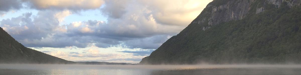
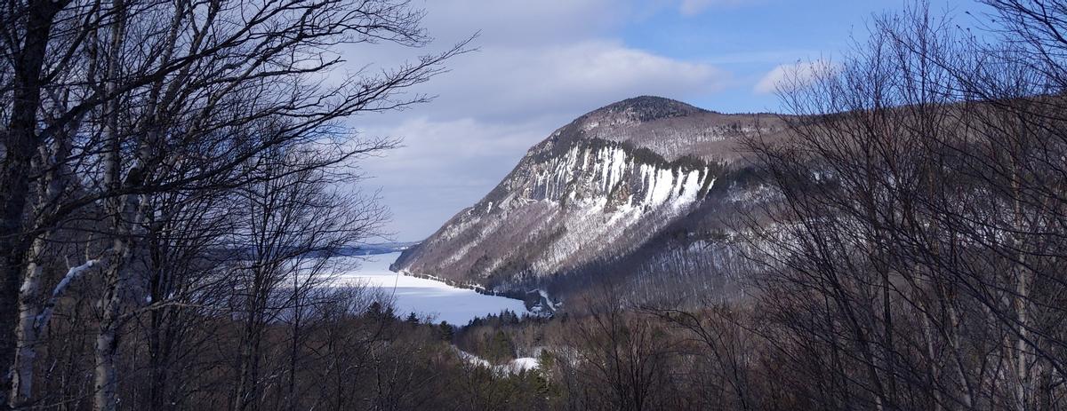
The iconic cliffs of Mounts Pisgah and Hor over Lake Willoughby are visible from many miles away, signalling the entrance to Vermont’s enigmatic and remote Northeast Kingdom. Anticipating a secluded hike up Mount Pisgah and into Vermont’s deepest woods to cliffside views over the lake, however, hikers may be surprised to encounter something increasingly common -- an overflowing parking lot and significant crowds. If waiting in line to enjoy the view or climb steep sections isn’t for you, there are plenty of other options within a half hour of the Pisgah parking lot!
Mount Pisgah is part of Willoughby State Forest, a 7,682 acre forest that straddles the divide between the Connecticut River watershed to the south and the St. Lawrence watershed to the north. Although the sheer cliffs of Mount Pisgah are a stunning feature of the forest, there are also multiple peaks, preserved natural areas, clear streams and remote ponds in the forest.
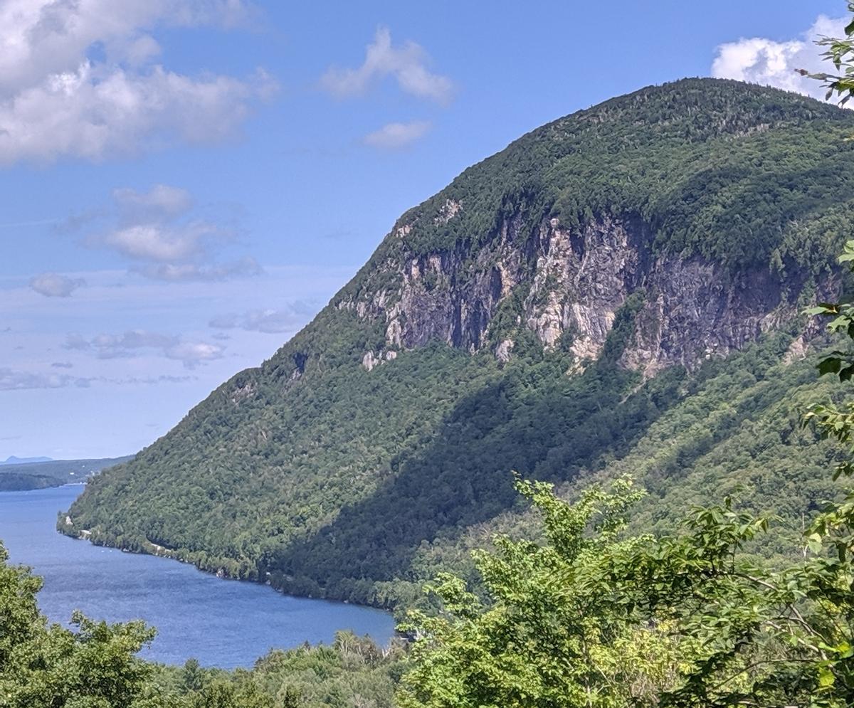
Mount Hor is Mount Pisgah’s sister mountain, just across Lake Willoughby and with equally impressive cliffs. To get to the Mt. Hor trailhead, turn west onto the CCC road just south of the south beach of Lake Willoughby. The CCC road winds upward, past a pull-off with a magnificent view north over the lake, to the Herbert Hawkes trailhead. The Herbert Hawkes trail heads moderately upward through largely sugar maple forest before it steepens to climb the ridge of Mt. Hor.
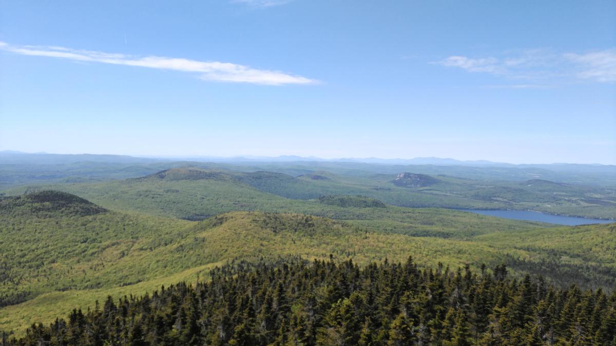
Turn left to head to Mt. Hor’s true summit and views to the west over Willoughby State Forest, or right to enjoy iconic views over Lake Willoughby. All three lookouts on Mount Hor (the summit and the two lookouts over the lake) are over steep cliffs. Take care with your footing while enjoying the view! If you visit the summit and both lookouts, it is a 3.25 mile round trip hike.
Be sure to check out the winter recreation opportunities on Mount Hor as well. There are 7.4 miles of groomed cross country ski trails (also open to snowshoeing) and more than 5 miles of gladed backcountry ski runs. Willoughby is a magical place when the snow flies!
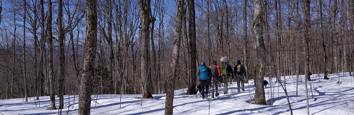
To get to Wheeler Mountain from the south, head north on US-5 from West Burke (rather than turning right onto US-5A to head to Lake Willoughby). Turn right onto Wheeler Mountain Road and drive past Wheeler Pond and the Moose Mountain parking area (see below) to the second parking area on the right. The trail leaves from the parking lot then crosses the road before it heads up the mountain. The trail was recently relocated and climbs at a moderate grade to a viewpoint over the forested valley. Eventually, the trail reaches the rocky and exposed ridge of Wheeler Mountain, with plenty of chances for views and places to rest on the rocks. The round trip distance from the parking lot to the summit and back is 4.3 miles.
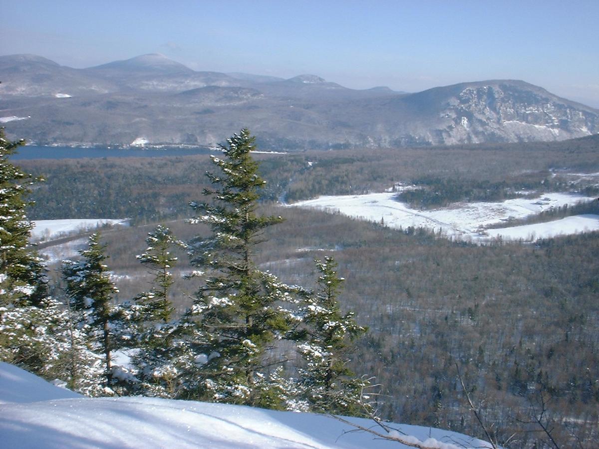
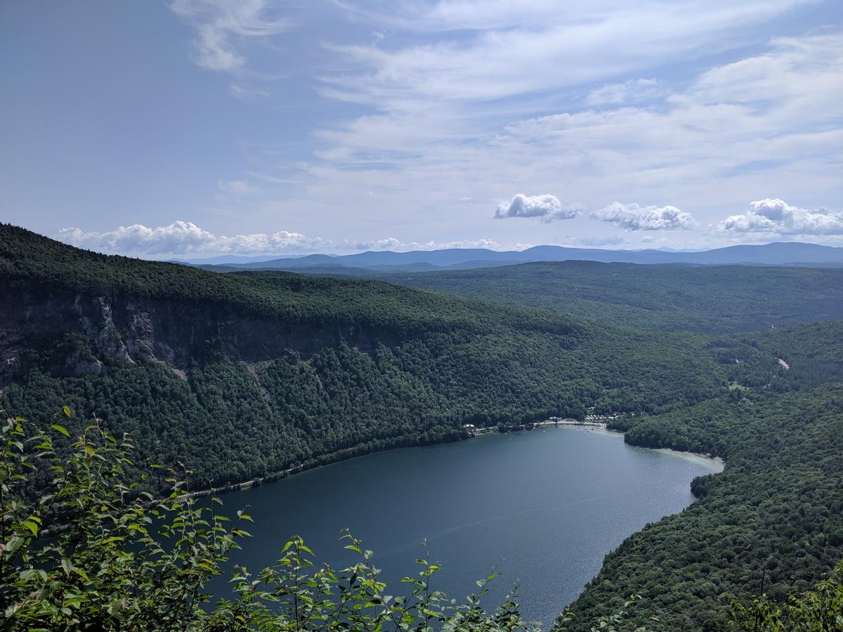
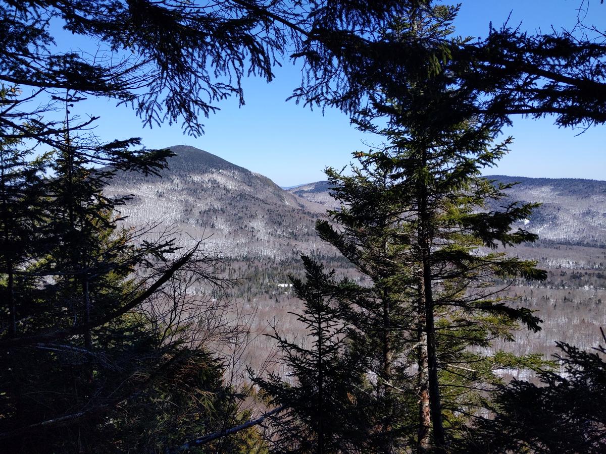
Before the parking lot for Wheeler Mountain, there is a small parking area on the right just past Wheeler Pond. From here, the Moose Mountain Trail heads up to a lovely viewpoint over the pond (a great destination for a kid-friendly hike!) then steeply up to the Moose Mountain summit. Although the Moose Mountain summit is treed, rest assured if you keep going past the summit to the viewpoint 1.2 miles beyond, you will be rewarded with beautiful views over Lake Willoughby and of both the Mount Hor and Mount Pisgah cliffs. Round trip to both viewpoints is 4.7 miles. If you drop a car at the Herbert Hawkes trailhead, you can do a point-to-point hike using the Brookside Trail to connect the Moose Mountain Trail to the Herbert Hawkes Trail.
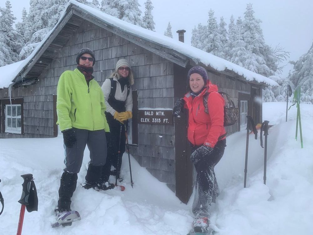
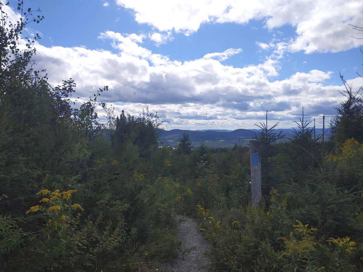
Bald Mountain is the highest summit in the Willoughby region and boasts a firetower on top to guarantee some of the best views around. There are three trailheads for Bald Mountain. The easiest to access from Lake Willoughby is the Long Pond trailhead off of Long Pond Road. The Long Pond trail, as well as the other trails up Bald Mountain, use old logging roads as parts of the route. Take care to watch for blue blazes to make sure you stay on the trails. Also note that sections of the trail pass through private property. Never block driveways and always pass homes with respect.
Besides the firetower, there is also a small cabin at the top of Bald Mountain. It is a nice place to get out of the elements for a snack if it is cold, windy or rainy. Overnight use is first-come first-serve. Depending on which trail you take, the round trip distance for hiking Bald Mountain is 4-5 miles.
Please note that the Telegraph Trail is quite rough and remote.
Haystack Mountain has a North and South Trail, both of which start on Long Pond Road so a 3.1 mile loop including the road walk is possible. (Note that the road is not plowed to the trailhead in the winter. Hikers will need to park at a pull off before the plow turnaround and walk on the road to the trailheads.) As one could anticipate from the profile of the mountain, the trail up Haystack starts with a moderate climb then gets significantly steeper before cresting to the summit.
Although the true summit is treed, there are multiple viewpoints over the remote forests and ponds of the region as well as toward Lake Willoughby.
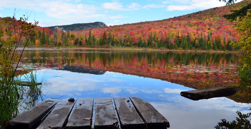
There are so many options for mountain hikes in the Willoughby area, it is easy to forget there are lovely options for less-difficult hikes as well. The Wheeler Pond trail circumnavigates Wheeler Pond with many opportunities to enjoy the reflections on the pond, especially nice in the fall.
Sentinel Rock State Park offers a wheelchair-accessible trail to an incredible and unique view over Lake Willoughby with information panels about the historic use of the area, and a short hiking loop through the forest.
Next time you have a hankering to hike Mount Pisgah, but the parking lot is full, try one of the many other options close by.
You may just find your new favorite hike!
Success! A new password has been emailed to you.