Mud season is here!Protect the trails we all love by sticking to open, dry areas. Learn more! 

Willoughby State Forest - Mount Hor Hiking Trails

This trail system is currently CLOSED. See Trail Alerts tab for details.
Mount Hor has a fabulous network of trails through the Northeast Kingdom wilderness, leading hikers to a number of vistas of the lake, the cliffs, and the mountains, as well as connecting hikers to other trail opportunities in Willoughby State Forest.
Trail Activity
Hiking Snowshoeing
Length
5.40 miles, Network
Difficulty
Moderate, Advanced
Towns
Sutton (VT), Westmore (VT)
Surface
Packed Earth/Dirt, Rock/Ledge
Pets
Permitted on leash
Fees
No

Description

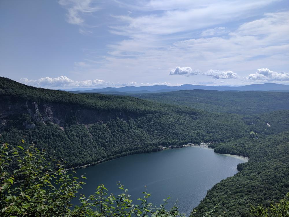
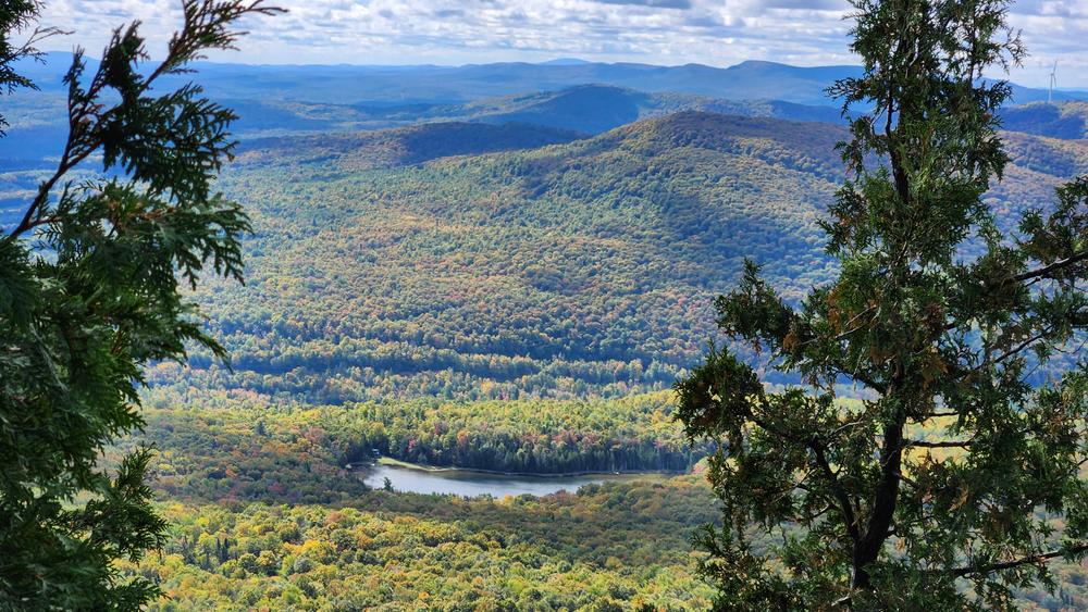
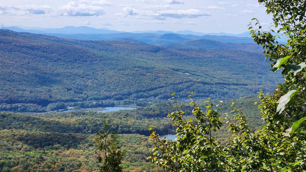
The summit of Mount Hor offers nearby views of the surrounding ponds and a distant view of the Green Mountains. From the other trail lookouts, hikers can see Lake Willoughby, the cliffs of Mount Pisgah, and in the distance, the White Mountains, Owl's Head, and Mount Orford. 

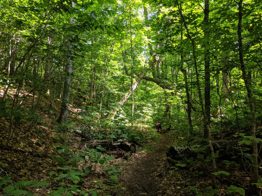
Herbert Hawkes Trail: This trail is the gateway to the other Mount Hor trails and lookouts. From the CCC Road, the forested trail winds up the mountain for 0.7 miles until it reaches a junction where hikers can turn left onto a spur to the summit of Mount Hor, or stay straight and continue on the Herbert Hawkes Trail. In another 0.3 miles there is a junction with the North Trail to the left; if hikers continue straight here they will end up at the North Lookout, where there are extensive views of the lake and the cliffs. 

North Trail: This trail ascends Mount Hor from the northwest. After 0.6 miles of traveling over a forest floor trail, the route comes to a junction with the Brookside Trail; here the North Trail continues straight. In another 0.6 miles the trail ends at a T-intersection with the Herbert Hawkes Trail. Here, hikers can turn left to access the North Lookouts, or turn right and follow signs for the Mount Hor summit. 

Brookside Trail: This trail connects the Moose Mountain Trail to the North Trail, and is useful to hikers wishing to create a longer route.

For more information on winter use, visit the Willoughby State Forest - Ski Trails page. 

Trail Manager

For more information about the trails, visit the Northwoods Stewardship Center or the Vermont Department of Forests, Parks, and Recreation online or contact:

Westmore Trails Committee
Town of Westmore
54 Hinton Hill Road
Orleans, VT 05860
Phone: (802) 525-3007
clerk@westmoreonline.org
View website

NorthWoods Stewardship Center

NorthWoods Stewardship Center
154 Leadership Drive/PO Box 220
East Charleston, Vermont 05833
Phone: (802) 723-6551
info@northwoodscenter.org
View website

VT Dept. Forests, Parks & Recreation District 5: St. Johnsbury District

VT Dept. Forests, Parks & Recreation District 5: St. Johnsbury District
374 Emerson Falls Road
St. Johnsbury, VT 05819
Phone: (802) 751-0136
Luke.OBrien@vermont.gov
View website

Trail Tips

Travel on Durable Surfaces
Stick to established trails. If there's no trail, try to walk on rock, gravel, or snow and spread out so that your group doesn't create a trail.
Legend
Hide All

Trailhead Information

Herbert Hawkes Trail: From Barton, drive east on VT-16 N for 6.6 miles. Turn right onto VT-5A South and continue for 5.7 miles. Turn into the parking area on the right hand side of the road. In the warmer months, drive up the CCC Road for 1.7 miles and pull off in the parking area. In the winter, parking is available at the lot at the bottom of the CCC Road, adding an extra 1.7 miles to the hike. 

North Trail: From Barton, drive east on VT-16 North/Eastern Avenue for 2.9 miles. Turn right onto Cook Road and continue for 1.6 miles. Turn right onto Lake View road and continue for 1.5 miles. Turn right onto Wheeler Mountain Road, then soon after, slight left onto Big Valley Lane. Continue straight until the end of the road where parking and the trailhead are located.

Click on a parking icon to get custom directions
Please Log In or Create Account to add comments.
These awesome businesses support our goal of connecting people to outdoor adventures!
Hang Tight!
Nearby services are loading
No Results
No Services Found

Trail Alerts

Trails
Mud Season Trail Closure
March 20, 2024 – May 24, 2024

One or more trails in this system is currently closed due to muddy or wet conditions. Please help to protect our trails by not walking on them when they are soft and easily damaged. Learn more.

If any trails are open, they will be listed on the Details tab.

SHARE THIS TRAIL

Add Trail Log

Please wait…
Join In on the Fun!
Log in or create an account below to unlock all the great features of Trail Finder: keep track of trails you want to do, preserve memories of trails you’ve done, earn badges, and more!
Your log in attempt was not successful. Please try again.
    Lost your password? Reset your password
    Don't yet have an account?
    There was an issue with your submission. Please try again.
      * Indicates required field
      Already have an account? Login here
      Enter your username, and we will send you a new, randomly generated password to your email account.
      There was an issue with your submission. Please try again.

        Success! A new password has been emailed to you.

        Log in now

        Please wait…