The solar eclipse is coming on April 8th! Learn more about where you can go to view the eclipse and other useful tips.

Bald Mountain Trails

Bald Mountain is the third highest peak in the Northeast Kingdom whose historic fire tower offers stunning views of the surrounding lakes and mountains. 
Trail Activity
Hiking Snowshoeing
Length
7.00 miles, Network
Difficulty
Moderate, Advanced
Town
Westmore (VT)
Surface
Packed Earth/Dirt, Rock/Ledge, Grass/Meadow, Gravel/Crushed Stone/Cinder
Pets
Permitted on leash
Fees
No

Description

NOTICE:

The former Mad Brook Trail parking area and snowplow turnaround is closed to public use. FPR, local landowners, and the Town of Westmore have developed a new, temporary winter parking area approximately 0.4 miles up the road, past the former parking site. Parking is limited to 3 vehicles. The first vehicle sets the pattern; park to optimize the number of vehicles.

To reduce pressure on this area, please consider visiting the Mad Brook Trail at off-peak times: mid-week, early/late in the day. If the lot is full, please seek alternate trail access. Do not block the road, driveways, or the plow turnaround. As always, please be respectful of private lands.

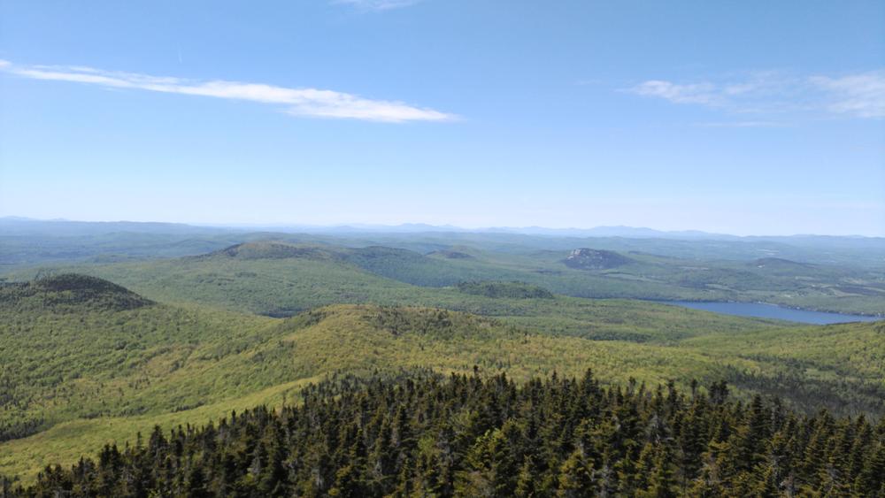
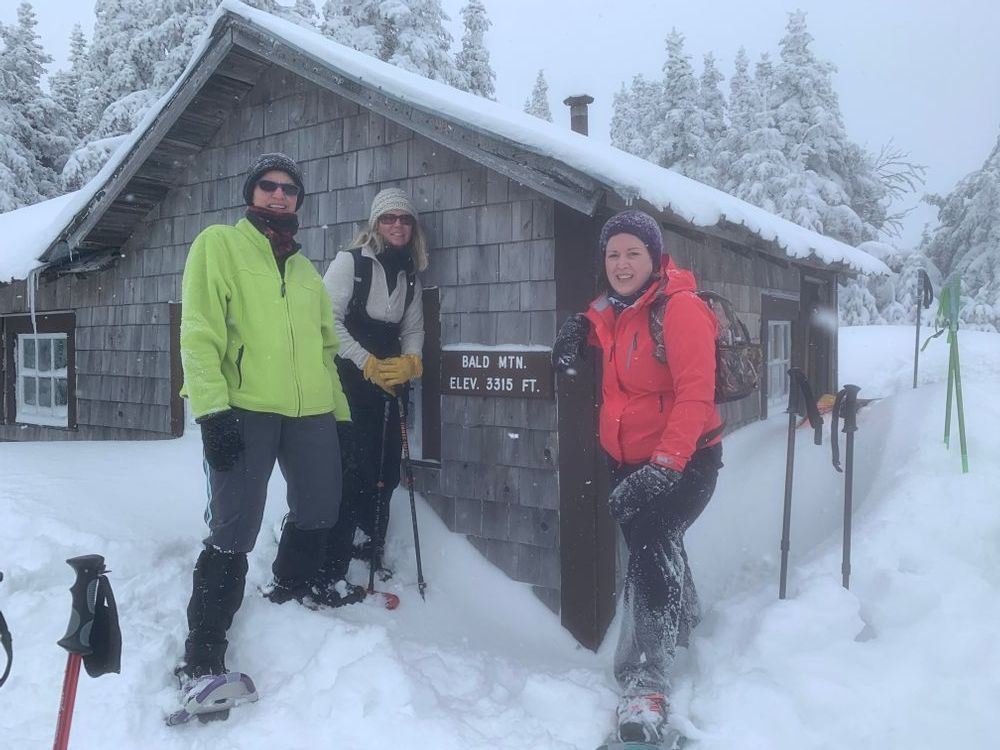
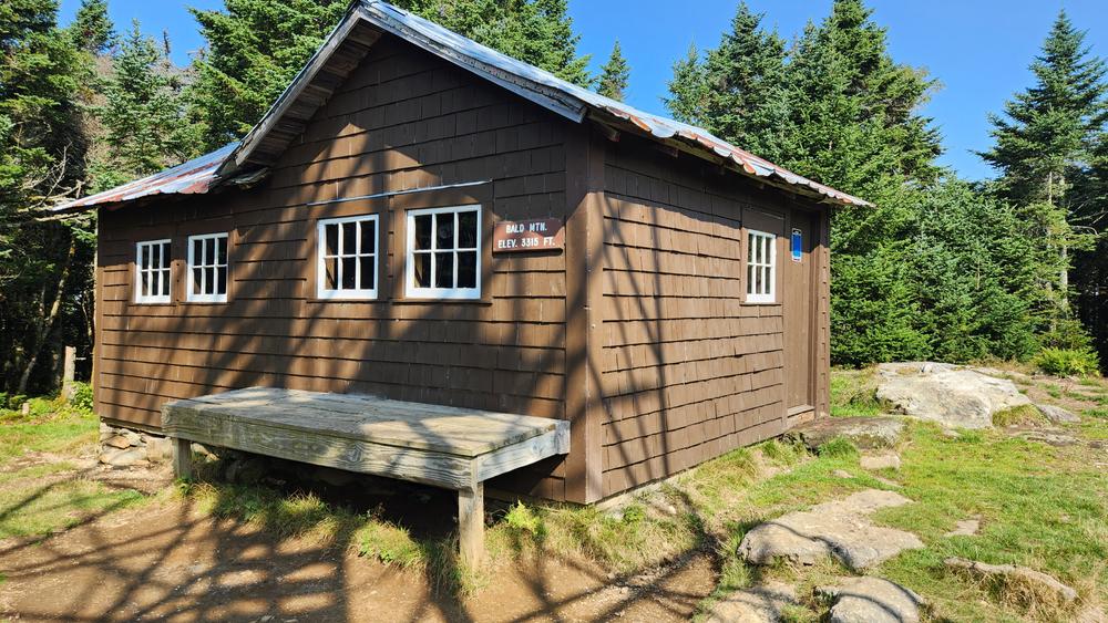
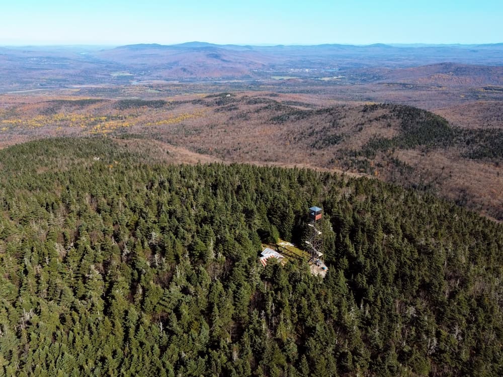
Bald Mountain: From the restored fire tower on the summit there is a 360-degree view that includes Lake Willoughby, Seymour Lake, Lake Memphremagog, parts of the Green Mountains, and all of the White Mountains. In addition to the fire tower, there is also a newly restored shelter at the summit. 

  • Long Pond Trail: (2.0 miles, 1,450 feet of elevation gain) From the parking area, the trail follows blue blazes up a gated logging road and bears right at the junction where the trail climbs a moderate hill to an open logging area. After the clearing, the trail turns into the trees where it follows an old woods trail. The trail winds through open hardwoods, crossing streams, and climbing steadily into the sub-alpine spruce-fir forest. As the trail approaches the mountain top, it climbs several steep pitches and passes large rock outcroppings, then the trail emerges to the top of the mountain. NOTE: This trail can be wet in spots, plan appropriately.
  • Mad Brook Trail: (3.0 miles, 1,415 feet of elevation gain) This trail approaches the summit from the north, starting from the terminus of Mad Brook Road in East Charleston. The trail follows a gravel drive for 0.5 miles, then travels straight across an open meadow. Please respect private landowners through this section. The trail then enters a mixed forest on an old road and climbs a gradual slope. The trail descends briefly after that to the base of Bald Mountain then climbs more steeply up to the summit of the mountain.
  • Telegraph Trail: The Telegraph Trail is the oldest route to the summit of Bald Mountain and was used to access the forest fire lookout station on the summit (now defunct). Traces of the old telegraph line are still present in places. It has been heavily altered by logging and a lack of sustained maintenance. Nevertheless, the trail provides an alternative and somewhat adventurous approach to the summit. From the gate on Tower Lane, the trail crosses a stream and immediately turns left along an old logging road. After crossing a large stream (use caution in winter), the trail enters an old clearing and follows the overgrown, but well-built logging road south as it climbs gently to a second, more recent log landing. From here the trail is noticeably more narrow and overgrown. The trail leaves the far left (southeast) corner of the log landing along an old skid way that is wet in places. As it approaches a saddle with thick regeneration the trail bears right (south) and avoids a more recently used ATV trail to the left. Staying right, the trail departs the saddle on yet another skid way, crosses a small stream and soon takes a sharp left turn. Here, leaving the young forest and logging areas, the trail climbs steeply up the mountain, crossing into the Willoughby State Forest and eventually emerging on the mountain summit.

Other Information

Note: There is a third trail that accesses the summit of Bald Mountain called the Telegraph Trail; however, the trail is seldom used and not maintained. 

Trail Manager

For more information, visit the Northwoods Stewardship Center or the VT Department of Forests, Parks & Recreation online or contact:

Westmore Trails Committee
Town of Westmore
54 Hinton Hill Road
Orleans, VT 05860
Phone: (802) 525-3007
clerk@westmoreonline.org
View website

NorthWoods Stewardship Center

NorthWoods Stewardship Center
154 Leadership Drive/PO Box 220
East Charleston, Vermont 05833
Phone: (802) 723-6551
info@northwoodscenter.org
View website

VT Dept. Forests, Parks & Recreation District 5: St. Johnsbury District

VT Dept. Forests, Parks & Recreation District 5: St. Johnsbury District
374 Emerson Falls Road
St. Johnsbury, VT 05819
Phone: (802) 751-0136
Luke.OBrien@vermont.gov
View website

Trail Tips

Respect Wildlife
Keep wildlife wild: do not feed, follow, approach, or otherwise harass wild animals. Doing so may alter their natural behaviors.
Legend
Hide All

Trailhead Information

Long Pond Trailhead: From Lyndonville, drive north on US-5 for 6.7 miles. Turn right onto VT-5A north and continue for 9.9 miles. Turn right onto Long Pond Road and continue for 2.1 miles; the parking area will be on the left.

Mad  Brook Trailhead: From Lyndonville, drive north on US-5 for 6.7 miles. Turn right onto VT-5A north and continue for 10.3 miles. Turn right onto Hinton Hill Road and continue for 4.5 miles. Turn right onto Mad Brook Road and continue 2.2 miles to the end of the road. (Parts of this road may be closed seasonally.) Parking is limited to 3 vehicles. The first vehicle sets the pattern; park to optimize the number of vehicles. To reduce pressure on this area, please consider visiting the Mad Brook Trail at off-peak times: mid-week, early/late in the day. If the lot is full, please seek alternate trail access. Do not block the road, driveways, or the plow turnaround. As always, please be respectful of private lands.

Telegraph Trailhead: From Lyndonville, drive north on US-5 for 6.7 miles. Turn right onto VT-5A north and continue for 10.3 miles. Turn right onto Hinton Hill Road and continue for 2 miles. At the top of the hill, bear right on Coles Road and follow for 1.7 miles. Turn right on Tower Lane and continue for 1.0 mile. Before the gated terminus, there is a small area on the left for parking. This parking area is not plowed in the winter.

Note: Tower Lane is a Class 4 Road and may not be plowed or maintained in the winter. Please respect adjoining landowners and be sure not to block driveways.

Click on a parking icon to get custom directions
Please Log In or Create Account to add comments.
These awesome businesses support our goal of connecting people to outdoor adventures!
Hang Tight!
Nearby services are loading
No Results
No Services Found

Trail Alerts

Trails
Private Property
This trail passes through private property. Please respect the landowner and protect future access by staying on the marked trail and following all rules.
Trails
Parking along Road
Parking for this trail is along a narrow gravel road. Please make sure to park to the side and do not block traffic or any private drives.
Facilities
Parking area closure

The former Mad Brook Trail parking area and snowplow turnaround is closed to public use. FPR, local landowners, and the Town of Westmore have developed a new, temporary winter parking area approximately 0.4 miles up the road, past the former parking site. Parking is limited to 3 vehicles. The first vehicle sets the pattern; park to optimize the number of vehicles.

To reduce pressure on this area, please consider visiting the Mad Brook Trail at off-peak times: mid-week, early/late in the day. If the lot is full, please seek alternate trail access. Do not block the road, driveways, or the plow turnaround. As always, please be respectful of private lands.

Trails
Hiking Mud Season
March 20, 2024 – May 24, 2024

It is mud season in Vermont. Even if a trail is marked as open, pay attention to trail conditions. If you encounter mud or ice, turn around. Come back once the trail has had time to dry out.  

SHARE THIS TRAIL

Add Trail Log

Please wait…
Join In on the Fun!
Log in or create an account below to unlock all the great features of Trail Finder: keep track of trails you want to do, preserve memories of trails you’ve done, earn badges, and more!
Your log in attempt was not successful. Please try again.
    Lost your password? Reset your password
    Don't yet have an account?
    There was an issue with your submission. Please try again.
      * Indicates required field
      Already have an account? Login here
      Enter your username, and we will send you a new, randomly generated password to your email account.
      There was an issue with your submission. Please try again.

        Success! A new password has been emailed to you.

        Log in now

        Please wait…