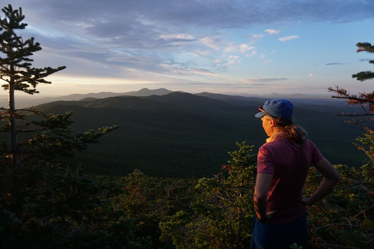
Sunrise and sunset hikes may be the most underrated type of hiking you can do. They can be short and done during non-working hours, each one is entirely unique, and you are out during the most beautiful times of day. Sunrise and sunset hikes are also great to do during the spring in particular; the sun rises and sets at much more reasonable hours than in summer, and hiking in the morning or afternoon allows you to avoid times of peak trail usage. While these hikes require some more careful planning, we’ve compiled a guide to help you make the most of your trip.
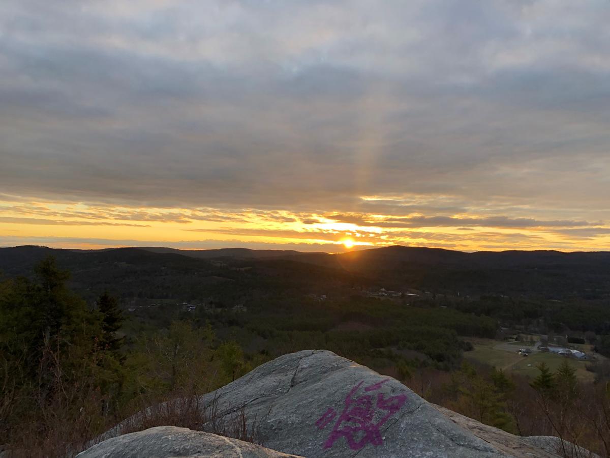
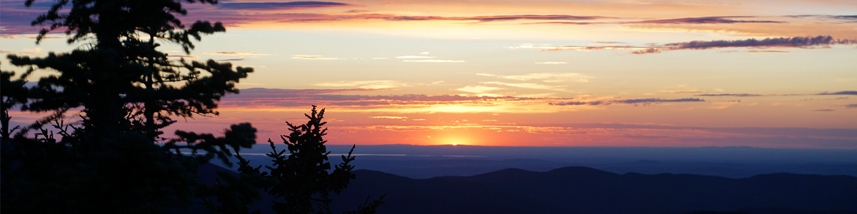
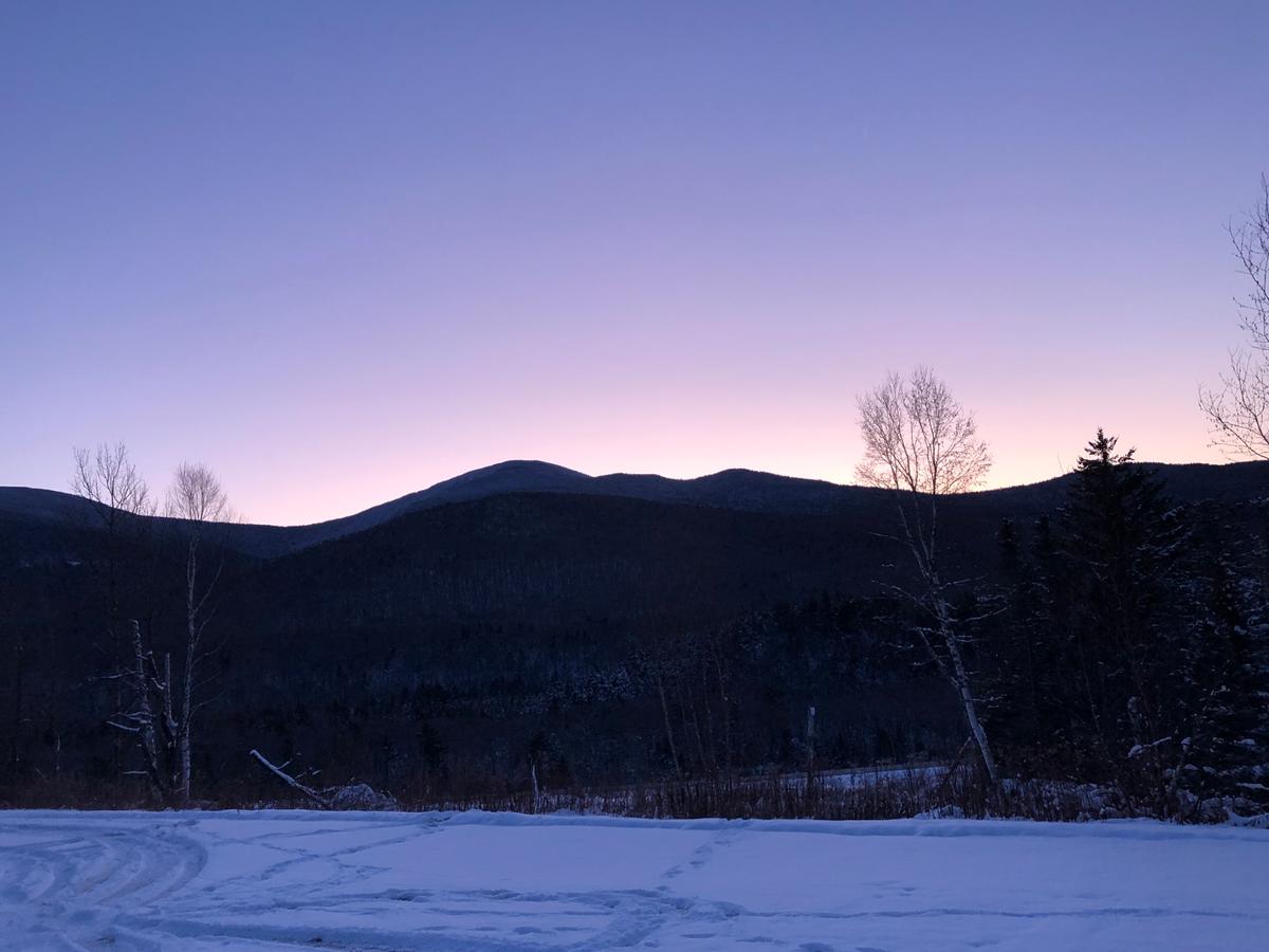
It’s hard to ruin a sunrise or sunset hike, but it can be pretty disappointing if you get to the top of a beautiful lookout only to see rays of sun just poking out from the other side of the trees! The sun rises in the east and sets in the west, so you’ll want to find a spot that has a 360 degree view or a clearing in your desired direction. To start, try using Trail Finder to search for summit hikes or lookouts and fire towers. You can also look for trail descriptions, comments, or photos that mention sunrises, sunsets, or the direction of views. Some summits will even have panoramic photos from the top posted on the map! Drag the orange street view icon over the map and look for small blue circles, and drop the icon onto one of the circles to view the photo.
You can also think back to hikes you’ve done previously with great views or ask friends for recommendations - and we’ve included some recommendations below for hikes in the Upper Valley area. When choosing a location, also consider how far you are willing to drive and hike, keeping in mind that half of it will be in the dark!
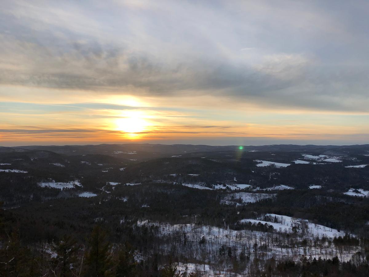
What weather and timing makes for the best sunrise/sunset? While there is no exact formula, you can pick days that will maximize your chance of seeing some epic colors. With these types of hikes, clouds are actually a good thing. When checking the weather forecast, look for days that have 30-60% cloud cover, middle to high cloud ceilings, and relatively low humidity. If you have two out of three of these things, you’ll probably still have a great view of the sun, and sometimes lots of low clouds or other configurations can produce stunning scenes.
As for timing, the color in the sky starts long before the upper edge of the sun’s disk touches the horizon line (the event that is used to determine the sunrise or sunset time that appears on your weather app). Arriving thirty minutes before and staying thirty minutes after the sunrise/sunset will allow you to experience the full range of colors and light, though if you’re short on time, arriving fifteen minutes before should be enough.
It’s a good idea to bring the usual ten essentials on your sunrise and sunset hikes, with special emphasis on bringing a good source of light such as a headlamp (and a backup!) for every person in your party. If you’re planning on hanging out to watch the light show, bring a sleeping bag or quilt to snuggle up in (this can be a game changer), as well as some snacks to munch on while you watch. Also see our previous post on hiking during the pandemic for tips on keeping the trail safe for yourself and others. Hiking in the dark makes it harder to see the direction or potential hazards of the trail. To make sure you are comfortable, you can hike up and down the same trail, or better yet, check out the trail beforehand during the day. Identify at the trailhead how the trail is marked, and make sure to keep an eye out for blazes as you go.
Every sunrise and sunset is special in its own way. While planning is helpful, it is often much better to go and see what you find (as long as conditions are safe) than to cancel your plans altogether. On one sunrise hike I went on, all we could see was a gray sky that grew gradually lighter, but for one magical minute the entire blanket of fog surrounding us glowed with a soft pink light. That moment made the whole hike worthwhile!
You can make the experience even more memorable by adding in a stop at a local diner for breakfast or restaurant for dinner after your hike. Check out Trail Finder’s Trailside Services feature for some ideas by clicking the “Services” tab while viewing a trail or search directly for services in your area. Happy hiking!
Wright's Mountain in Bradford, Vermont is a 1.6 mile round-trip, out and back trail leading to a cabin and stunning panoramic view of Vermont at sunset.
The Trescott Water Supply Lands in Hanover, New Hampshire are a network of trails with multiple scenic and reservoir views. For a sweeping view into Vermont at sunset, park on Trescott Road and hike up to Prospect Hill on a wide trail with some rough footing, approximately 1.5 miles each way.
The Faulkner Trail in Woodstock, Vermont is unique for its gentle, switchbacked trail and gorgeous view of Woodstock. The last 100 yards to South Peak is rocky and steep.
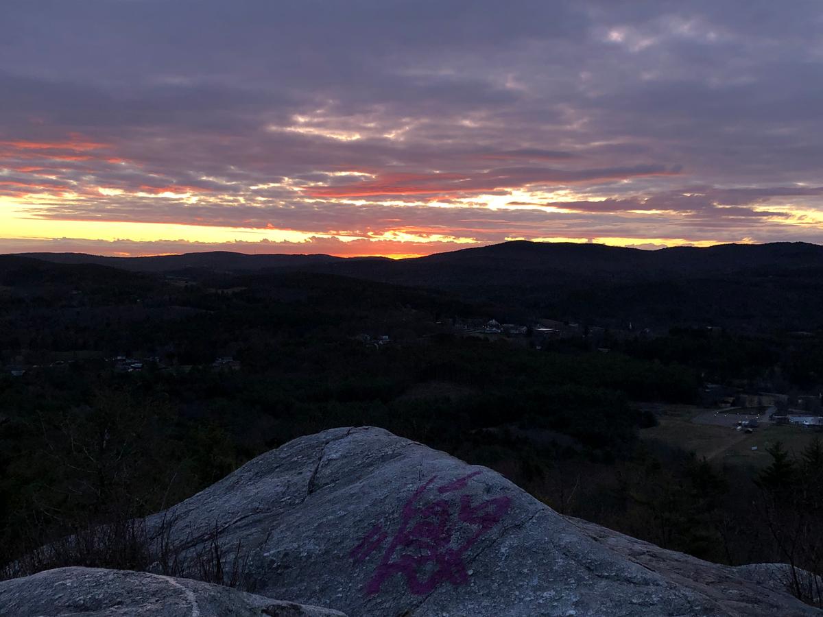
French’s Ledges is a lovely easy- to moderately- graded hike through the woods that ends with a short, steep section up to the ledges themselves, which offer 360 degree views of the surrounding area.
Check out these recommended hikes on the map below to find out whether any are near you!
Success! A new password has been emailed to you.