Northern Rail Trail

A nearly flat trail which travels from Lebanon, New Hampshire, in the Mascoma River Valley, passing though historic villages and by scenic lakes, streams, and hills along the old railroad bed of the Boston & Maine Railroad Northern Line, until it reaches Boscawen, a few miles North of Concord.
Trail Activity
Ungroomed cross-country skiing Walking Bicycling Horseback riding Snowmobiling
Length
59.00 miles, One Way
Difficulty
Easy, Moderate, Advanced
Towns
Andover (NH), Boscawen (NH), Canaan (NH), Danbury (NH), Enfield (NH), Franklin (NH), Grafton (NH), Lebanon (NH), Orange (NH), Wilmot (NH)
Surface
Gravel/Crushed Stone/Cinder
Pets
Permitted on leash
Fees
No

Description

HIGH USE TRAIL:

This is a busy trail system, especially on weekends between 9AM-4PM. Consider visiting outside of peak periods. Use Trail Finder to identify other nearby trails. If the parking lot is full when you arrive, please choose another trail. 

Learn more about high use trail systems.

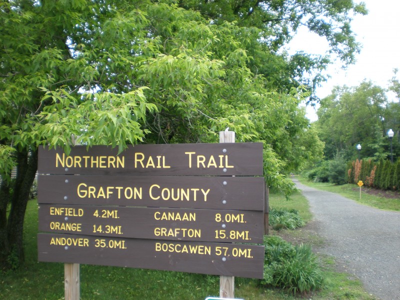
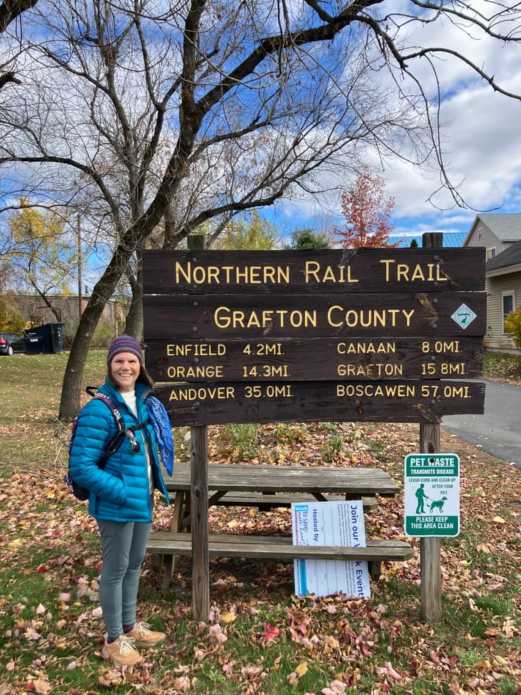
Along the Trail eastbound from Lebanon:

  • First of seven crossings of Mascoma River in Lebanon.
  • Pass under I-89, enter wooded valley of the Mascoma.
  • Scenic Mill Road and kayak course at twin bridges.
  • Dam at East Lebanon, a bustling sawmill village from 1780-1840. First views of Mascoma Lake.
  • Ice House Road, site of B&M RR Mascoma Depot and sidings. Parking with access from Route 4.
  • Views down lake to Shaker Bridge, built 1849 to give Enfield colony access to the railroad, of which it was a stockholder.
  • The Cut. Initials carved in stone date from widening in 1890s. Spectacular ice formations in winter.
  • Enfield town center. Freight shed now a laundromat. Depot ahead, with 1950s creamery opposite. Services.
  • Baltic Mill and dam. Made woolen cloth for outerwear and blankets, 1890s-1970s.
  • Blackwater Road. Mascoma River canoe access.
  • South Road, Crystal Lake three miles south.
  • Indian River high bridge.
  • Canaan town center. Depot and freight house. Services.
  • Mirror Lake, views of Cardigan Mountain.
  • Orange Cut, high point on Northern Line, 968 feet.
  • Trail tunnel under Route 4, opened 2001.
  • Riddle Hill Road to Ruggles Mine. Mica and minerals.
  • Grafton. Limited services.
  • Merrimack County line, Danbury.
  • Danbury to West Franklin, via packed granite surfacing.
  • Trail currently continues south to a point just north of the Boscawen/Concord city line

Other Information

Of the three rail corridors laid out west and north from Concord in central NH to points on the Connecticut River, the Northern Railroad survived the longest. It was completed in 1847, with Daniel Webster giving the keynote address in downtown Lebanon, at a spot just a few yards from where the trail begins today. The fare to Boston via Lowell, Massachussetts was $4. As with so many other early railroads, the Northern was plagued with financial difficulty thoughout its early history. Acquired by the Boston & Maine in 1887, the line flourished for about forty years, largely due to its terminus at White River Junction, Vermont, the regional rail hub. With the Depression, the Northern Branch joined hundreds of other American railroads in a long decline toward oblivion.

Passenger service ended in 1965, with a few freight runs operating into the early 1970s. The B&M stopped maintaining the line and soon abandoned it. In 1996, sixty miles of the corridor were acquired by the State of New Hampshire for $5 million in Federal transportation enhancement funds, to be converted to a recreation trail.

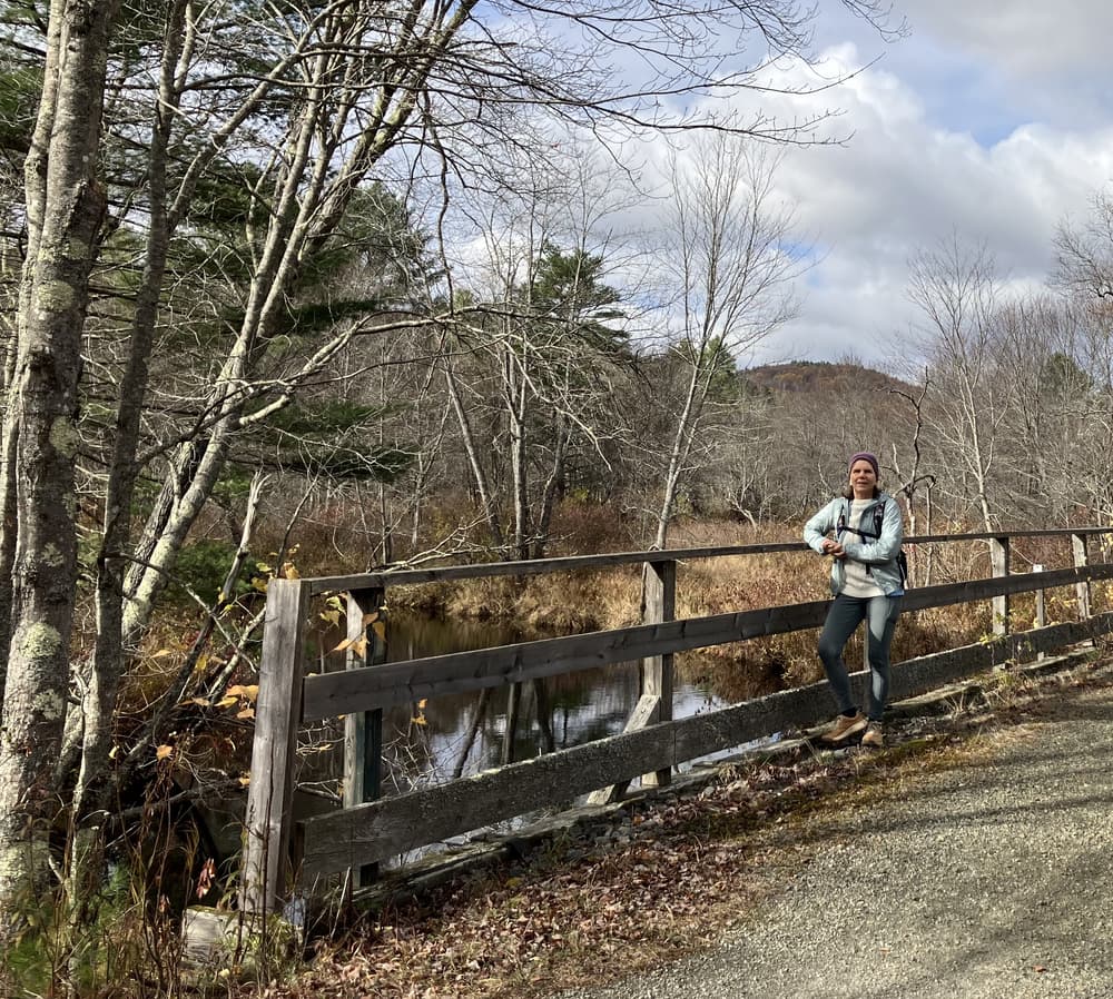
Within a few months, local snowmobile clubs had decked bridges and removed obstacles, opening the entire length to winter use. Luckily for the redevelopment of the trail for warm weather use, the railroad had invested little in ballasting the Grafton County section of the line with heavy stone. The fine black cinders that cover most of the surface between Lebanon and Lake Mascoma today date from before 1950, when the waste product from coal-fired steam engines was spread between the crossties to dampen vibration and soften the ride. By 2000, volunteers working with the local support group had removed the ties and graded the cinders in the western half of the corridor, making twelve miles walkable and bikeable. The stone dust portions of the trail, which are mostly east of Enfield, were applied more recently, using state grants, foundation gifts, and private fundraising. The "last mile" of stone dust was laid in 2010 in Grafton, as the Friends of the Northern Rail Trail began to shift from trail building to trail maintenance. A connection to the Merrimack County section of the trail in Danbury was completed in 2010 and further surfacing improvements were completed on a few portions in Merrimack County in  2011. The trail was extended 2.5 miles, ending at Holy Cross Road, just off Route 3 in West Franklin.
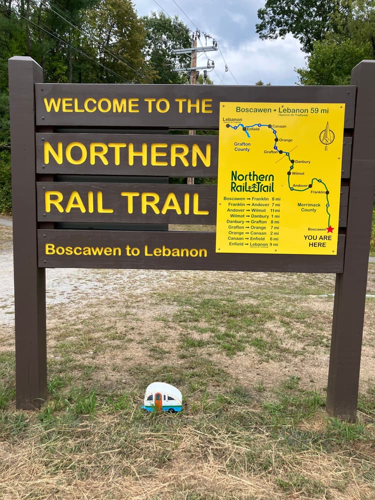
The Northern Rail Trail now goes a total of 59 miles from Lebanon to just north of the Boscawen/Concord city line; 23 miles in Grafton County and 34 in Merrimack. The extension of the trail to the west as a portion of the Mascoma River Greenway is actively being pursued by the City of Lebanon. The ultimate hope is to connect downtown Lebanon with West Lebanon via the rail corridor, perhaps to include a rail-with-trail configuration.

The Northern Rail Trail currently extends south to a trail terminus 1/2 mile north of the Hannah Dustin Park & Ride off exit 17 from I-93.

Overview map with mile post marker locations

Section maps

Trail Manager

Visit the Northern Rail Trail or the Friends of the Northern Rail Trail online for more information and printable maps or contact:

Friends of the Northern Rail Trail

Friends of the Northern Rail Trail
PO Box 2095
Lebanon, NH 03266
info@FNRT.org
View website

NH Bureau of Trails

NH Bureau of Trails
172 Pembroke Road
Concord, NH 03301
Phone: (603) 271-3254
nhtrails@dncr.nh.gov
View website

Trail Tips

Be Considerate of Other Visitors
Consider volunteering with a trails organization to give back to the trails that give you so much!
Legend
Hide All

Trailhead Information

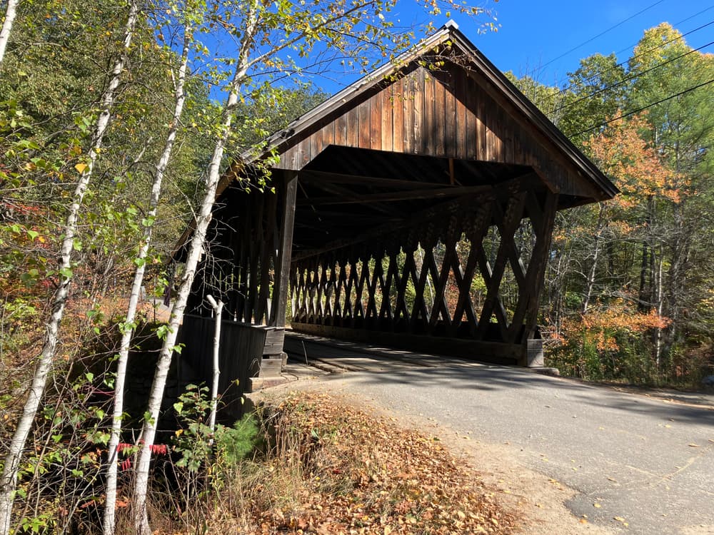
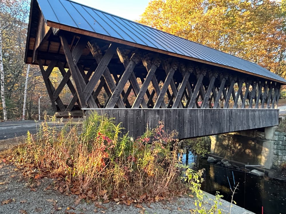
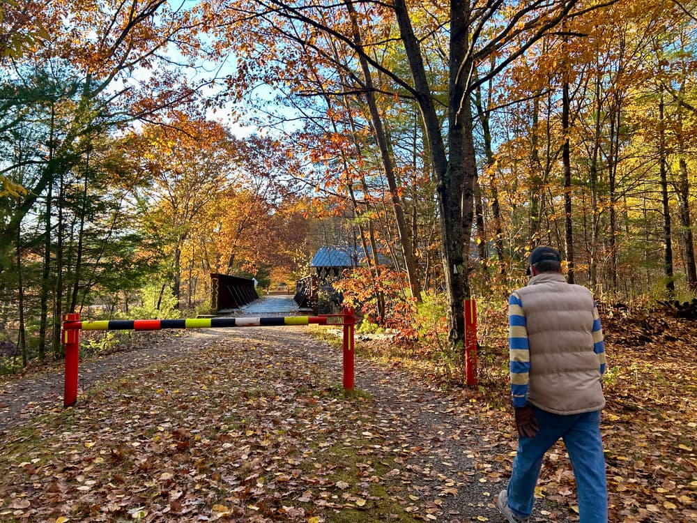
Western Terminus: Parking is available in downtown Lebanon along Taylor Street (in front of the CCBA) and in the two lots behind Lebanon City Hall. Additional parking is available near the trail gate east of Packard Hill Covered Bridge on Riverside Drive. 

Eastern Terminus: Park at the Hannah Dustin Park & Ride (a mile or so west from Exit 17 off I-93) and follow the ramp at the southwest corner down to the old rail line. Follow that rail line north and to the right along River Road for about a quarter of a mile where there are blue signs indicating the start of the Northern Rail Trail about 10 feet off of River Road. There is no parking at the point where the Trail starts. 

Parking is also available at other trailheads along this route, such as Ice House Road off Route 4 (Near Mobil station). The major trailheads are plowed and accessible in the winter.

Click on a parking icon to get custom directions
Please Log In or Create Account to add comments.
the owl
October 21, 2025
OWL-Old Walking Lady just completed Day 3 (October 19) walking from Potter's Place to Danbury Country Market. Another incredible day with sunny skies and comfortable temps for walking! The walk was a little less today as my friend and I chose to walk a shorter distance today. Being a Sunday we encountered lots of bikers. SIDE NOTE: we really appreciated it when bikers used their bells or shouted out with a warning so we had time to step aside. Thanks bikers! We walked for 7.5 miles then checked out this amazing store! Walking any section of this trail is an awesome experience and well worth it!
the owl
October 21, 2025
Hi, this is OWL-Old Walking Lady, back with an update about my second walk along the NRT. The day is Friday, October 10. I am making my way north from Boscawen to West Lebanon. Day 2 was shared with a friend as we started at Webster Lake to walk to Potter's Place. We walked about 10.5 miles in about 3 hours 20 minutes. The weather was again perfect, sunny and cool! I am really enjoying my walks!
the owl
October 21, 2025
Hi, decided early Fall 2025 to walk the Northern Rail Trail in its entirety after constantly seeing the large granite mile markers in the Lebanon, NH region of this trail. Took me a while to realize WRJ meant White River junction as we were new to NH from central NY. We bought 13 acres in Newport, NH to build our retirement home closer to kids and grand-kids and have been slowly learning about all the wonderful activities NH provides; cultural, natural and community. We walked our dog, Owen, mostly in the Lebanon/Enfield area for the past couple of years before he unexpectedly passed leaving a large void in our lives. He was my constant walking partner. So I decided to start at the beginning from Boscawen, NH to West Lebanon, NH.
The first day I walked was Friday, October 3. My husband, Fred, dropped me off with a kiss and off I went. It was a glorious day with plenty of sunshine though the trail was mostly in the woods with scattered moments of warm sun on my face. Following the Merrimack for many miles and passing a few people along the way it was mostly quiet and serene. Chatted with a couple who were birding and some bikers. One guy was doing some maintenance near the prison and offered some places to stop along the way. I walked almost 13 miles taking about 4 hours and 25 minutes. I rested for a few minutes at the Gerrish Depot --appreciated the historic signs, port-a-potty and picnic tables! Fred was waiting for me at the Webster Lake trailhead. After a 50 minute ride home I thoroughly enjoyed a hot bath in lavender epsom salts and never felt any soreness.
cycleguy
December 20, 2024
I would like to ride the trail on a road bike, what section(s) of the trail are paved for road cycling?
englest
February 19, 2016
Made a quick stop in Lebanon to go for a winter fat bike ride on the Northern Rail Trail while driving along I-89. Loved all the bridges and views of the river.
These awesome businesses support our goal of connecting people to outdoor adventures!
Hang Tight!
Nearby services are loading
No Results
No Services Found
SHARE THIS TRAIL

Add Trail Log

Please wait…
Join In on the Fun!
Log in or create an account below to unlock all the great features of Trail Finder: keep track of trails you want to do, preserve memories of trails you’ve done, earn badges, and more!
Your log in attempt was not successful. Please try again.
    Lost your password? Reset your password
    Don't yet have an account?
    There was an issue with your submission. Please try again.
      * Indicates required field
      Already have an account? Login here
      Enter your username, and we will send you a new, randomly generated password to your email account.
      There was an issue with your submission. Please try again.

        Success! A new password has been emailed to you.

        Log in now

        Please wait…