Mud season is here!Protect the trails we all love by sticking to open, dry areas. Learn more! 

Mount Mansfield East

This trail system is currently PARTIALLY OPEN. See Trail Alerts tab for details.
Trail access the east side and summit ridge of Mt. Mansfield, the highest point in Vermont. 
Trail Activity
Accessible Experience Hiking Snowshoeing
Length
12.90 miles, Network
Difficulty
Easy, Advanced, Strenuous
Towns
Cambridge (VT), Stowe (VT), Underhill (VT)
Surface
Packed Earth/Dirt, Rock/Ledge, Boardwalk/Bog Bridging
Pets
Permitted on leash
Fees
No
Other Activities
Backcountry skiing

Description

TRAIL CLOSURES:
The Barnes Camp Boardwalk is currently open, but the rest of the trails are closed for mud season.


HIGH USE TRAIL:

This is a busy trail system, especially on weekends between 9AM-4PM. Consider visiting outside of peak periods. Use Trail Finder to identify other nearby trails. If the parking lot is full when you arrive, please choose another trail.

Learn more about high use trail systems.

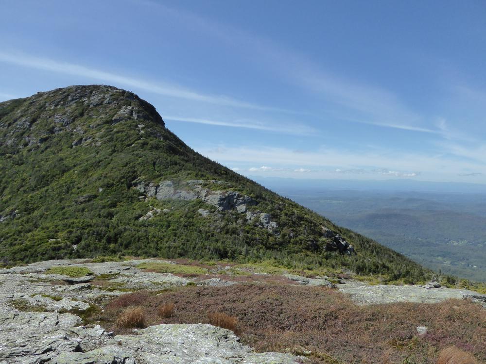
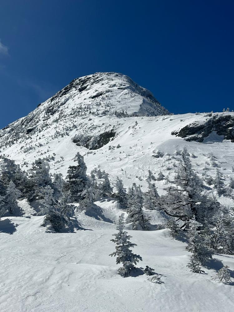
Mt. Mansfield, the tallest point in Vermont, features a long summit ridge with multiple summits including The Forehead and The Nose. It is one of the most popular hiking destinations in Vermont, drawing visitors from all over the Northeast and Quebec, and can become very crowded. In order to avoid crowds, plan to visit early in the morning or on weekdays. 

There are many ways up to the summit of Mt. Mansfield from multiple trailheads. Please note that the trails described below leave from different trailheads. If planning to start and end at different trailheads, make sure to drop a car and plan for the driving distance between trailheads.

TRAIL DESCRIPTIONS 

Hell Brook Trail to Chin (Difficult)
Length - 1.8 miles, 2660’ Elevation Gain
Surface - Dirt and Ledge
Description - This extremely challenging route can be dangerous when wet and on the descent. Most of the way up the mountain it winds along the scenic Hell Brook. Follow the blue blazes until you meet the Adam’s Apple Trail (0.2 miles) and in Eagle Pass join the Long Trail for the final 0.3 miles.
 
Long Trail South to Chin (Difficult)
Length - 2.3 miles. 2700’ Elevation Gain
Surface - Dirt and Ledge
Description - Follow the white blazes from the parking area (just South of the Smugglers’ Notch Picnic Area). This steady climb affords you access to the highest peak in the State of Vermont. At 1.7 miles you will pass the historic Taft Lodge, one of the many Long Trail lodges operated by the Green Mountain Club.
 
Long Trail - Nose to Chin (Moderate)
Length - 1.2 miles, 550’ Elevation Gain
Surface - Dirt and Ledge
Description - Follow the Toll Road ($) from Route 108 starting behind the Fire Side Tavern to parking area A at the Nose. The white blazes above the tree line lead you to the summit of Mt. Mansfield. Incredible 360 degree views await.
 
Haselton to Mt. Mansfield Nose (Difficult)
Length - 2.1 miles, 2500’ Elevation Gain
Surface - Dirt and Ledge
Description - Starting in the Midway Base Lodge Parking lot the first 1.6 miles follows blue blazes until it meets up with the Toll Road for the final half mile. Before it terminates at the Nose you are afforded a multitude of scenic vistas due to the ski trails transecting the Haselton.
 
Hell Brook Cut-off:
Length: 0.6 miles
Surface: Packed dirt and ledge 
 

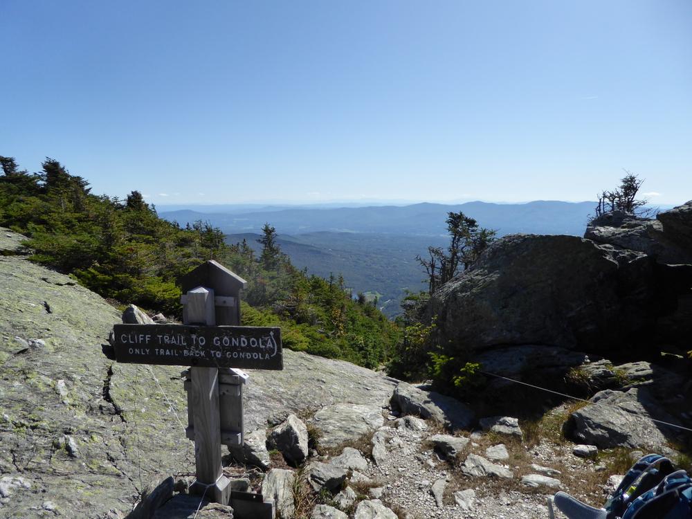
Lakeview, Canyons, Subway, and Cliff Trails: These trails parallel the Long Trail along the Mansfield summit ridgeline, but follow adventurous terrain, over and under boulders and along cliff edges. Take them for excellent views, more challenging hiking, and smaller crowds.

Barnes Camp Universally Accessible Boardwalk:
Length - 0.12 miles
Surface - Boardwalk
Description - The Barnes Camp Boardwalk provides great wildlife viewing opportunities and access to wetlands adjacent to the west branch of the Little River.


Trail Manager

For more information, visit Vermont Department of Forests, Parks and Recreation online or contact: 

Green Mountain Club

Green Mountain Club
4711 Waterbury-Stowe Rd.
Waterbury Center, VT 05677
Phone: (802) 244-7037
gmc@greenmountainclub.org
View website

VT Dept. Forests, Parks & Recreation District 4: Barre District

VT Dept. Forests, Parks & Recreation District 4: Barre District
5 Perry Street, Suite 20
Barre, VT 05641-4265
Phone: (802) 476-0182
Walter.Opuszynski@vermont.gov
View website

Trail Tips

Plan Ahead and Prepare
Be prepared for extreme weather. Bring rain/wind gear, warm clothing, and matches/fire starters.
Legend
Hide All

Trailhead Information

Hell Brook Parking: This parking lot provides access to the Hell Brook Trail. It is open only in the summer. The Mountain Road is closed at Barnes Camp in the winter months. From the intersection of VT-100 and VT-108 in Stowe, drive north on VT-108 for 9.1 miles. Parking is on the right. The Hell Brook trailhead is across the road from the pull-off parking area.

Barnes Camp Parking: This parking lot provides access to the Long Trail and is open year-round. From the intersection of VT-100 and VT-108 in Stowe, drive north on VT-108 for 7.8 miles. The lot for the Barnes Camp Visitor Center will be on the right. This area is plowed in the winter.

Stowe Mountain Resort Parking: This parking lot provides access to the Haselton Trail. From the intersection of VT-100 and VT-108 in Stowe, drive north on VT-108 for 7.7 miles. Turn left into the Stowe Mountain Resort and park in the large lots. 

Click on a parking icon to get custom directions
Please Log In or Create Account to add comments.
These awesome businesses support our goal of connecting people to outdoor adventures!
Hang Tight!
Nearby services are loading
No Results
No Services Found

Trail Alerts

Trails
Hiking Mud Season
March 20, 2024 – May 24, 2024

It is mud season in Vermont. Even if a trail is marked as open, pay attention to trail conditions. If you encounter mud or ice, turn around. Come back once the trail has had time to dry out.  

SHARE THIS TRAIL

Add Trail Log

Please wait…
Join In on the Fun!
Log in or create an account below to unlock all the great features of Trail Finder: keep track of trails you want to do, preserve memories of trails you’ve done, earn badges, and more!
Your log in attempt was not successful. Please try again.
    Lost your password? Reset your password
    Don't yet have an account?
    There was an issue with your submission. Please try again.
      * Indicates required field
      Already have an account? Login here
      Enter your username, and we will send you a new, randomly generated password to your email account.
      There was an issue with your submission. Please try again.

        Success! A new password has been emailed to you.

        Log in now

        Please wait…