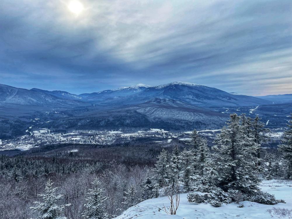
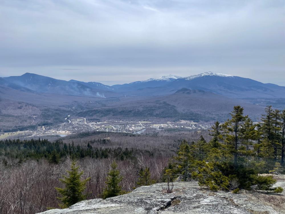
The Centennial Trail, part of the Appalachian Trail, was so named as it was constructed by AMC in 1976, the club's centennial year. The trail begins briefly along a woods road before heading off on a trail through the woods. The first of many stone steps are quickly encountered. The trail ascends steeply at times, and more gradually at other times, past some overgrown viewpoints to an outlook with restricted views about half way up the trail. Past this restricted overlook, there is a long, gradual climb that angles up the side of the ridge to the easterly summit of Mount Hayes, with some restricted views to the south. The trail descends then ascends across ledges to the junction with the Mahoosuc Trail, 3.1 miles from the trailhead. Heading south on on the Mahoosuc Trail 0.2 miles leads to the summit of Mount Hayes (elevation 2,555 feet), with some limited views. Descending an additional 0.3 miles down the Mahoosuc Trail the trail reaches nice open ledges with better views to the south. The total distance from the trailhead to the summit is 3.3 miles, or 3.6 miles to the ledges.
The Mahoosuc Trail offers an alternative route to the summit of Mount Hayes. It begins with a moderate climb through the woods, briefly following along a brook. It continues on gentle grades to Mascot Pond, just below the prominent cliffs of Leadmine Ledge. From here the trail climbs more moderately to a spur trail, at 1.9 miles, to Popsy Spring. A steep climb from this spur trail leads to flat ledges just south of the summit, offering view to the south. The summit of Mount Hayes (elevation 2,555 feet), another 0.3 miles past these ledges and marked with a cairn, has more limited views. The total distance from the trailhead to the summit is 2.4 miles.
Before you hike, know the hiker responsibility code and be prepared:
![]() Visit the hikeSafe website to learn more!
Visit the hikeSafe website to learn more!
The Mount Hayes trails are managed by the White Mountains National Forest and maintained by the Appalachian Mountain Club. For more information about the trails, please contact:
![]()
![]()
CENTENNIAL TRAILHEAD
From US-2 in Shelburne, go north on North Road for 0.5 miles, and just after crossing the Androscoggin River turn left on Hogan Road. The trailhead, marked with a sign, is located on the Hogan Road near the junction with North Road. Parking is permitted at this junction, and at a small area 0.2 miles down the Hogan Road from North Road, on the left (south) side of the road.
MAHOOSUC TRAILHEAD
From US-2 in Shelburne, go north on North Road for 0.5 miles, and just after crossing the Androscoggin River turn left on Hogan Road. Please note, this gravel road is very rough in places. Go 1.3 miles (past the centennial trailhead) and bear left, then bear left again after another 1.1 miles. Go 2.3 miles to the Gorham Hydro Station, and park on the right side of the road across from the station; do not park next to the station. Proceed on foot another 0.1 miles up the road to the trailhead on the right.
Alternatively, access the trailhead on foot across private land from a parking area on NH-16 in Gorham. From the western junction of NH-16 and US-2 in Gorham, go 0.3 miles north on NH-16 to the parking area on the right, by an old railroad bridge. Park here and cross the Androscoggin on foot on the pedestrian walkway, then utilize the Undermine bike trails to a bridge crossing a canal on the other side of the island, and turn right onto the trail with a sign indicating "Mahoosuc Hiking Trail Detour." Ascend to Hogan Road, turn right and follow the road for a half mile to the Mahoosuc Trail.
Please note: Hogan Road is not maintained in winter.
Success! A new password has been emailed to you.