The solar eclipse is coming on April 8th! Learn more about where you can go to view the eclipse and other useful tips.

Deer Leap

In addition to traveling over Deer Leap Mountain, these trails leads to the ledge looming over the north side of Sherburne Pass, offering views of the nearby Killington and Pico peaks, with distance views extending to New York's Adirondacks.
Trail Activity
Hiking
Length
2.00 miles, Network
Difficulty
Moderate
Town
Killington (VT)
Surface
Packed Earth/Dirt, Rock/Ledge
Pets
Permitted
Fees
No

Description

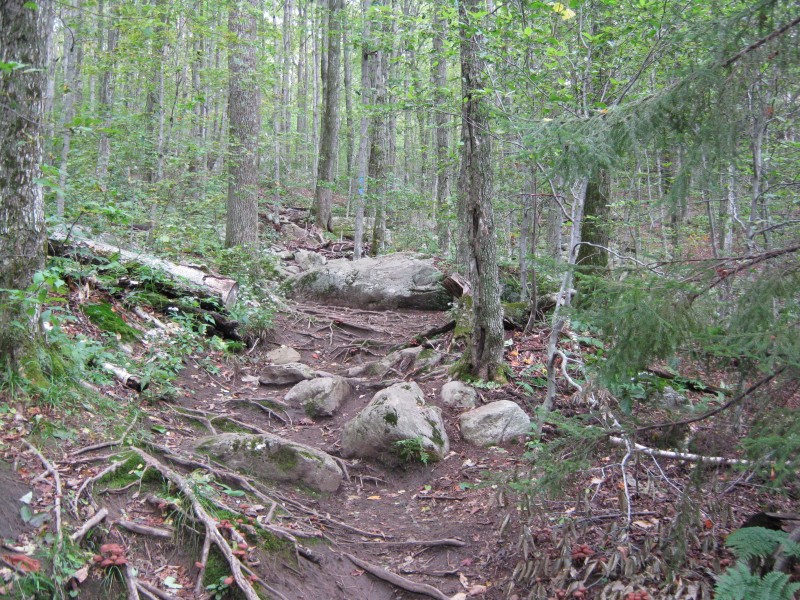
The Sherburne Pass Trail is the former, historic route of the Long Trail. It extends south of US-4 as well as north. Its half-mile northern section is described here. The trail enters the woods at the east end of the Inn at Long Trail’s parking lot. It ascends quickly alongside the road (some road noise can be heard in the initial portions of the trail), until it meets the Appalachian Trail (AT) after 0.5 miles.

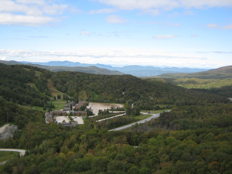
The east end of the Deer Leap Trail is 220 feet north along the Appalachian Trail from the junction of the AT with the Sherburne Pass Trail. From the AT, the Deer Leap Trail bears west and climbs 0.4 miles through an attractive birch forest to a spur trail. The Overlook Spur Trail leads 0.2 miles south to a dramatic rock outcropping, with views over Sherburne Pass, of the nearby Coolidge Range, and to the west, New York’s Adirondacks.

Continuing north from the spur, the trail drop to a brook before climbing again to the top of Deer Leap Mountain. It then descends gradually to the north until reaching its western junction with the AT, 1.3 miles from the trail's eastern junction with the AT.

Trail Manager

Visit Green Mountain National Forest online for more information or contact:

Green Mountain National Forest: Supervisor's Office - Rutland

Green Mountain National Forest: Supervisor's Office - Rutland
231 North Main Street
Rutland, VT 05701
Phone: (802) 747-6700
View website

Green Mountain Club

Green Mountain Club
4711 Waterbury-Stowe Rd.
Waterbury Center, VT 05677
Phone: (802) 244-7037
gmc@greenmountainclub.org
View website

Trail Tips

Plan Ahead and Prepare
Visit busy trailheads mid-week to avoid crowds.
Legend
Hide All

Trailhead Information

Take US-4 east from Rutland or west from Killington to the top of Sherburne Pass. There are a few parking spots on the north side of US-4, on which side the trailhead is located, and many spaces on the south side of the road. Be extremely careful crossing US-4.

Click on a parking icon to get custom directions
Please Log In or Create Account to add comments.
These awesome businesses support our goal of connecting people to outdoor adventures!
Hang Tight!
Nearby services are loading
No Results
No Services Found
SHARE THIS TRAIL

Add Trail Log

Please wait…
Join In on the Fun!
Log in or create an account below to unlock all the great features of Trail Finder: keep track of trails you want to do, preserve memories of trails you’ve done, earn badges, and more!
Your log in attempt was not successful. Please try again.
    Lost your password? Reset your password
    Don't yet have an account?
    There was an issue with your submission. Please try again.
      * Indicates required field
      Already have an account? Login here
      Enter your username, and we will send you a new, randomly generated password to your email account.
      There was an issue with your submission. Please try again.

        Success! A new password has been emailed to you.

        Log in now

        Please wait…