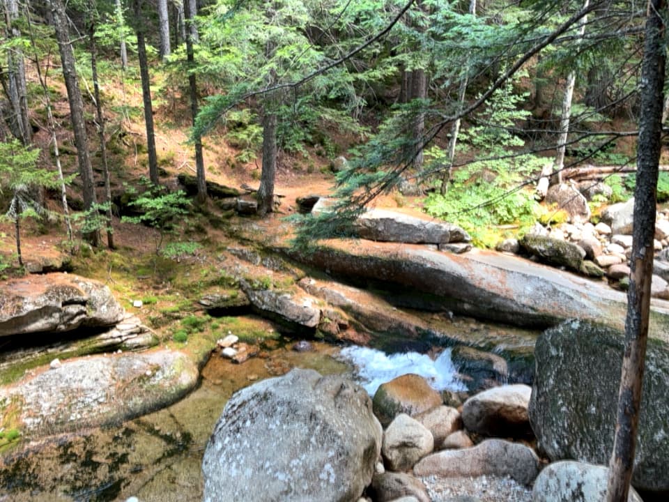
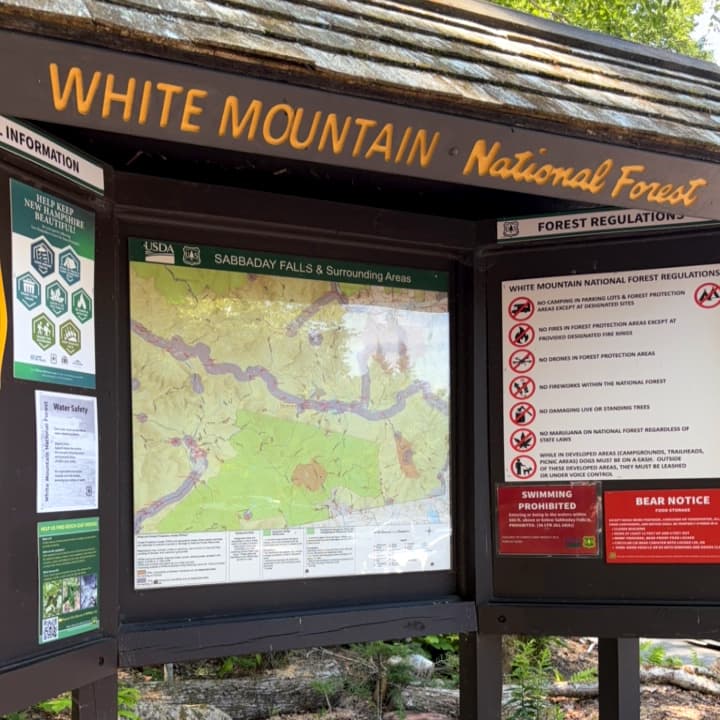
Sabbaday Falls is a very popular wayside stop along the Kancamagus Scenic Byway, the trail winding its way through a mixed evergreen forest along the Sabbaday Brook to viewpoints of the brook and the falls.
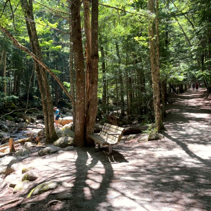
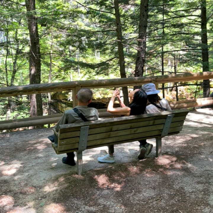
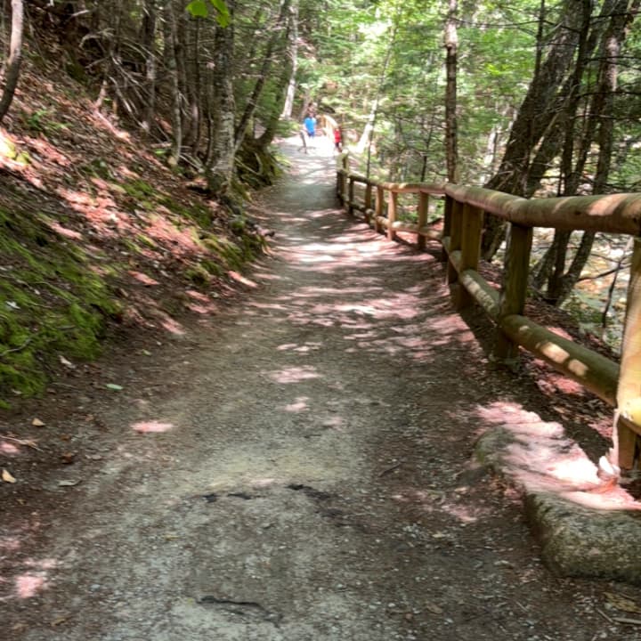
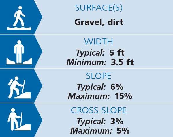
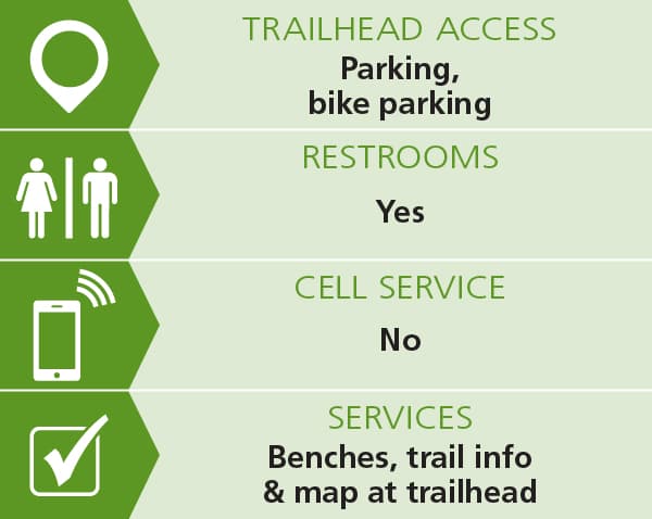
Beginning from the Sabbaday Falls Picnic Ground, the first 0.3 miles of the Sabbaday Brook Trail is approximately 5 feet wide with a crushed gravel surface, making it suitable for a wide variety of users. Along the way, benches offer resting spots and nice views of the surrounding forest. While the trail is mostly of a gradual slope, there are sections where the grade exceeds 15%, and some areas showed signs of erosion and water damage in summer of 2025. The trail does not provide accessible access all the way to the primary waterfall viewpoint.
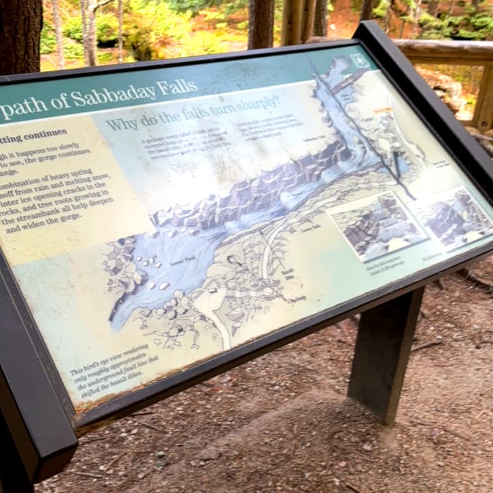
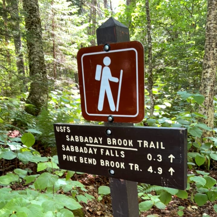
Upon reaching the Falls, the Sabbaday Brook Trail continues straight ahead as a singletrack hiking trail up to Mount Tripyramid. To the left, the Waterfall Trail diverges as a series of stairs that wind dramatically up the side of the gorge above the Falls. In 0.1 miles, the Waterfall Trail rejoins the Sabbaday Brook Trail, and hikers can follow the Brook Trail back down to the Picnic Ground and parking area.
Due to its popularity, this site can get extremely crowded, especially in peak seasons, so plan accordingly.
(Applies to section shown as Access(ible) Experience in trail map, leading to loop; does not include loop itself)
Trail conditions can change without warning. Trail last assessed: 7/24/2025
Fees: The day use fee at Sabbaday Falls Picnic Ground is $5 per vehicle
Before you hike, know the hiker responsibility code and be prepared:
![]() Visit the hikeSafe website to learn more!
Visit the hikeSafe website to learn more!
For more information, visit the White Mountain National Forest trail page, or contact:
![]()
From Interstate 93: Take Exit 32 for Lincoln and head east on the Kancamagus Scenic Byway (NH-112). Follow the byway east for 19.9 miles, and turn right for the Sabbaday Falls Picnic Ground at the sign.
From Conway: Follow the Kancamagus Scenic Byway (NH-112) west for 16.1 miles, and turn left for the Sabbaday Falls Picnic Ground at the sign.
Success! A new password has been emailed to you.