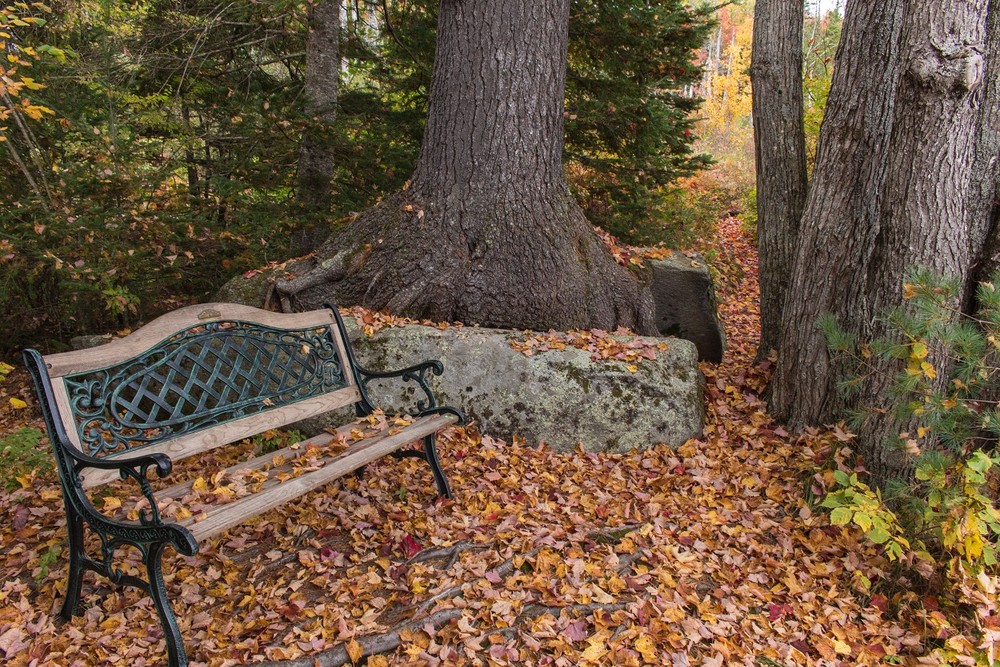
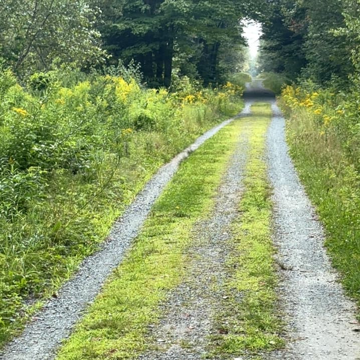
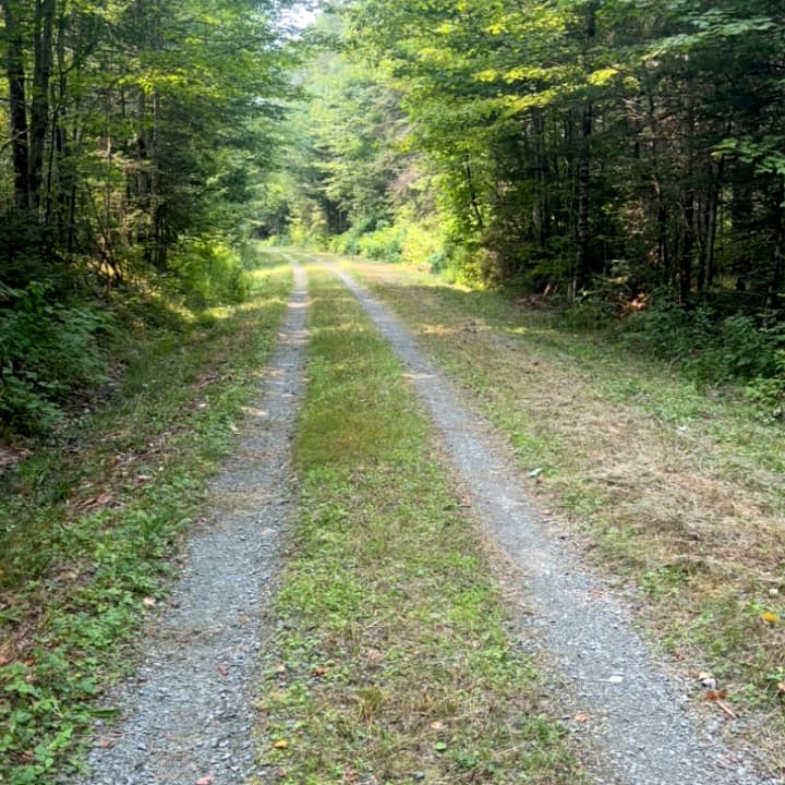
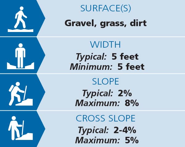
The Pondicherry Rail Trail (an extension of the Presidential Rail Trail) is the most popular trail at the refuge and leads in 1.5 miles to Cherry Pond and Waumbek Junction. Following the former bed of the Maine Central Railroad, the approximately 8 foot wide, gravel-surfaced trail has very smooth footing with minimal grades, typically 2%, and is suitable for a wide range of users including wheelchair users and others with mobility challenges. See Trail Access Information below for more information about this Accessible Experience.
Leaving the Airport Road parking lot, the trail heads northeast, passes through a wide power line corridor, and reaches a junction with a spur trail on the right and a sign for the observation deck about 1.4 miles from the parking lot.
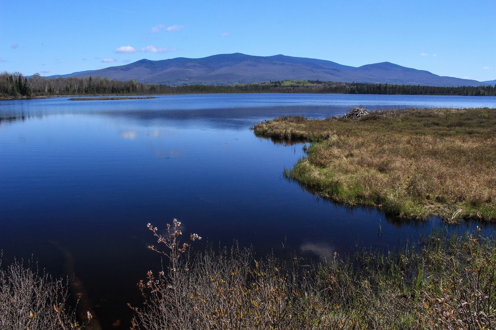
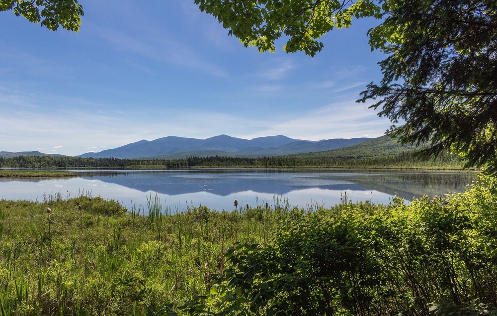
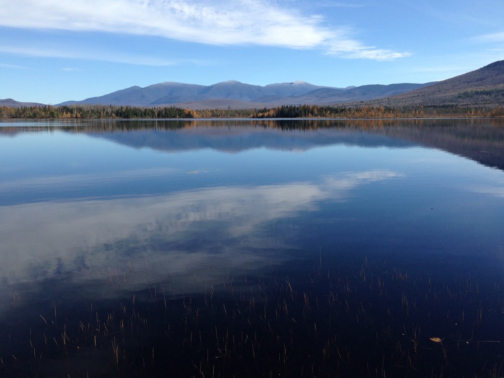
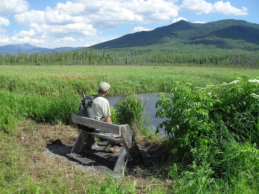
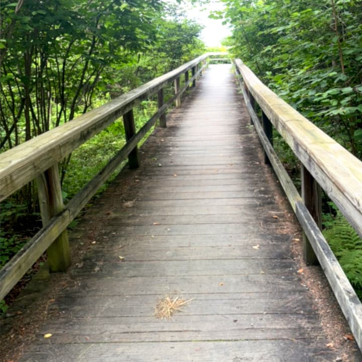
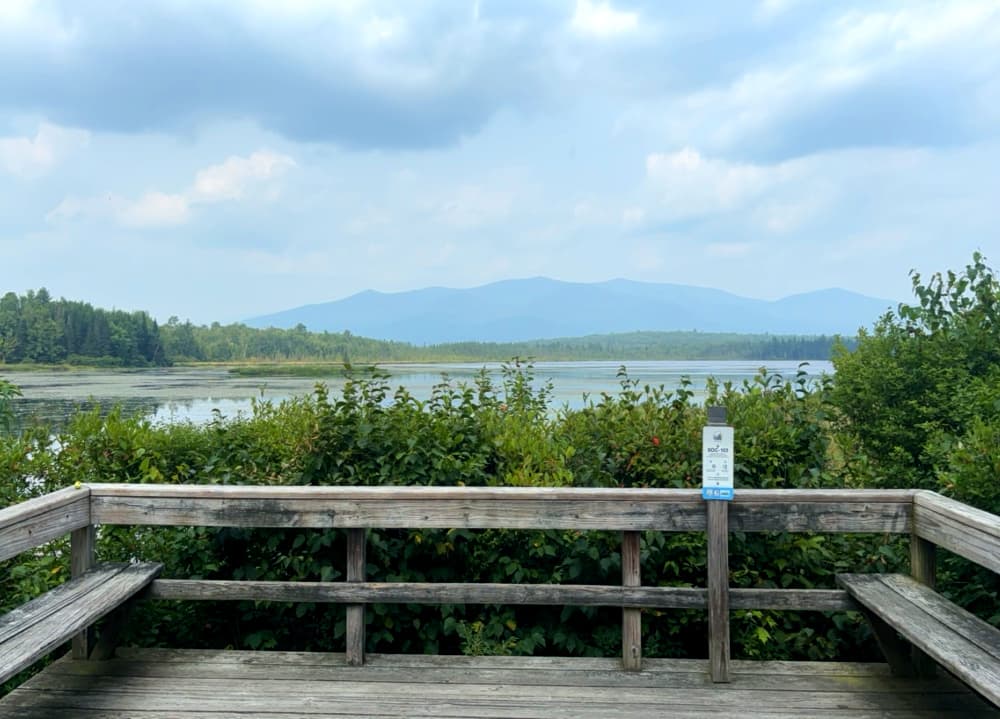
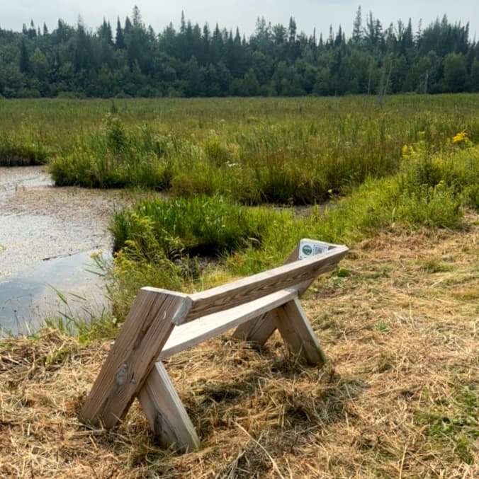
From this junction, the 0.1 spur trail to the right leads to the Tudor Richards Viewing Platform on Cherry Pond. The viewing platform is reached via a 90 foot long, 3.5 foot wide boardwalk. From the approximately 12 x 12 foot platform, there is a magnificent view of Cherry Pond, the Northern Presidentials, and the Pliny Range. The platform honors Tudor Richards, a longtime member and leader of NH Audubon who was instrumental in the acquisition of the land that created Pondicherry in 1963, and is a wonderful spot for birdwatching.
Continuing a short distance straight ahead from the junction on the Pondicherry Rail Trail (instead of taking the spur trail) leads to Waumbek Junction. Waumbek Junction is where the Boston & Maine Railroad (formerly the Whitefield & Jefferson Railroad) met the Maine Central Railroad (formerly the Upper Coos Railroad). Although little evidence remains today, the Junction was the site of a passenger station, freight house, station agent’s house, and ball signal. A short trail called the Waumbek Link connects Waumbek Junction and the Tudor Richards Viewing Platform.
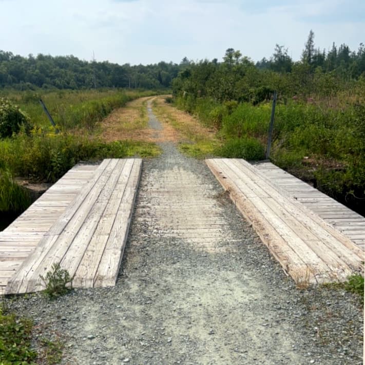
A portion of the Presidential Rail Trail (which runs from Gorham to Whitefield) heads west for 2.6 miles from NH-115A to Cherry Pond, meeting up with the Pondicherry Rail Trail at Waumbek Junction. Following the former bed of the Boston & Maine Railroad, this trail passes through two marshes and a variety of habitats and offers a scenic approach to the pond. This section of trail was resurfaced in 2020 with 3/4 inch ledge pack (a mixture of stone, sand, and fines) and a hard, erosion-resistant surface was created. Like the Pondicherry Rail Trail, this level, 8 foot wide, hard-surfaced trail is good for walkers, bicyclists, wheelchair users, and others with mobility challenges. See Trail Access Information below for more information about this Accessible Experience.
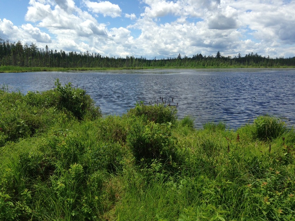
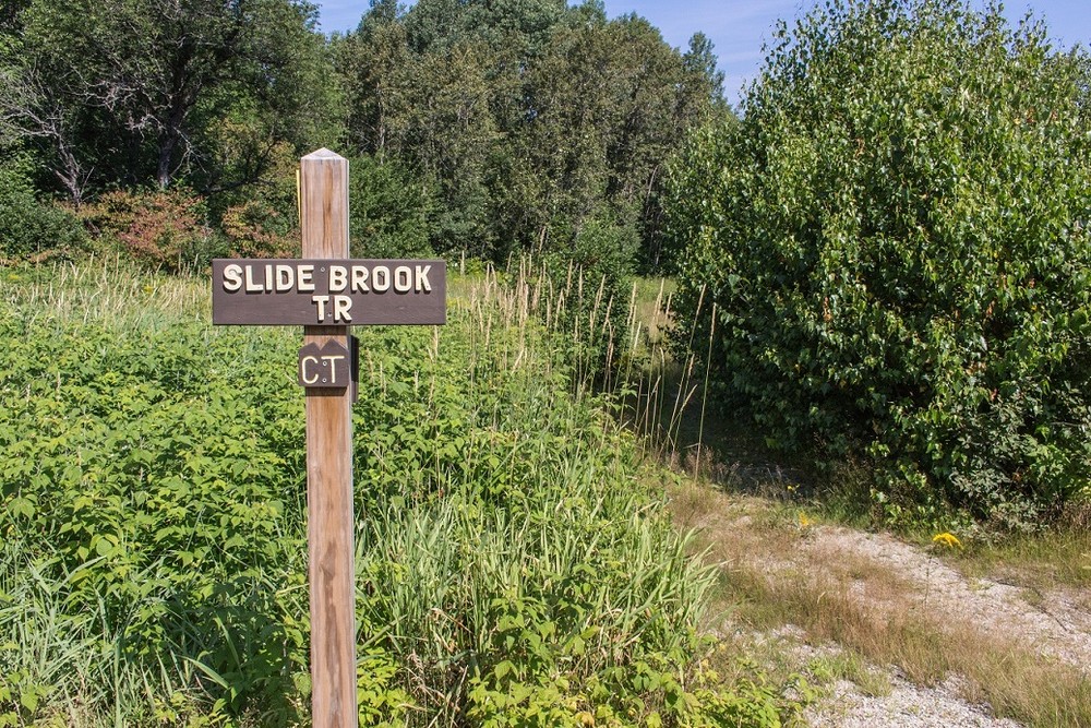
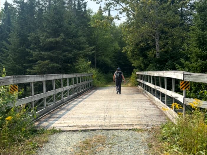
As the Presidential Rail Trail heads west from NH-115A, it passes the junction with the Slide Brook Trail and crosses the Giant Trestle bridge over Stanley Slide Brook in 0.7 miles. Continue walking or riding from the bridge through a lovely spruce fir forest and, in 0.9 miles, reach Cedar Marsh and, shortly beyond that, Moorhen Marsh. Both of these marshes have scenic views of the mountains and are excellent areas for birdwatching. From Moorhen Marsh, the trail bends to the northwest and reaches the Tudor Richards Viewing Platform.
From the Slide Brook Trail junction to Waumbek Junction, the Presidential Rail Trail is part of the long-distance Cohos Trail, which runs from Crawford Notch to the Canadian border. The Presidential Rail Trail and Pondicherry Rail Trail also coincide with the Cross New Hampshire Adventure Trail, an 83 mile scenic route for bicyclists from the Connecticut River to Maine.
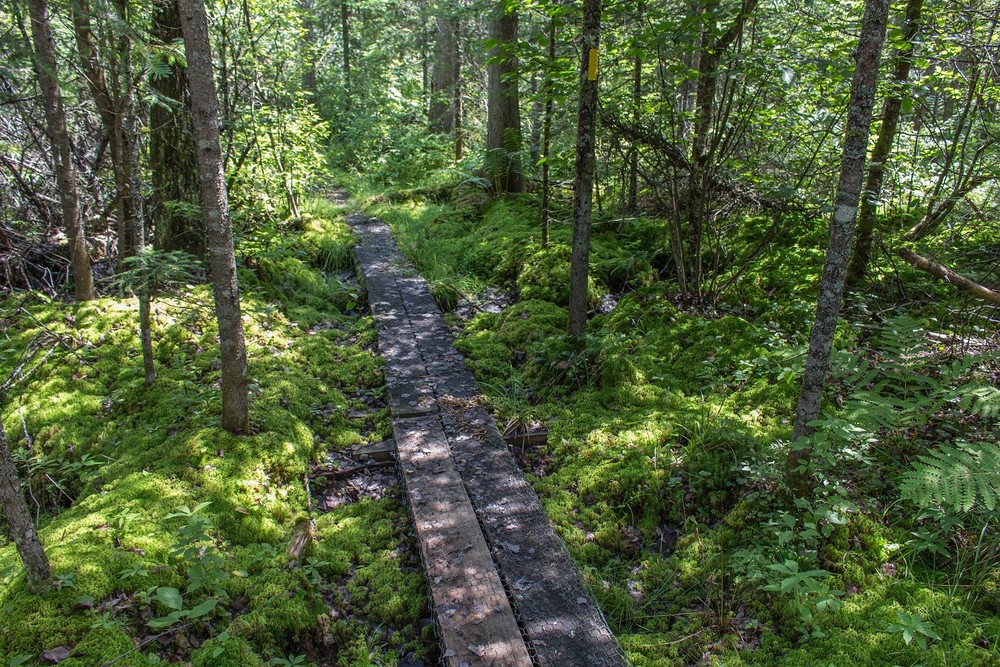
North of Waumbek Junction are the trailheads for the Shore Path, Rampart Path, and Little Cherry Pond Trail. On these trails walkers will encounter exposed rocks and roots, narrow bog bridging, and a couple locations with side slope issues.
The Shore Path and the Rampart Path are short trails along the western edge of Cherry Pond with good views of both the pond and the surrounding mountains. Both are part of the long-distance Cohos Trail and are blazed in yellow. These trails follow what is known as an “ice push rampart,” an unusual geological feature created over the last 11,000 years when ice in Cherry Pond has pushed gravel and small boulders onto the shore of the pond, creating a low berm (or rampart).
The Shore Path leaves the railroad tracks on the right just north of the bridge over the Johns River, reaches the shore of the pond (where there is a short spur trail to the right), and then turns left. Following along the shore past several viewpoints with benches, the trail soon reaches a National Natural Landmark plaque before returning to the railroad tracks.
To reach the Rampart Path, walk north from the Shore Path along the railroad tracks. The trail leaves the tracks on the right and runs for about half a mile before meeting the Colonel Whipple Trail. Partway along the trail a short spur leads across the tracks to the Little Cherry Pond Trail. There are several viewpoints and benches along the Rampart Path, including an open area at the edge of the pond that offers a sweeping view of the pond and the mountains. In Cohos Trail descriptions, the Rampart Path is referred to as the Ice Ramparts Trail.
The Little Cherry Pond Trail (designated a National Recreation Trail in 2006) has relatively smooth footing with minimal elevation gain and offers opportunities to view a variety of wildlife and vegetation, including carnivorous plants. An excellent guide compiled by the New Hampshire Natural Heritage Bureau details the vegetation found along this trail.
The trail leaves the railroad tracks about 0.3 miles north of Waumbek Junction, opposite a short spur trail to the Rampart Path. In 0.2 miles the first loop junction is reached. Turn left here (arrow) and follow the southern loop of the trail for 0.4 miles to the second loop junction. Proceed straight here for 0.2 miles, crossing a long stretch of bog bridges, and reach the shore of Little Cherry Pond where there is a small viewing platform and a bench. Return to the second loop junction, turn left, and follow the northern loop of the trail for 0.3 miles back to the first loop junction, passing through a black spruce and tamarack forest on more bog bridges. Proceed from the first loop junction back to the trailhead. Total mileage for the trail is 1.5 miles.
Just over 2 miles in length, the Colonel Whipple Trail is named after Colonel Joseph Whipple, the founder of Jefferson, and runs from Whipple Road in Jefferson to the northern end of the Rampart Path near Cherry Pond. Part of the long-distance Cohos Trail, the Colonel Whipple Trail is blazed in yellow. It is a bit rougher than some of the other trails at Pondicherry with wet footing in spots and is good for someone desiring a more remote hike.
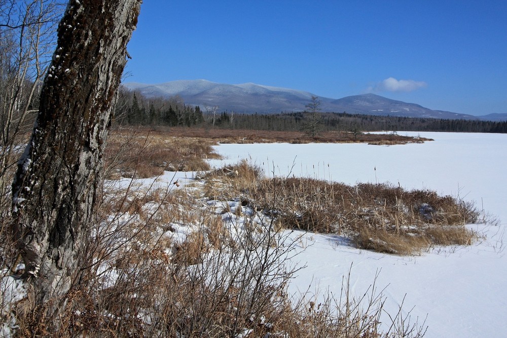
Leaving the trailhead on Whipple Road, the trail heads west and then trends south through a relatively young forest that was logged in 1998. Just over a mile from the trailhead, the trail starts to bend west and soon reaches an extensive area of blowdowns with bog bridges at the edge of a large wetland. The trail then bends south with more bog bridges and soon reaches the junction with the Rampart Path. If you proceed about 100 yards on the Rampart Path, you will reach a bench at the edge of Cherry Pond with an extensive view of the surrounding mountains. In the winter, this bench makes a nice destination for a moderate snowshoe hike.
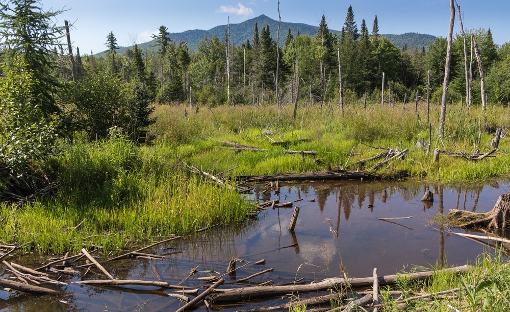
The Slide Brook Trail is just over half a mile in length and leads from NH-115 to the Presidential Rail Trail. It is part of the long-distance Cohos Trail and is blazed in yellow. Leaving the trailhead off NH-115, proceed a short distance to the edge of a large field. This field was the terminus of the famous Cherry Mountain Landslide, which occurred on July 10, 1885 (see the state historical marker in the Owls Head Trail parking lot). Head in a northeasterly direction across the field, following the blazed posts. The trail then enters the woods and soon crosses an old beaver dam from which there are views of Cherry Mountain and Owls Head. The trail then returns to the woods, crosses a powerline corridor, and soon reaches the Presidential Rail Trail. Turn left if you would like to proceed on the rail trail to Moorhen Marsh and Cherry Pond.
(Applies to the sections of trail shown as Access(ible) Experience in the trail map)
Trail conditions can change without warning. Trail last assessed: 8/04/2025
Refuge History
Pondicherry Wildlife Refuge was created in 1963 when New Hampshire Audubon and the New Hampshire Fish and Game Department acquired 312 acres of land around Cherry and Little Cherry Ponds from the Brown Paper Company. Much of the credit for this acquisition goes to Tudor Richards, a longtime member and leader of New Hampshire Audubon. Inspired by Horace Wright’s The Birds of the Jefferson Region in the White Mountains, Richards made many birding trips to Cherry and Little Cherry Ponds, beginning in the late 1940s, and developed a deep love for the area. His vision and determination were instrumental in the creation of the refuge, which he called “Pondicherry”, a name found on early maps of the region.
In 2000, the U. S. Fish and Wildlife Service acquired 670 acres of land adjacent to the Audubon tract and, partnering with New Hampshire Audubon and the New Hampshire Fish and Game Department, established the Pondicherry National Wildlife Refuge. Using money from the Federal Duck Stamp Program, the U. S. Fish and Wildlife Service continued to acquire additional tracts of land, so that the refuge now covers nearly 6500 acres.
An interesting sidebar to the refuge history outlined above is the railroad history found at Pondicherry. The Pondicherry Rail Trail follows the former bed of the Maine Central Railroad, which for many years ran south to north through the area, while the Presidential Rail Trail follows the former bed of the Boston & Maine Railroad, which ran roughly west to east through the area. Waumbek Junction marks the spot where the two lines met and was the site of a passenger station, freight house, and station agent’s house. Although the tracks were removed when the Pondicherry Rail Trail and the Presidential Rail Trail were created, one still walks along a stretch of active railroad track north of Waumbek Junction to reach the Shore and Rampart Paths and the Little Cherry Pond Trail. Very infrequently a train will pass through here—a reminder of a previous chapter in Pondicherry’s history.
(From the Friends of Pondicherry National Wildlife Refuge website)
Wildlife at Pondicherry
Pondicherry has a wide variety of wildlife, including birds, moose, bears, beavers, snowshoe hares, turtles, butterflies, and dragonflies. Refuge checklists have been compiled for Birds, Mammals, Reptiles and Amphibians, Fish, Odonata (Dragonflies and Damselflies), and Butterflies. These checklists, as well as more information about Pondicherry’s wildlife, can be found on the Birding and Wildlife pages on the Friends of Pondicherry National Wildlife Refuge website.
The US Fish and Wildlife Service, NH Audubon, NH Fish and Game Department, and the NH Trails Bureau manage Pondicherry as a conservation partnership. A volunteer organization called the Friends of Pondicherry helps maintain the trails and wildlife habitat and sponsors periodic field and work trips on the refuge. For more information, visit the Friends of Pondicherry National Wildlife Refuge website.
![]()

![]()
There are multiple ways to get to the Pondicherry Trails System.
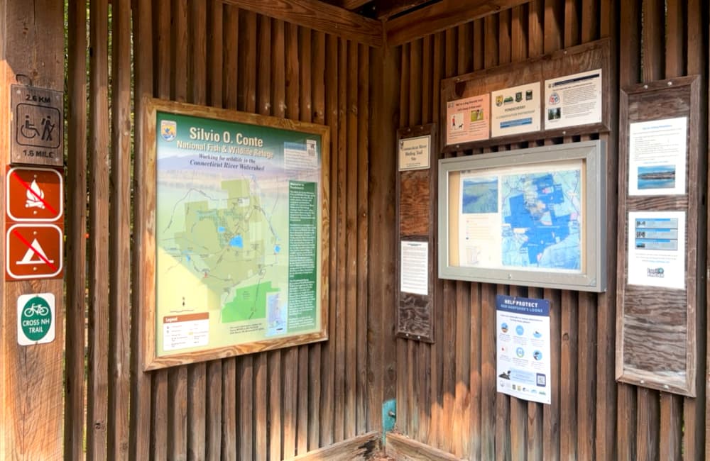
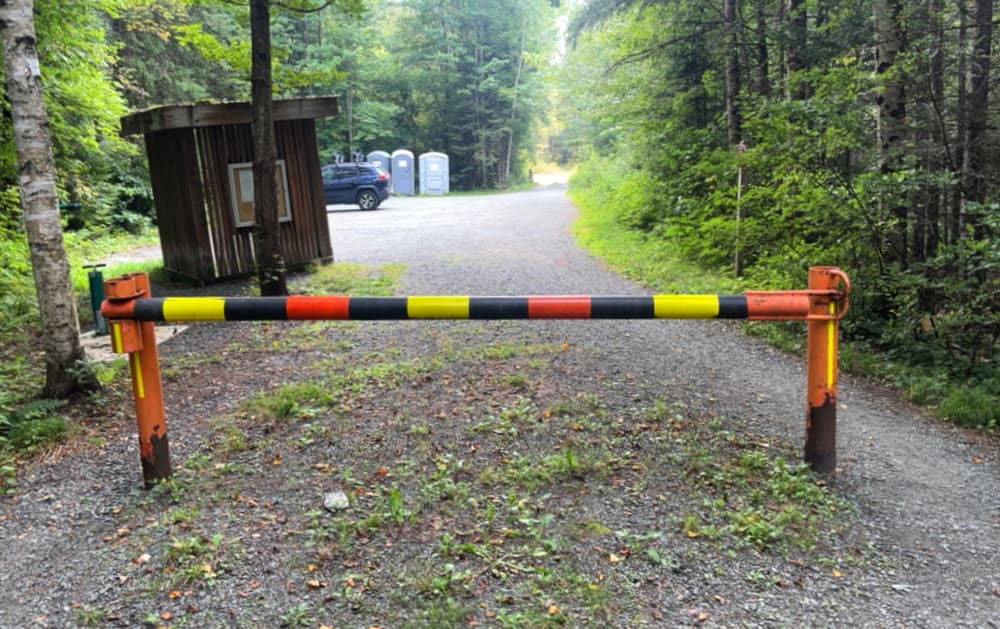
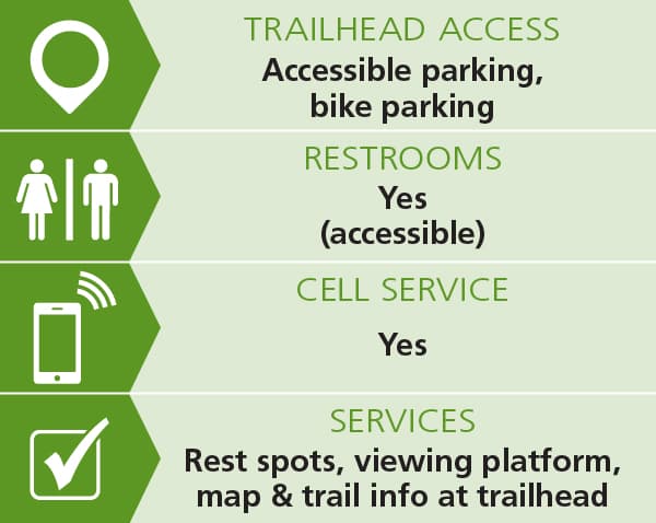
The Pondicherry Rail Trail (an extension of the Presidential Rail Trail) is the most popular trail at the refuge and leads in 1.5 miles to Cherry Pond and Waumbek Junction. The trailhead for the Pondicherry Rail Trail is located off Airport Road in Whitefield, about 1.5 miles from NH-115. Driving down Airport Road, look for a brown Pondicherry sign on the right and turn into the parking lot, crossing a small bridge. There is a kiosk with a trail map and other information about the refuge; the trail begins just beyond the kiosk and gate. [E911 address for this trailhead: 289 Airport Road, Whitefield, NH 03598]
The shortest approach to the Shore Path and Rampart Path is from the parking lot for the Pondicherry Rail Trail off Airport Road in Whitefield (see directions above). To reach the Shore Path, walk the Pondicherry Rail Trail, which begins just beyond the kiosk, for about 1.5 miles to Waumbek Junction, cross the Johns River, and proceed a short distance along the railroad tracks to the Shore Path trailhead on the right. To reach the Rampart Path, continue a short distance north from the Shore Path trailhead along the railroad tracks. The trailhead will be on the right, just past a beautiful view of Cherry Pond and the surrounding mountains. Although trains use the railroad tracks very infrequently, care should be taken when walking along them.
Access the Little Cherry Pond Trail from the Airport Road parking lot. Follow the directions above for the Shore Path, but after the Johns River, proceed 0.3 miles along the railroad tracks to the Little Cherry Pond Trail trailhead on the left. Although trains use the railroad tracks very infrequently, care should be taken when walking along them.
The northern trailhead of Colonel Whipple Trail is located on Whipple Road, 0.7 miles from NH-115A and 0.8 miles from NH-116. Look for a small clearing with a Cohos Trail kiosk and a yellow gate. Park off the road at the edge of the clearing, taking care not to block the gate. The Colonel Whipple Trail, marked by a small sign and a yellow blaze on a tree, starts beyond the gate. The trail can also be accessed from the Rampart Path, but this makes for a much longer hike. [E911 address for this trailhead: 162 Whipple Road, Jefferson, NH 03583]
The most direct approach to the Slide Brook Trail is from NH-115 in Jefferson. Park at the Owls Head Trail parking lot on the south side of NH-115 (about 5.8 miles from the junction of US-3 and NH-115). Cross NH-115 and then walk a short distance east along the highway until you see the sign for the Slide Brook Trail on your left. Alternatively, the Slide Brook Trail can be accessed from NH-115A by walking 0.7 miles west along the Presidential Rail Trail from where the rail trail crosses NH-115A. The northern end of the Slide Brook Trail is on the left side of the rail trail, just before you reach the Giant Trestle bridge. [E911 address for NH-115 trailhead: 801 Owl's Head Highway, Jefferson, NH 03583 (NH-115)]
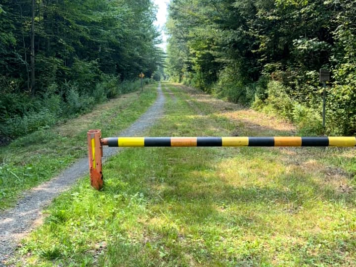
About half a mile north of NH-115, the Presidential Rail Trail crosses NH-115A. Look for a gate on the left and park in the small parking area on the side of the trail, taking care not to block the gate. There are no ADA-designated parking spaces in the parking area that provides room for about 6 cars. However, the lot is level, somewhat sandy but hard-packed, and accessible for most wheelchairs and other mobility devices. There is a 52-inch gap between the gate at the rail trail trailhead and a post that blocks entrance to ATVs but allows entrance for all others. [E911 address for this trailhead: 794 Meadow Road, Jefferson, NH 03583 (NH-115A)]
Success! A new password has been emailed to you.