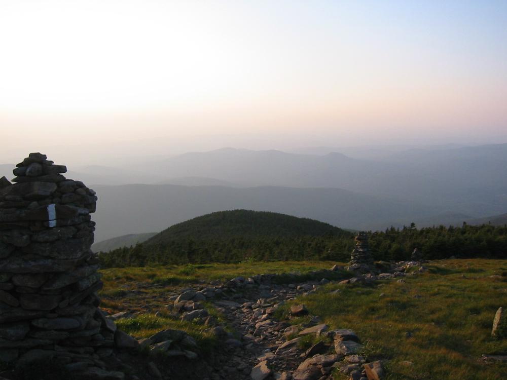
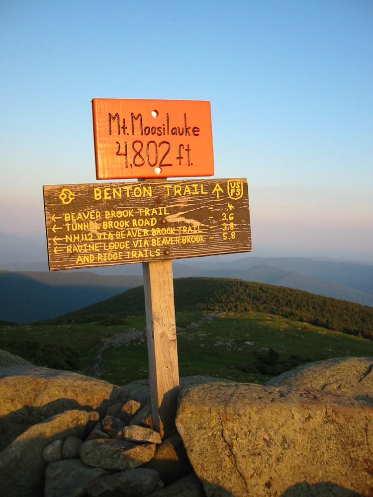
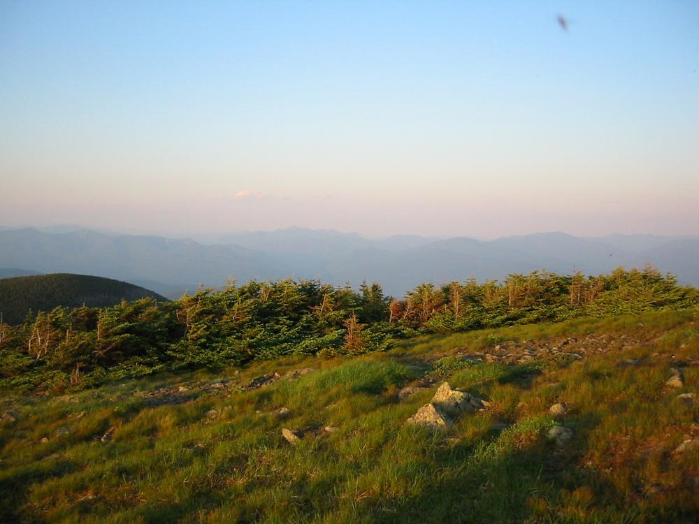
Mount Moosilauke (4,802') is an iconic broad-summited mountain that stands largely apart from other Four Thousand Footers in the White Mountain Region. An extensive network of trails is maintained by the Dartmouth Outing Club and the White Mountain National Forest, including a portion of the Appalachian Trail. The broad open summit of Mount Moosilauke is home to the largest alpine area in the White Mountains beyond the Presidential Range. On clear days, the summit of Moosilauke provides sweeping panoramic views of the Green Mountains to the west and the rest of the White Mountains to the east.
There are multiple ways to climb Moosilauke providing opportunities for loop or point-to-point hikes. Three of the most popular, from the three largest trailheads, are described below.
PLEASE NOTE: The trails up Mount Moosilauke are strenuous, and weather on the exposed alpine summit can be harsh and unpredictable.
Beaver Brook Trail: The 3.8 mile Beaver Brook Trail is the most challenging route up Moosilauke. It follows the Appalachian Trail south from Kinsman Notch on NH-112. From the trailhead, the trail rises extremely steeply along the Beaver Brook Cascades. The Beaver Brook Shelter is located 1.5 miles up the trail. The trail continues steeply to the sub-peak of Mount Blue above Jobildunk Ravine, and at 3.4 miles the trail joins the Benton Trail just below treeline. The trail continues 0.4 miles through the open alpine area to the summit of Mount Moosilauke.
Glencliff Trail: The 3.0 mile Glencliff Trail foillows the Appalachian Trail up the southwestern face of Mount Moosilauke to South Peak, where the trail continues over the alpine zone via the Moosilauke Carriage Road to the summit. A tenth of a mile from the trailhead off High Street in Benton, the Glencliff Trail joins the Appalachian Trail, marked by white blazes. The trail ascends for 2.6 miles to a junction with the Moosilauke Carriage Road and a spur trail for South Peak. To the right, the spur trail travels 0.2 miles to South Peak (4,523). To the left, the trail continues as the Moosilauke Carriage Road the 0.9 miles to the summit of Mount Moosilauke.
Gorge Brook Trail: The 3.7 mile Gorge Brook Trail is the most popular route up the mountain from the Ravine Lodge trailhead. From the turnaround at the end of Ravine Lodge Road, the trail follows a logging road for 100 yards, then turns left to descend and cross the Baker River. Follow signs carefully for the Gorge Brook Trail past junctions with the diverging Asquam-Ridge Trail, Hurricane Trail, and Snapper Trail. At 2.1 miles, the trail turns onto an old logging road with a cleared outlook to the south, then leaves the logging road as singletrack trail winding uphill. At 3.3 miles, the trail opens onto the exposed alpine zone and continue 0.4 miles to the summit of Mount Moosilauke.
At the base of the mountain, Dartmouth's College's historic Ravine Lodge offers day-use hiker service and lodging on a reservation basis. Visit the Ravine Lodge website for more information.
COVID-19 UPDATE: Due to the ongoing COVID-19 situation, the Moosilauke Ravine Lodge and its facilities remain closed to the public until further notice. This includes to alumni and hikers. Trails from the lodge are open for use. Future updates will be posted on the Ravine Lodge website here.
Before you hike, know the hiker responsibility code and be prepared:
![]() Visit the hikeSafe website to learn more!
Visit the hikeSafe website to learn more!
For more information, visit the White Mountain National Forest trail page, or the Dartmouth Outing Club website, or contact:
![]()
![]()
Ravine Lodge Trailhead: Driving north, take Exit 26 off Interstate 93 for NH-25 in Plymouth. Head west on US-25 for 20.5 miles, then bear right onto NH-118 in Warren. Continue on NH-118 for 6.0 miles, then turn left onto Ravine Road for the Dartmouth Outing Club's Moosilauke Ravine Lodge. Drive 1.5 miles to the end of the road (stay to the right at the access road turn-off) and reverse direction in the turn-around. Drive back down and find a parking space on the right side of the road (the western downhill side, closest to the Lodge and Mount Moosilauke). Make sure there’s room for busses to pass. Do not park in the turn-around!
Glencliff Trailhead: Driving north, take Exit 26 off Interstate 93 for NH-25 in Plymouth. Head west on NH-25 for 24 miles, then turn right onto High Street in Warren. Continue up High Street for 1.3 miles, and the Glencliff Trailhead is on the right.
Beaver Brook Trailhead: From Interstate 93, take 32 for NH-112 in Lincoln. Head west on NH-112 / Lost River Road for 6.6 miles uphill. At the height of land, turn left into the parking area for the Beaver Brook Trailhead.
Success! A new password has been emailed to you.