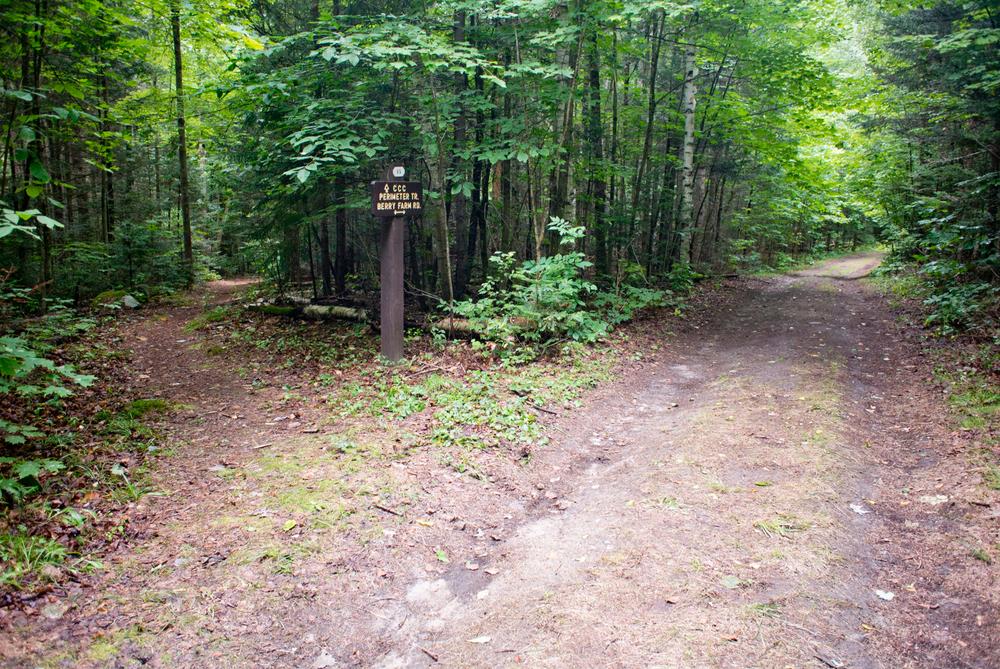
Located just a couple minutes from downtown Gorham, Moose Brook State Park recreation facilities were largely built by the Civilian Conservation Corps (CCC) in 1934-1936. Hearkening back to the spirit of the CCC, the Coos Cycling Club began their existence by reclaiming and adding on to the old 1930s trails in the park, which now make up some of the more technical, old-school portions of the club's network. There is plenty of easy to moderate riding mixed in as well. With a doubletrack access road dividing the two halves of the park and an ice-cold swimming hole at the base, a fun half-day of riding can be made out of exploring the trails within Moose Brook State Park.
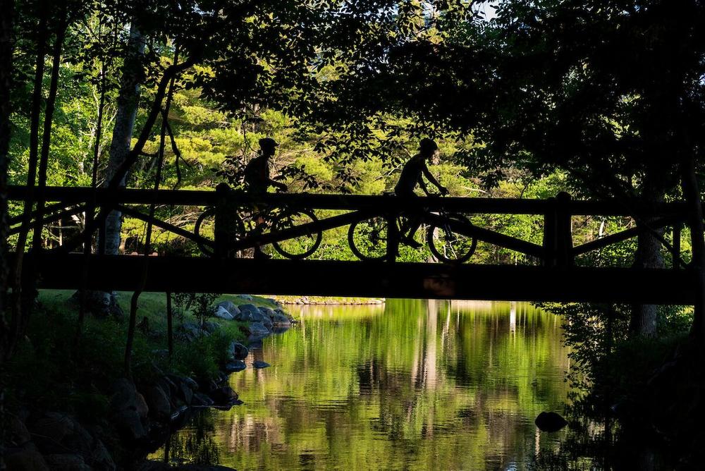
All the bike trails in the park loop back to the doubletrack trail, Berry Farm Road. Other trails include Deerfly with a steady climb, many roots, and fun features to play on or ride around; Borderline which was created more recently and crosses a number of mountain bike bridges; and many other fun trails, some technical and some suitable for beginners.
The Hinchey trail is suitable for beginners and connects Moose Brook State Park to the Presidential Rail Trail. The Lost Campground trail leaves the Hinchey Trail 0.3 miles from Jimtown Road. This half mile loop is beginner-friendly after a short initial climb. What was once slated to be a campground is now a beautiful mature white pine forest.
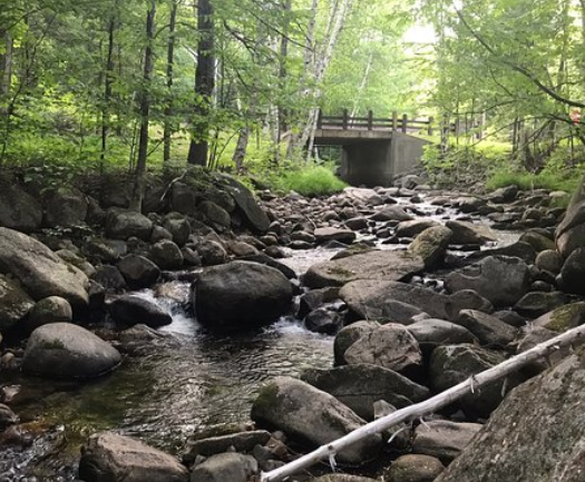
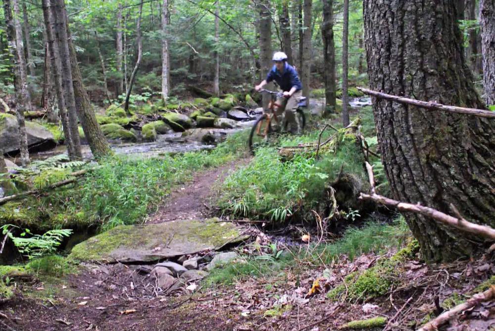
The classic CCC Perimeter West to Perkins Path loop is a challenging 2.5 mile route, best ridden in a counter-clockwise direction. From the Park Office, Berry Farm Road climbs uphill. CCC Link diverges to the lefft and connects to High Road of Low Road, both of which link to CCC Perimeter West. CCC Perimeter West climbs to the top of Perkins Path, which ends back at the Park Office. Rock gardens, bridges and stream crossings make this loop a fun technical challenge.
A detailed map of the network that includes difficulty ratings for the individual trails is available from the Coos Cycling Club.
In Moose Brook State Park, Moose River and Peabody River offer ideal opportunities for fishing; there are opportunities for swimming and picnicking as well. Camping is available at a 59-site campground inside the Park. More information about the park is available at the Visitor Center on Jimtown Road and at the NH State Park website.
These mountain biking trails are part of a growing purpose-built mountain biking network maintained by the Coos Cycling Club, a non-profit organization dedicated to growing the mountain biking community through trail-building, group rides for all levels and ages, and vibrant events.
The trail is maintained by the Coos Cycling Club. For more information, visit their website or contact:

![]()
There are multiple access points to this trail system.
A trailhead located on Jimtown Road, 300 feet west on the road from US-2, gives access to the Presidential Rail Trail. The Rail Trail heads in opposite directions on either side of Jimtown Road; the trail heading west connects to the Moose Brook State Park mountain bike trails via the Hinchey Trail. Parking is available at this location along the sides of the road. Or, after leaving your car at this location, take a right just past the Rail Trail trailhead onto Crestwood Drive, and after 300 feet bear left onto Brook Street. There is a trailhead for the River Trail on the left just before Moose Brook.
The campground trailhead is located a half mile down Jimtown Road from US-2, and provides easy access to the double track Berry Farm Road bike trail.
The trailhead at the Visitor Center is another quarter mile past the campground on Jimtown Road. It provides access to the network via Perkins Path and Annie's Way/Ethan's Loop.
Success! A new password has been emailed to you.