From the preserve's trailhead, the path forks offering two options for the ascent. The western trail to the left climbs for 1.5 miles in a steep and very clearly defined stair-like pattern over a set of ancient floodplain terraces. Some of the terraces represent the shore of ancient Lake Hitchcock, the great glacial lake that ran much of the length of the Connecticut and West Rivers at the end of the ice age. The eastern trail to the right follows a smoother ascent taking you past a scenic frog pond, over a bubbling stream and through shady hardwood forests. Near the top, be sure to bear left on the eastern trail for the final .5 miles to the summit. The trails join on exposed granite for the final ascent, which can be slippery in wet weather. Consider linking the two trails for an awesome loop hike! There is also a 0.8-mile trail connecting Black Mountain to the West River Trail to the south.
Black Mountain rises abruptly from the West River in Dummerston to a horseshoe ridge with a summit of 1,280 feet. The mountain originated as a mass of molten rock deep beneath the surface of the earth between 345 and 395 million years ago. Erosion has exposed the granite that forms the core of the mountain.
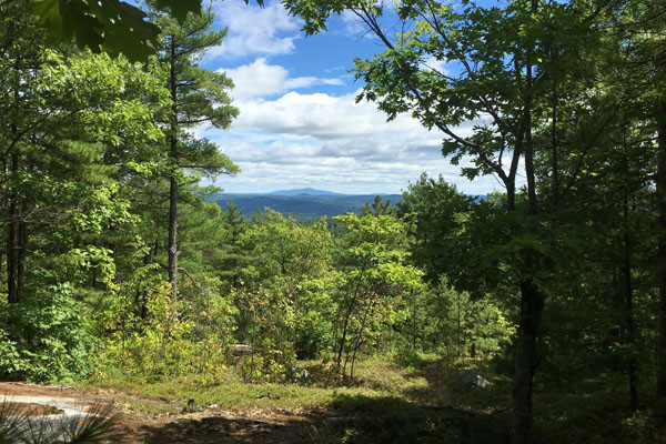
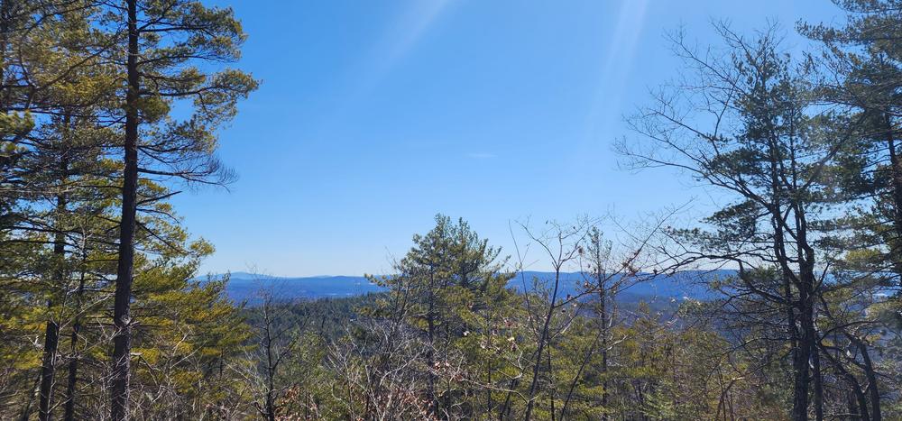
The lower slopes of Black Mountain are covered by hemlock and hardwoods such as sugar maple and beech. The pluton’s steep upper slopes and summit include craggy granite bedrock ledges covered by a thin layer of poor acidic soil. Here where nutrient-needy and water-loving plants can’t grow, the only pitch pine-scrub oak woodland in Vermont flourishes. Smallish pitch pines, red and white pines, oaks and red maples, lift gnarled limbs above a grassy glade cloaked in lowbush blueberry and huckleberry. Lichen-covered glacial erratics – boulders dropped by melting glaciers – are scattered about. From the top of Black Mountain there are views as far as New Hampshire’s Mount Monadnock, and into the West River and Connecticut River valleys.
Visit The Nature Conservancy in Vermont online for more information or contact Murray McHugh, Critical Lands Manager for Southern VT:

1112 Rice Farm Rd, Dummerston, VT
Take 1-91 to Exit 4, Putney. Make a left at the end of the exit ramp on Rte. 5 and go south for 2.4 miles. Turn right on Schoolhouse Rd. (which becomes East West Rd.) and go 4.5 miles through East Dummerston and Dummerston Center. Drive slowly, watching for a very sharp left turn onto Quarry Rd. (unpaved), just before the West River. Go south on Quarry Rd. (which becomes Rice Farm Rd.) for 1.9 miles to a small parking area on the left. A Nature Conservancy sign marks the preserve and trailhead.
Success! A new password has been emailed to you.