Mud season is here!Protect the trails we all love by sticking to open, dry areas. Learn more! 

Baker Peak & Griffith Lake

These trails connecting to the Long Trail and traveling in part through the Big Branch Wilderness are mostly forested with a couple scenic viewpoints.
Trail Activity
Hiking
Length
4.20 miles, Network
Difficulty
Moderate
Towns
Mount Tabor (VT), Peru (VT)
Surface
Packed Earth/Dirt, Rock/Ledge
Pets
Permitted
Fees
No

Description

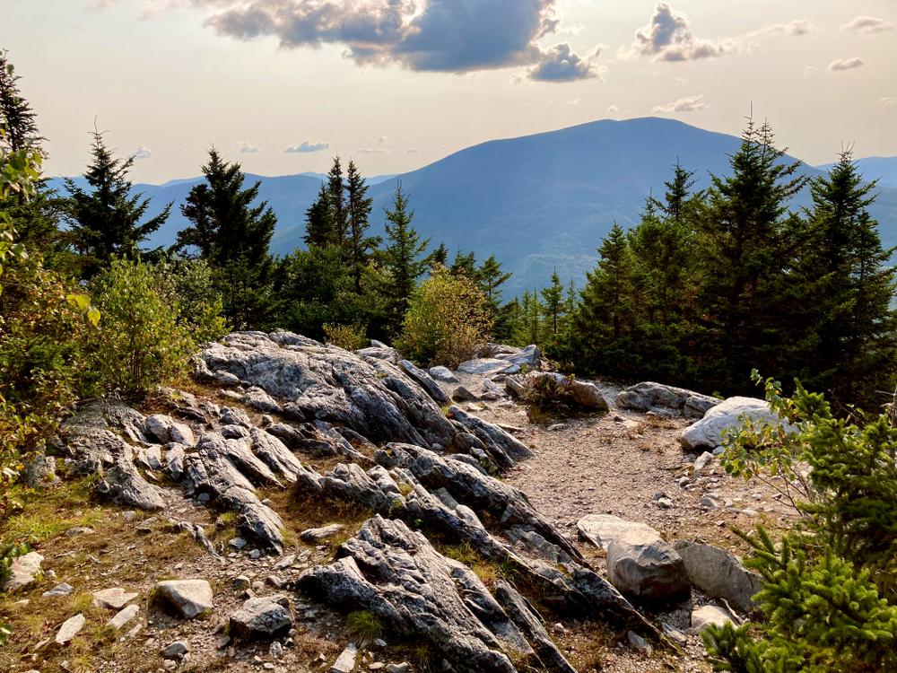
The Lake Trail enters the woods from the parking lot and gently ascends an old road. At a switch back to the left at 0.9 miles, the trail enter the Big Branch Wilderness, and the climb steepens. At 1.5 miles there is a bridge anchored to the rock face where old trestle supports are still visible. After reach a spur to the right, which climbs to an open rock with views of Dorset Peak and the valley, the trail ascends to cross McGinn Brook at the junction with the Baker Peak Trail, at 1.9 miles. The climb moderates from the junction, leading to the Long Trail just north of Griffith Lake, 3.3 miles from the trailhead.

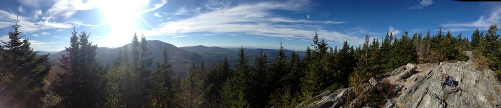
The Baker Peak Trail connects the Lake Trail to the Long Trail near the ledges of Baker Peak. From its junction with the Lake Trail, The Baker Peak Trail begins by gradually ascending on an old woods road. It then climbs a steeper grade over ledges where it meets up with the Long Trail, 0.9 miles from the junction with the Lake Trail, and 0.1 miles south of the ledges on Baker Peak.The total distance from the Lake Trail trailhead to Baker Peak is 2.9 miles.

Trail Manager

For additional information, visit the Green Mountain Club website, or contact:

Green Mountain National Forest: Supervisor's Office - Rutland

Green Mountain National Forest: Supervisor's Office - Rutland
231 North Main Street
Rutland, VT 05701
Phone: (802) 747-6700
View website

Green Mountain Club

Green Mountain Club
4711 Waterbury-Stowe Rd.
Waterbury Center, VT 05677
Phone: (802) 244-7037
gmc@greenmountainclub.org
View website

Trail Tips

Travel on Durable Surfaces
If your bike tires make an indent on the trail surface, it is too wet to ride. Come back when the trails have dried out.
Legend
Hide All

Trailhead Information

Take US-7 south 2.1 miles from Danby, and turn east onto South End Road. Follow South End Road 0.5 miles east to a parking lot at the trailhead.

Click on a parking icon to get custom directions
Please Log In or Create Account to add comments.
These awesome businesses support our goal of connecting people to outdoor adventures!
Hang Tight!
Nearby services are loading
No Results
No Services Found
SHARE THIS TRAIL

Add Trail Log

Please wait…
Join In on the Fun!
Log in or create an account below to unlock all the great features of Trail Finder: keep track of trails you want to do, preserve memories of trails you’ve done, earn badges, and more!
Your log in attempt was not successful. Please try again.
    Lost your password? Reset your password
    Don't yet have an account?
    There was an issue with your submission. Please try again.
      * Indicates required field
      Already have an account? Login here
      Enter your username, and we will send you a new, randomly generated password to your email account.
      There was an issue with your submission. Please try again.

        Success! A new password has been emailed to you.

        Log in now

        Please wait…