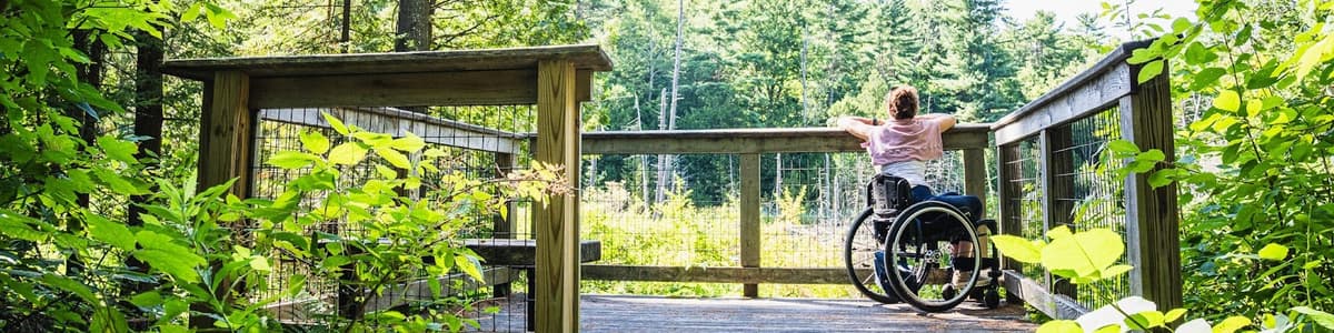
Beyond the well-known rail trails and recreation paths, there are lesser-known gems across the state that offer smoother surfaces, minimal grades, and meaningful access to nature.
Below is a selection of five wheelchair-accessible trails spread across the state, so you can explore from the Champlain Valley to the southern Green Mountains.
Whether you’re looking for ADA accessible trails, scenic boardwalks, or hard-packed rail corridors, these routes make accessible activities in Vermont easier to plan.
To see the location of these trails as pins on a state map, scroll to the bottom of this page. Click each location on the map to see additional accessibility information, including parking, restrooms, benches, and more.
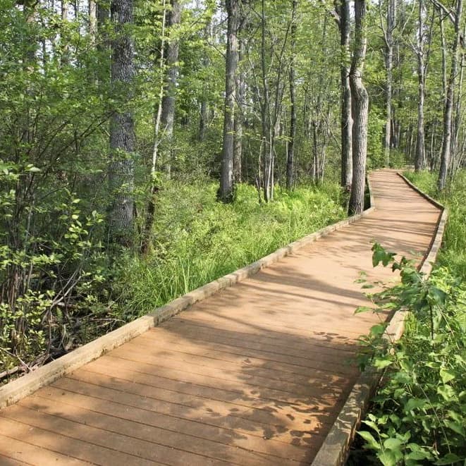
Length: 0.8-mile loop
Surface: Paved and hard-packed stone dust
Width & slopes: 5-foot wide boardwalks over the flood plain forest and wetland with minimal cross slopes and a maximum grade of 8%

Located in northwestern Vermont near the Canadian border and Lake Champlain, the Discovery Trail at the Missisquoi National Wildlife Refuge offers a peaceful wetland experience with broad views of marshes and bird habitat. This loop trail passes by two small ponds, into a wooded wetland, and finishes in a grassland. It is a nearly flat trail with boardwalk-raised areas. Redwing blackbirds, squirrels, a variety of ducks, muskrats, song birds, hawks, deer, red fox, and coyote may be spotted.
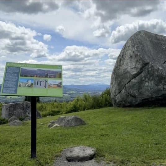
Length: 0.16 miles to top of knoll, round trip; 0.1 miles round-trip to the rock
Surface: Packed gravel and stonedust surface
Width & slopes: 4+ feet wide with minimal cross slopes, typical 3-5% grade with a maximum grade of 14% in some sections
Tucked into northeastern Vermont just outside of the Lake Willoughby area, Sentinel Rock State Park is a quiet destination that offers an accessible path to spectacular, panoramic views of the area from a grassy knoll above Sentinel Rock, a large glacial erratic. Further up the path past the rock, you will find an accessible picnic area at the accessible trail's turnaround spot, which makes for a great lunch or snack spot. For wheelchair users seeking, seeking a less-trafficked setting in Vermont, this park offers a peaceful alternative to busier recreation areas.
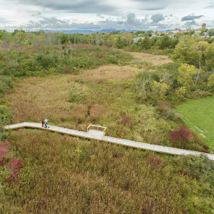
Length: 0.9 miles, round trip
Surface: Packed stonedust, boardwalk
Width & slopes: 5 feet wide with minimal cross slopes, typical grade of 2-4% with a few short sections at 6-8%
Located about 30 minutes drive south of Burlington, the Vergennes Connector Trail runs from Vergennes Union High School to New Haven Road along a mostly flat corridor. The trail passes the school’s athletic fields and high ropes course before crossing wetlands and a stream via a 155-foot ADA accessible elevated boardwalk. There are plans for the trail to become part of a future five-mile walking path that will eventually circumnavigate the city. An adjoining network of non-accessible trails connect to the elementary school from the connector trail.
Length: 1+ mile loop (accessible first loop)
Surface: Packed gravel leading to boardwalk; forest floor and stonedust beyond the river
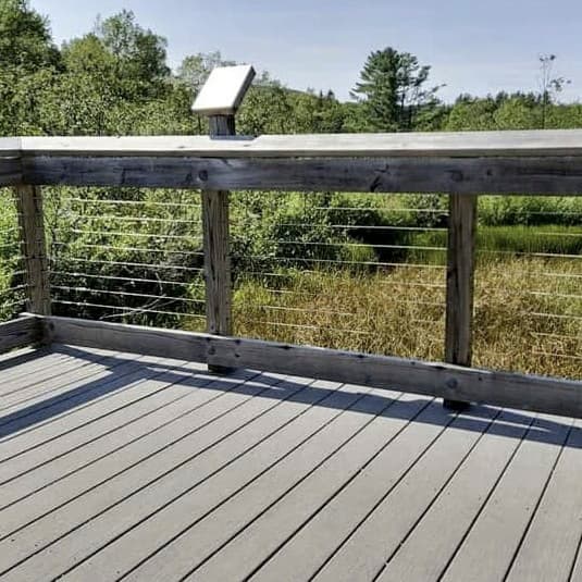
Width & slopes: First loop 4+ foot wide accessible boardwalk with slight slopes and cross slopes; packed gravel approach 5 feet wide. Meadow section 4+ feet wide with hard-packed surface; short maximum slope of 8% for approximately 30 feet
Located in central Vermont in the Green Mountain National Forest, the Robert Frost Interpretive Trail commemorates the poetry of one of Vermont’s most beloved poets. Several of his poems are mounted along the trail in wooded and field settings that reflect the landscapes described in his work.
Length: ~7 miles, roundtrip
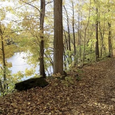
Surface: Compacted stone dust on former railbed
Width & slopes: 5 feet wide with generally flat grade, minimal cross slope, and a typical grade of 0-2% with 5% maximum
The Lower Section of the West River Trail runs along the former West River Railroad bed between Brattleboro and Dummerston, offering one of southern Vermont’s longest and flat multi-use trails. Start at the Rice Farm Trailhead or at the Marina Trailhead. Note: the Brattleboro trailhead has a narrow entrance of 24”. The trail follows the river with opportunities to see local flora and fauna, geology, history, archaeology, and even engineering (since it passes below the unique bridge that carries Route I-91 across the West River).
While these trails offer accessible features, conditions can vary with weather and seasonal maintenance.
The map below shows you where these five trails are located in Vermont. Click on a map pin to view the detailed listing page and trail map for each trail. Review the Details and Comments tabs on each listing for updated surface descriptions and information about parking layout, restrooms, and more.
For more wheelchair accessible trails in Vermont, be sure to explore Trail Finder’s Access(ible) Experiences map.

Success! A new password has been emailed to you.