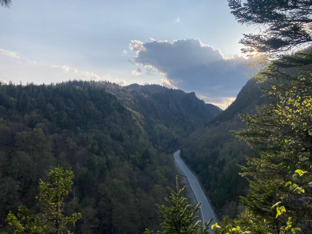
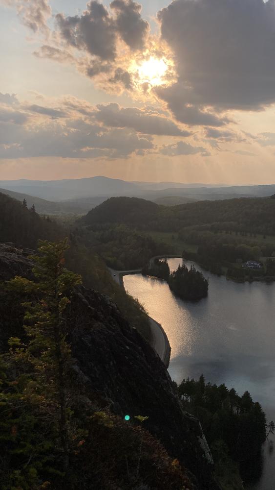
Starting at the west end of Sanguinary Ridge, the trail begins in the forest but quickly starts to ascend quite steeply, including traversing a scree field. There are views back down towards the Balsams resort and Lake Gloriette. The trail reaches the high point of the ridge after 0.4 miles. Continuing to the east, the descent is much more gradual than the ascent. A considerable distance downhill from the height of land, the trail passes four cliff top ledge openings with views of Dixville Notch, Dixville Peak, and lands to the east, including the distance Mahoosuc Range. The trail concludes to the east at the Flume Brook Picnic Area.
Cars may be spotted to hike the trail in one direction, or the one mile between trailheads along NH-26 can be walked or biked, with pleasant views of the surrounding peaks provided from the bottom of the notch. Alternatively, the Sanguinary Ridge can be hiked as a part of a larger loop circling Dixville Notch, connecting with the Table Rock Trail at the west end of the Notch, the Huntington Cascade Trail at the east end, and the Three Brothers Trail connecting the two.
The Cohos Trail is a system of pathways and spur trails from southern Crawford Notch in the White Mountain National Forest through the Great North Woods to the Canadian border at far-flung Pittsburg, NH. Within this geography it stretches for 170 miles of wilderness hiking. To learn more about the Cohos Trail, visit their website, purchase the Cohos Trail Guidebook and support the organization.
For additional information, visit the Cohos Trail Association website, or contact:
Cohos Trail AssociationTHE BALSAMS
From US-3, head east on NH-26 to Dixville Notch, 10.5 miles from Colebrook. Look for the entrance to The Balsams resort at the east end of Lake Gloriette, and take this left onto Cold Spring Road (on the north side of NH-26). The trailhead is on the right as soon as you turn onto Cold Spring Road. There is space for parking on the left, between Cold Spring Road the Lake Gloriette.
FLUME BROOK PICNIC AREA
From The Balsams entrance at Cold Spring Road at the east end of Lake Gloriette, go an additional 1.1 miles to the Flume Brook Picnic Area, on the left. There is parking at the picnic area, the east end of the Sanguinary Ridge Trail.
Success! A new password has been emailed to you.
