The blue-blazed multi-use trail climbs gently from the parking lot and makes a soft left onto an old flat woods road. At 0.16 mile, the trail turns right, leaving the woods road and ascending slightly. At 0.27 mile, the bike/ski trail leaves the hiking trail and veers left. The hiking trail continues straight ahead under the power-line carrying electricity from the Wilder Dam, crosses the cleared right-of-way and passes an intersection with the bike/ski trail just before entering the woods again, where it veers right to start the climb to the tower. After two switchbacks, the trail turns right at 0.6 mile to ascend the summit ridge to the fire tower, where, on a clear day, you will behold great 360-degree views of the Upper Valley.
This trail gets extensive use and requires extensive maintenance. Please observe mud season closings (typically April through mid-May).
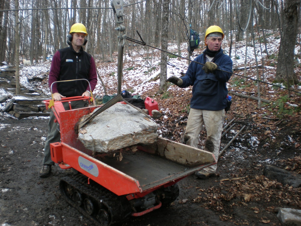
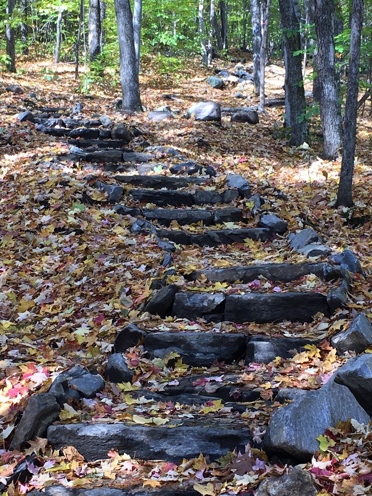
The Norwich Trails Committee is currently collaborating with the Upper Valley Trails Alliance to make the trail more sustainable by rebuilding eroded and steep sections using rock steps and gravel surfacing.
Please consider volunteering your time to maintain this or other trails in the region. Contact us at volunteer@uvtrails.org.
For more information contact:
Norwich Trails CommitteeFrom Main Street, Norwich, continue west out of the village and past Beaver Meadow Road for 0.5 miles. Turn left onto Turnpike Road and continue for 5.3 miles to the trailhead parking area on left. While traveling on Turnpike Road, stay left at New Boston Road and Upper Turnpike Road intersections, which are located 1.0 and 2.7 miles from Main Street. When you drive under the powerline corridor you’ll be 0.7 miles from the parking area.
Success! A new password has been emailed to you.
