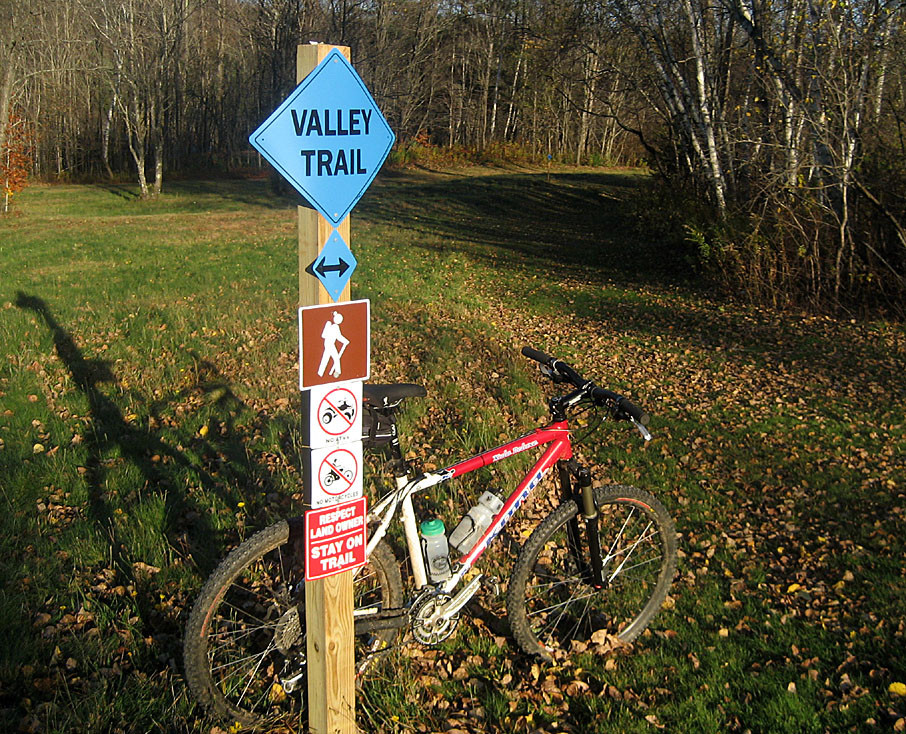
The Valley Trail connects the resort villages of Wilmington and Dover in southern Vermont. The southern end of the trail is located off Route 9 in Wilmington across from Reardon’s Crossing Bridge, while the northern end terminates at Mount Snow in Dover. Nine trailheads and parking areas along the way and several spurs off the main trail enable users to hike all or part of the trail.
With a variety of trail options, the Valley Trail is suitable for users of all ages whether on foot or on bicycles. The trail is meant for year-round recreational use for visitors and residents alike. It’s a great way to get some exercise and enjoy the beauty of southern Vermont. For the first time, the towns of Wilmington and Dover are connected by a recreational trail making it possible for someone to go from one town to the other totally on the Valley Trail.
An option is to park in one of the towns and hike, bike, snowshoe, or cross-country ski in the other direction, and once you get into town, take the Moover complimentary transportation system back to your parked car. After your journey, refresh with dining in our restaurants.
The 14-mile trail was created in 2014 by the Wilmington Trails Committee and the Bi-Town Economic Development Committee, a group made up of representatives from the towns of Dover and Wilmington. The Bi-Town Committee focuses on common goals and projects that benefit both communities.
Maps of the Valley Trail are available on the websites of the Town of Wilmington or the Town of Dover, or from the Southern Vermont Deerfield Valley Chamber of Commerce office on West Main Street in Wilmington. For more information, please contact:
![]()
Route 9/West Main Street Parking Lot (Wilmington): You can park in a public parking lot on West Main Street to access the southern end of the Valley Trail. Signs on the south side of West Main Street (Route 9), 170 yards west of the traffic light in the center of Wilmington, direct you to this parking lot. From your car, walk back to West Main Street, turn left, and walk 0.15 miles to the trailhead on the right, marked by a kiosk.
Chimney Hill Tennis Courts (Wilmington): From the traffic light at the center of the village of Wilmington, drive 1.1 miles west on Route 9 (West Main Street) and turn right onto Haystack Road. Drive 0.3 miles and turn right onto the parking lot for the Chimney Hill Tennis Courts.
Heritage Club Trailhead (Wilmington): From the traffic light at the center of the village of Wilmington, drive 2.5 miles north on Route 100 towards West Dover, and turn left onto Coldbrook Road. The trailhead is on the left, at the entrance to the Hermitage Club, 2.4 miles from Route 100.
Crosstown Road Trailhead (West Dover): From Route 100 in West Dover, drive west on Crosstown Road for one mile, to the trailhead, where the road makes a sharp bend to the right.
Handle Road/Crosstown Trails Trailhead (West Dover): From the traffic light at the center of the village of Wilmington, drive 2.5 miles north on Route 100 towards West Dover, and turn left onto Coldbrook Road. The trailhead and parking area is on the right, 3.7 miles from Route 100. From the South Entrance to the Mount Snow Ski Area, drive 2.0 miles south on Handle Road, and the parking area and trailhead will be on your left.
Success! A new password has been emailed to you.