In 2019, a network of trails was created to provide access to this beautiful open space. The carefully planned trails are designed to leave sensitive wildlife habitats undisturbed and protect water quality downstream. As you enjoy these new or rerouted trails, please stay off closed trails and follow the trail signs.
Locke Trail - The longest trail on the property, the Locke Trail leads from Marsh road, passes the parking area at Stonehouse Pond, leads to the Ledges Loop Trail, continues across private land (please respect the private landowners who allow this trail to pass through their property), connects to the Overlook Trail, Brook Trail, and South Trail before leading off the property onto private land.
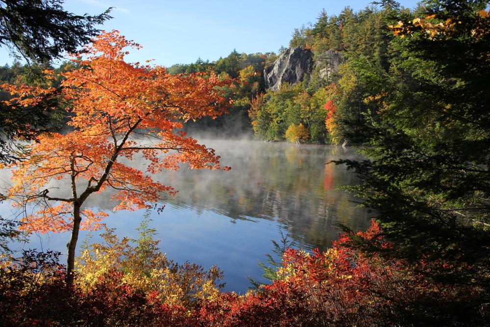
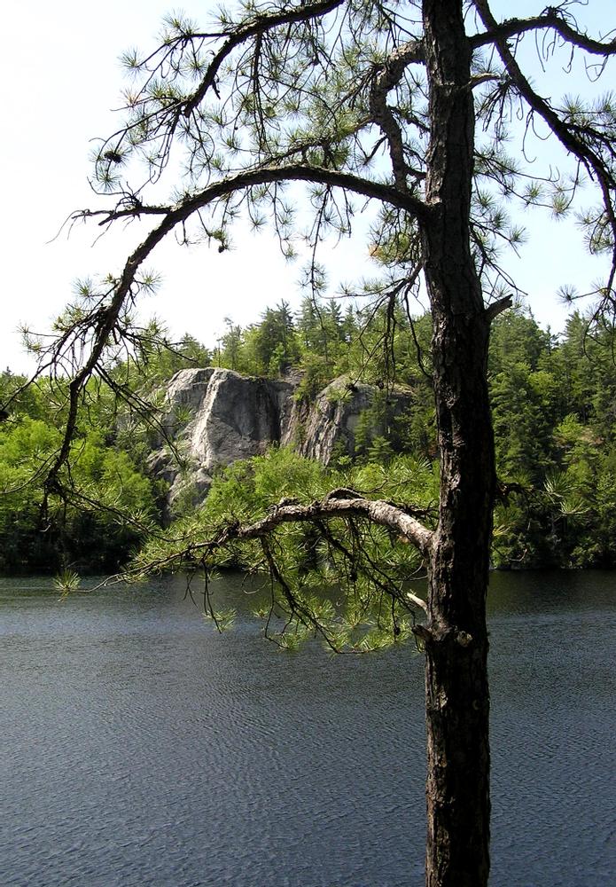
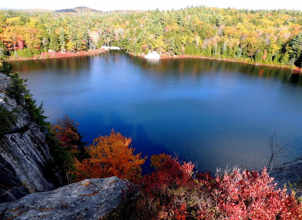
Ledges Loop - This short loop connects Locke Trail to the Overlook Trail and leads to the top of the beautiful cliffs overlooking Stonehouse Pond.
Overlook Trail - This trail connects a northern portion of the Locke trail to the Overlook Trail and then continues on to reconnect with the Locke Trail further south.
Brook Trail - This trail leads from private land, overlaps briefly with the Locke Trail, and then continues on to a wildlife viewing spot overlooking a shrubby wetland.
South Trail - This trail extends from the Merry Hill parking lot to Marsh Road.
Marsh Road - An unmaintained dirt road extending from Rte. 9 to Merry Hill Road. Connects to the Locke Trail, Marrison Trail West, South Trail, and Marrison Trail. The Marsh Road Bypass provides a way around a beaver pond.
Marison Trail - This trail follows old woods roads from the Marrison Trailhead parking on Rte. 202 to Marsh Road. The trail passes through two openings - the first at the intersection of Marison and Bog Trails where you'll see a stone staircase leading to nothing (the site where the previous owner planned to place a hunting lodge), the second opening has old foundations of a farm.
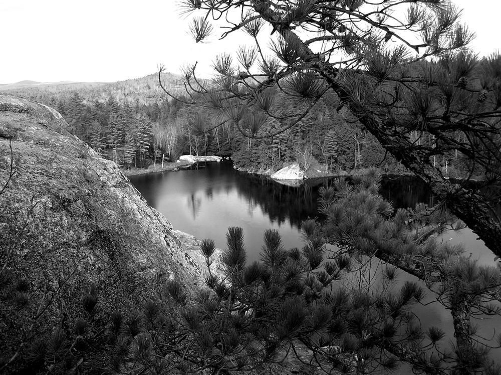
Bog Trail - Splits off from and connects back to the Marrison Trail making a nice loop and providing nice views of Round and Little Round Ponds.
Marison Trail West - Splits off Marrison Trail in an opening with an old foundation and connects to Marsh Road.
In 2017 after a two-year fundraising effort, SELT acquired 1,500 acres of this property from a European investor who, at one time, planned an exotic game reserve for the property. Trails now use the woods roads and retaining walls once destined to support this now abandoned vision.
Within Stonehouse Forest lies Stonehouse Pond, managed by NH Fish and Game (NHFG). Stonehouse pond is an important 11-acre cold-water fishery and trout pond for fly fishing only. The pond and surrounding 231 acres were acquired by SELT in 2010 in partnership with the Trust for Public Land, NHFG, Town of Barrington, US Natural Resources Conservation Service, and the Carolyn S. Bedford Trust.
In 2019, a network of trails was created to link these two properties and provide access to this beautiful open space. The carefully planned trails are designed to leave sensitive wildlife habitats undisturbed and protect water quality downstream. As you enjoy these new or rerouted trails, please stay off closed trails and follow the trail signs.
The purchase of Stonehouse Forest was made possible with support from 425 generous individuals, Great Bay Resource Protection Program, NH Land and Community Investment Program (LCHIP), Mooseplate Program, NHFG, Open Space Institute's Resilient Landscapes Initiative, the Doris Duke Charitable Foundation, Town of Barrington, and US Fish and Wildlife Service's Coastal Wetlands Conservation Program.
The Southeast Land Trust of New Hampshire is a membership-based, non-profit whose mission is to protect and sustain the significant lands in our communities for clean water, outdoor recreation, fresh food, wildlife, and healthy forests. SELT works in the 52 communities of southeastern New Hampshire to voluntarily conserve special places for the public benefit through conservation easements and ownerships. Once land is conserved, SELT ensures the conservation goals are met through our landowner easement stewardship program and through sustainable management of SELT-owned lands. Join as a member or volunteer today!
Visit SELT online for more information, or contact:

There are three parking areas to access Stonehouse Forest:
Stonehouse Pond - From route 4 in Northwood follow Rte. 202 East approximately 3 miles. Look for a NH Fish and Game sign for Stonehouse Pond on the right. From Rte. 9 in Barrington, follow Rte. 9 West until it merges with Rte. 202. Continue West another 2 miles and look for a NH Fish and Game sign for Stonehouse Pond on the left. Follow access road to parking area. This road and parking area are generally not plowed in the winter.
Marrison Trailhead - From Route 4 in Northwood follow Rte 202 East approximately 4 miles. Look for a SELT sign and parking area on the right. From Rte. 9 in Barrington, follow Rte 9 West until it merges with Rte. 202. Continue West another 1 mile and look for a SELT sign and parking area on the left.
Merry Hill Road/South Trailhead - From Route 4 (in Nottingham) take Merry Hill road about 1.7 miles. Look for a SELT sign and parking area on the left.
Success! A new password has been emailed to you.