Mud season is here!Protect the trails we all love by sticking to open, dry areas. Learn more! 

Rinker Steele Natural Area

Located in a mix of mature hardwood and softwood trees, the trail follows the edge of Rinker Pond, climbing upslope to the Quarry Loop and Hillside Trails.
Trail Activity
Walking Hiking Mountain biking
Length
0.60 miles, Network
Difficulty
Easy
Town
Hanover (NH)
Surface
Packed Earth/Dirt
Pets
Unknown
Fees
No
Other Activities
Groomed cross-country skiing

Description

This hilly, heavily-wooded tract, owned by the Town of Hanover and conserved in 2010 by the Hanover Conservancy, offers some quaint trails including:

  • Brookside Trail that skirts the edge of Rinker Pond and heads gently uphill across a sideslope trail to reach a plateau that sits steeply above the pond
  • Quarry Loop that passes by a former granite quarry used to build the Dartmouth Outing Club building and the St. Denis Church
  • Hillside Trail which provides access to the top of a small promontory, a nice spot for picnicking.

Soils on these steep slopes are fragile and easily eroded – please stay on designated trails.

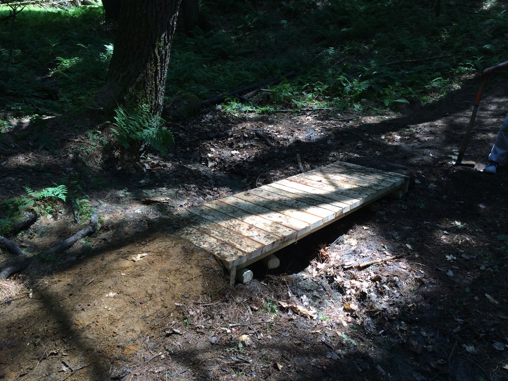
A new trail providing mountain bike access was built in the spring of 2012 by Upper Valley Mountain Bike Association, with permission by Hanover Conservation Commission, as part of a trail reroute plan to remove a trail off a steep hillside. This trail links access from Storrs Pond trails and to Oak Hill trail including Frankestein's Folly to Game Trail. Trails to Route 10 across the Rinker Steele property are for foot use only.


Other Information

The pond is fed by Camp Brook from Storrs Pond a few hundred feet to the east and drains into the Connecticut River. Canoes can be put in to the right of the entrance and the "Rinker Tract" signpost off Route 10.

Trail Manager

Visit Hanover Conservancy or Town of Hanover online for more information or contact:

Hanover Trails Committee

Hanover Trails Committee
41 South Main Street
PO Box 483
Hanover, NH 03755
Phone: (603) 643-0742
hanovertrails@gmail.com
View website

Hanover Conservancy

Hanover Conservancy
71 Lyme Road
Hanover, NH 03755
Phone: (603) 643-3433
info@hanoverconservancy.org
View website

Trail Tips

Plan Ahead and Prepare
Use common sense. If it seems like a bad idea, it probably is.
Legend
Hide All

Trailhead Information

Located off Route 10 north of Kendal and south of Fullington Farm and Wilson's Landing.

Head north from Hanover for approximately 2.5 miles. Continue 400 yards north of the Chieftain Motel where you'll find a blue and white "Rinker Tract" sign on the east side of Route 10. Pull off onto the shoulder. Trailhead located next to sign.

Click on a parking icon to get custom directions
Please Log In or Create Account to add comments.
These awesome businesses support our goal of connecting people to outdoor adventures!
Hang Tight!
Nearby services are loading
No Results
No Services Found
SHARE THIS TRAIL

Add Trail Log

Please wait…
Join In on the Fun!
Log in or create an account below to unlock all the great features of Trail Finder: keep track of trails you want to do, preserve memories of trails you’ve done, earn badges, and more!
Your log in attempt was not successful. Please try again.
    Lost your password? Reset your password
    Don't yet have an account?
    There was an issue with your submission. Please try again.
      * Indicates required field
      Already have an account? Login here
      Enter your username, and we will send you a new, randomly generated password to your email account.
      There was an issue with your submission. Please try again.

        Success! A new password has been emailed to you.

        Log in now

        Please wait…