Mud season is here!Protect the trails we all love by sticking to open, dry areas. Learn more! 

Moosalamoo National Recreation Area: Rattlesnake Cliffs/Oak Ridge Trails

Network of trails with views of Champlain Valley, Lake Dunmore, Silver Lake, Adirondack Mountains, and waterfalls.
Trail Activity
Hiking Mountain biking
Length
17.00 miles, Network
Difficulty
Moderate, Advanced
Towns
Leicester (VT), Salisbury (VT)
Surface
Packed Earth/Dirt
Pets
Permitted on leash
Fees
No

Description

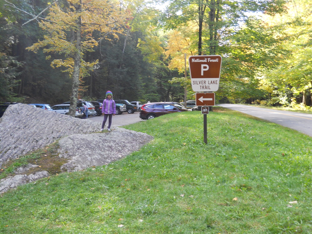
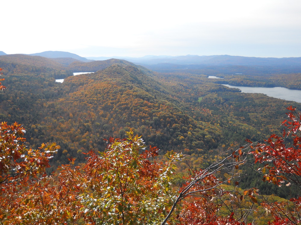
Rattlesnake Cliffs and Aunt Jenny Trail: 1.6 miles (3-4.5 hours round trip). Starting at the Silver Lake / Falls of Lana parking area off Route 53 south of Branbury State Park, go up past the Falls of Lana to the Silver Lake trail and take a left over the bridge onto the Rattlesnake Cliffs Trail, and either continue up it past the North Branch Trail, or take the next left on the Aunt Jenny Trail to where it eventually rejoins the Rattlesnake Cliff Trail above. After a short distance, the Rattlesnake Cliffs Trail will be on the left. Take that and go to both overlooks where you will get spectacular views of Silver Lake, Lake Dunmore, the Champlain Valley, and the Adirondacks. Return either on the Rattlesnake Cliffs Trail or the Aunt Jenny Trail. Use Restrictions: No horses, mountain bikes, or motorized vehicles.

Note: From March to August some years the trail to the cliffs is close to protect nesting Peregrine Falcons.

Other Information

Please check current trail and road closures in the Green Mountain National Forest.

Trail Manager

Visit Moosalamoo Association or Green Mountain National Forest online for more information and an interactive map or contact:

Moosalamoo Association

Moosalamoo Association
PO Box 148
Brandon, VT 05733
Phone: (802) 989-6980
execdir.moosalamoo@gmail.com
View website

Green Mountain National Forest: Supervisor's Office - Rutland

Green Mountain National Forest: Supervisor's Office - Rutland
231 North Main Street
Rutland, VT 05701
Phone: (802) 747-6700
View website

Trail Tips

Respect Wildlife
Avoid known animal mating or nesting areas during sensitive times.
Legend
Hide All

Trailhead Information

The trailhead is in the Town of Salisbury on Route 53.

  • From Middlebury, travel south on Route 7 to its intersection with Route 53. Follow Route 53 for 3.9 miles. Trailhead parking is a paved parking lot, located on the left and prominently marked.
  • From Rochester, travel south on Route 100 to its intersection with Route 73. Travel 13.6 miles east on Route 73 into Forest Dale. Turn north onto Route 53, and follow it 5.3 miles.

From the north end of the parking lot, follow the footpath to a service road, and turn right. At a sharp curve in the road, there is a toilet building. Bear left here and over a bridge to reach the Falls of Lana Picnic Area. The trail begins at the Falls of Lana Picnic Area.

Click on a parking icon to get custom directions
Please Log In or Create Account to add comments.
These awesome businesses support our goal of connecting people to outdoor adventures!
Hang Tight!
Nearby services are loading
No Results
No Services Found
SHARE THIS TRAIL

Add Trail Log

Please wait…
Join In on the Fun!
Log in or create an account below to unlock all the great features of Trail Finder: keep track of trails you want to do, preserve memories of trails you’ve done, earn badges, and more!
Your log in attempt was not successful. Please try again.
    Lost your password? Reset your password
    Don't yet have an account?
    There was an issue with your submission. Please try again.
      * Indicates required field
      Already have an account? Login here
      Enter your username, and we will send you a new, randomly generated password to your email account.
      There was an issue with your submission. Please try again.

        Success! A new password has been emailed to you.

        Log in now

        Please wait…