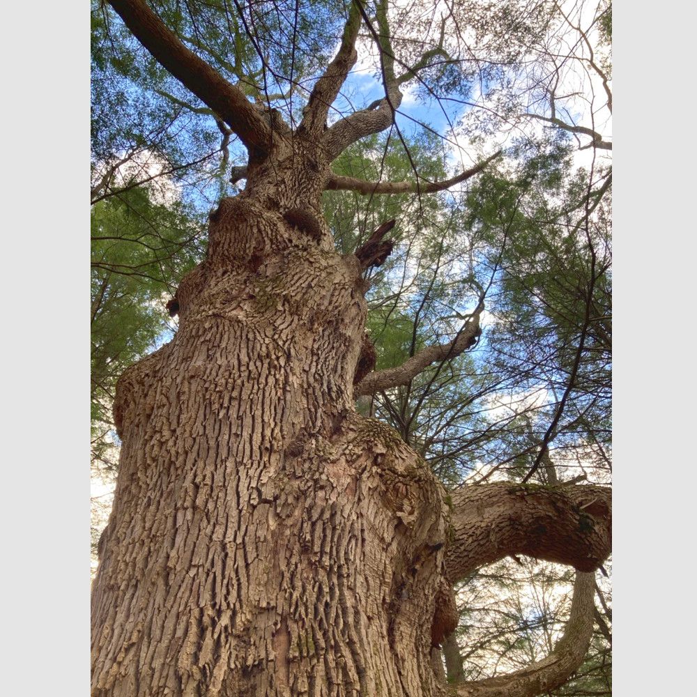
The Missing Link Trails are a brand new trail system still in development. A portion opened in Fall 2020. In the next several years trails will be extended north and south, but for now the trail's northern terminus is Vermont's second largest ash tee, and the southern terminus is a wooded hilltop. The trail will serve as the "missing link" between the Putney Mountain Association's trails to the north (PMA's Southern Tier Trails and Putney Mountain Trails), and the Town of Dummerston's Prospect Hill trail. It will eventually be part of a trail system stretching from Brattleboro to Grafton.
From the trailhead parking area, the Missing Link access trail follows an old roadway 0.2 miles to the white-marked Missing Link Trail.
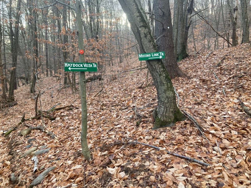
You can turn right, or south on the Missing Link Trail, and walk 0.4 miles south the top of a hill where the trail currently ends. It will be extended south to Prospect Hill in the next year or two.
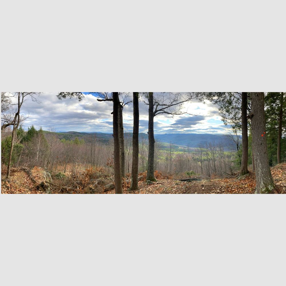
You can turn left, or north on the Missing Link Trail, where you cross a small stream and climb at a fairly moderate grade 0.7 miles to a junction. The 0.4 mile long Haydock Vista Trail, marked in orange, bears left and continues climbing to the Haydock Vista, 1.2 miles from the parking lot. Continues past the vista, making your way around rock ledges before climbing to re-join the Missing Link Trail.
From this upper junction of the Haydock Vista Trail, you can turn right on the Missing Link Trail and descend through a wonderful sugar maple forest to the access trail and the parking lot. You can also turn left and immediately reach another view, similar to but somewhat smaller than the Haydock Vista. Continue along a hillside clothed in hemlock for 0.7 miles to the second largest ash tree in Vermont, where the northern portion of the Missing Link Trail currently ends. It will be extended to north Holland Hill Road in the future.
Parking area to southern end of Missing Link Trail: 0.6 miles
Parking area to Haydock Vista: 1.2 miles
Parking area to Haydock Vista and return, using the Haydock Vista and Missing Link Trails: 2.5 miles
Parking area to north end of Missing Link Trail, including Haydock Vista Trail: 3.9 miles
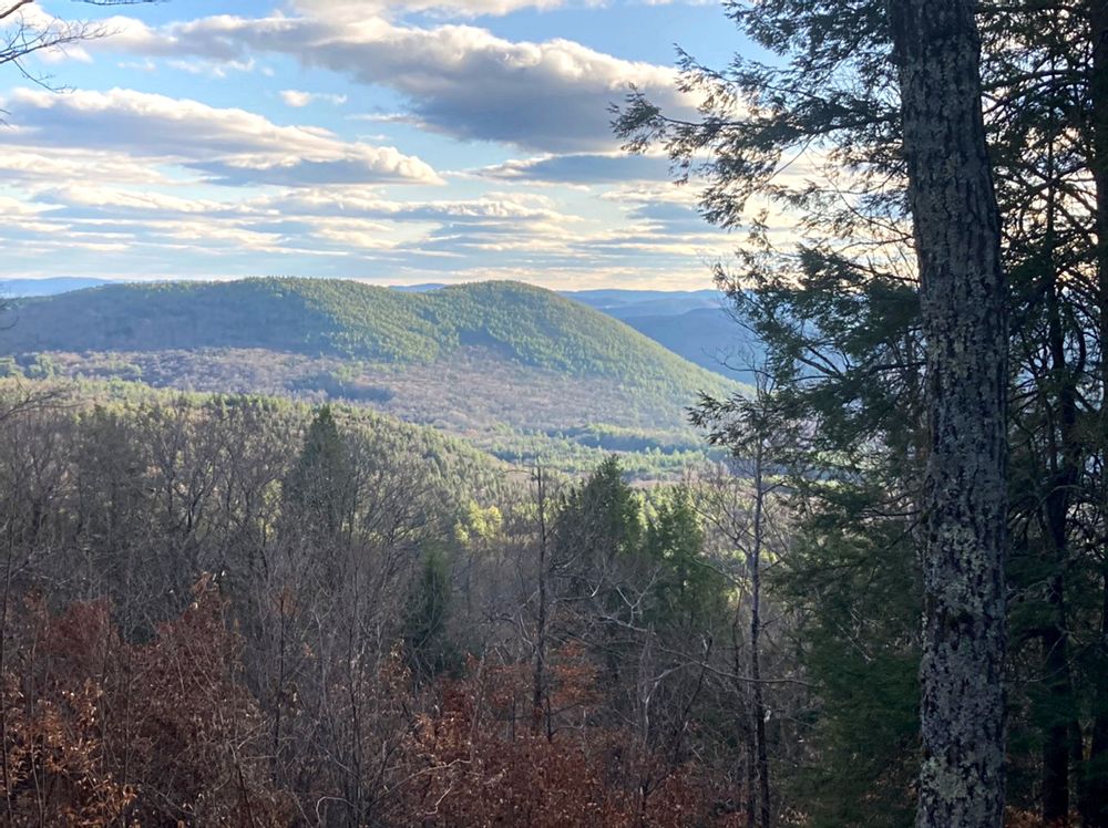
The Haydock Vista is a tri-state view that looks down the West River Valley. The sharp little peak of Round Mountain captures your attention, while the evergreen-covered slopes of Black Mountain dominates the view. Farther left is Northfield Mountain in Massachusetts and Wantastiquet Mountain in New Hampshire. The trail and the vista are named after Roger Haydock who built many trails in the area.
Maps and additional information about the Putney Mountain Association can be found on their website. The Association offers guided woods walks and many other activities throughout the year, with learning opportunities for all ages and experience levels. A calendar of events is available on the website.
These trails are maintained by the Putney Mountain Association.
![]()
The trailhead parking area is located at 645 Hague Road, Dummerston, VT. From Route 30, cross the West Dummerston covered bridge and immediately turn left onto Camp Arden Road. In one-half mile, bear right onto Green Mountain Camp Road, and take your first left 0.2 miles later onto Hague Road. Follow Hague Road for 1.3 miles to the parking area on the left. This is just after the road starts to climb a steep hill, and just before several posted signs along the road where town maintenance ends.
Success! A new password has been emailed to you.