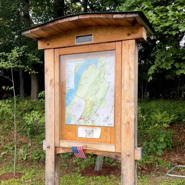
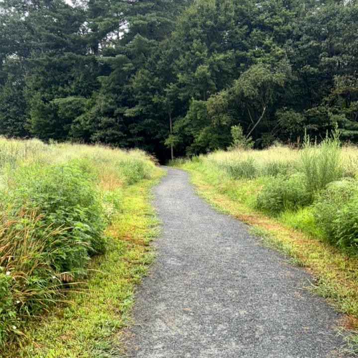
Pine Park is home to over 100 acres of forested land and an extensive trail network perfect for walking, running, or relaxing in nature. Visitors can explore old-growth forest, spot native plant life, and enjoy views of Girl Brook and the Connecticut River. Trail maps are available at each of the park’s entrances.
Rope Ferry Trail (0.8 miles)
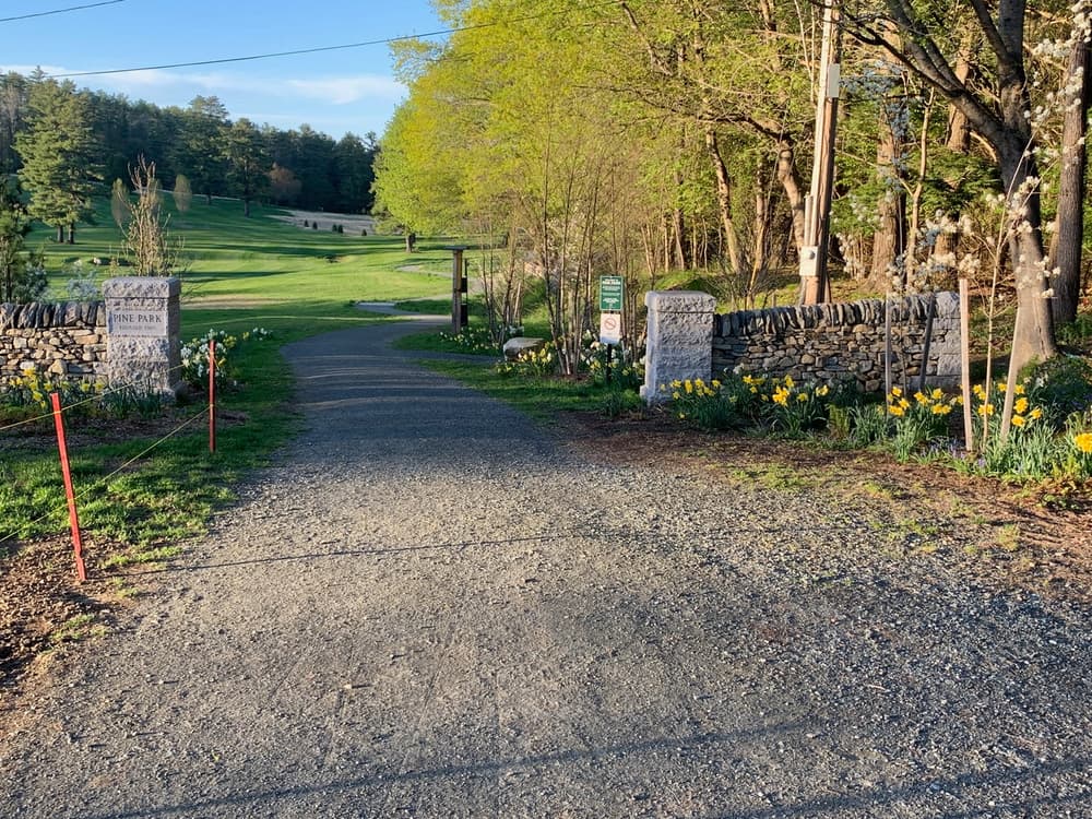
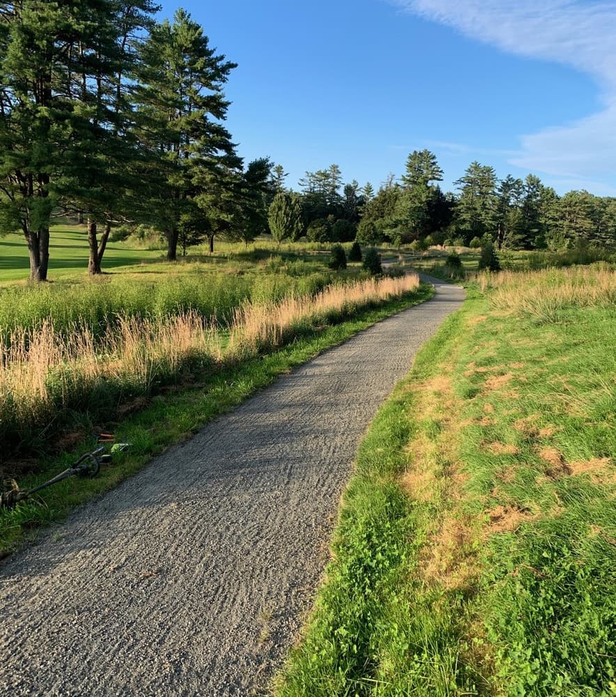
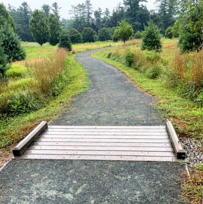
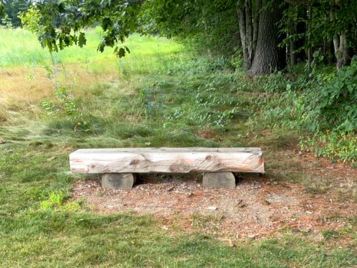
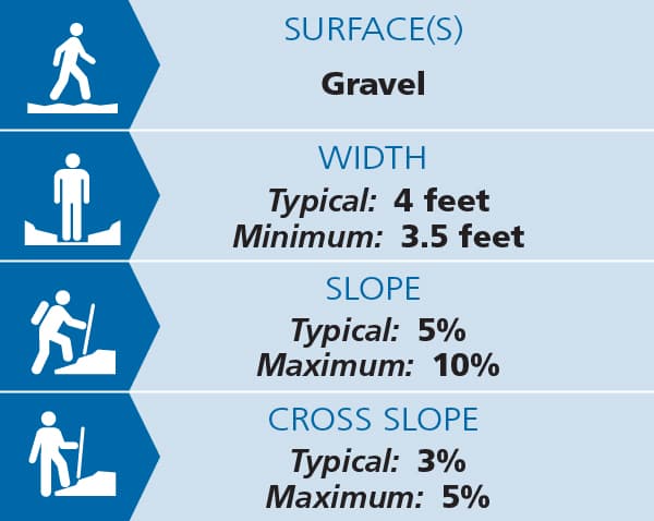
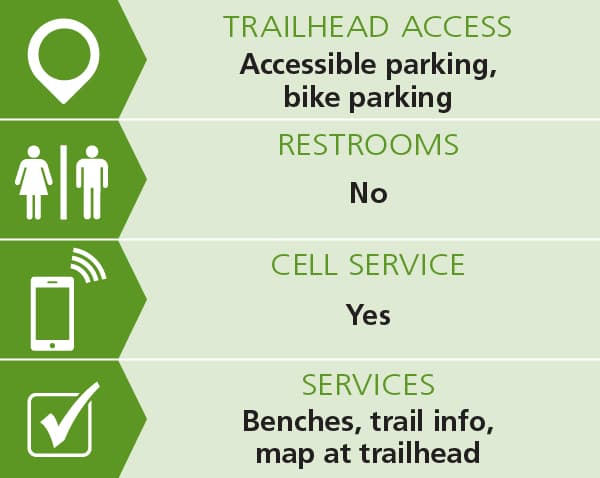
This trail begins at the main entrance at the end of Rope Ferry Road, marked by a stone wall. The first 2,100 feet of the trail has a firm stone dust surface and gradual inclines, designed for easier access. The trail has benches along the way as it gently winds north through the park. The trail then enters the woods and slopes gradually downhill to a four-way intersection near the park’s northern end. The historic name comes from the original ferry route that once brought people across the Connecticut River before the Ledyard Bridge existed. See Trail Access Information below for more information about this Accessible Experience.
River Trail (0.5 miles)
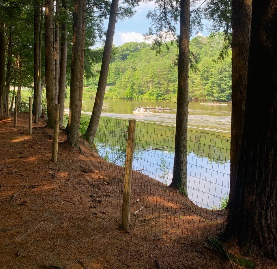
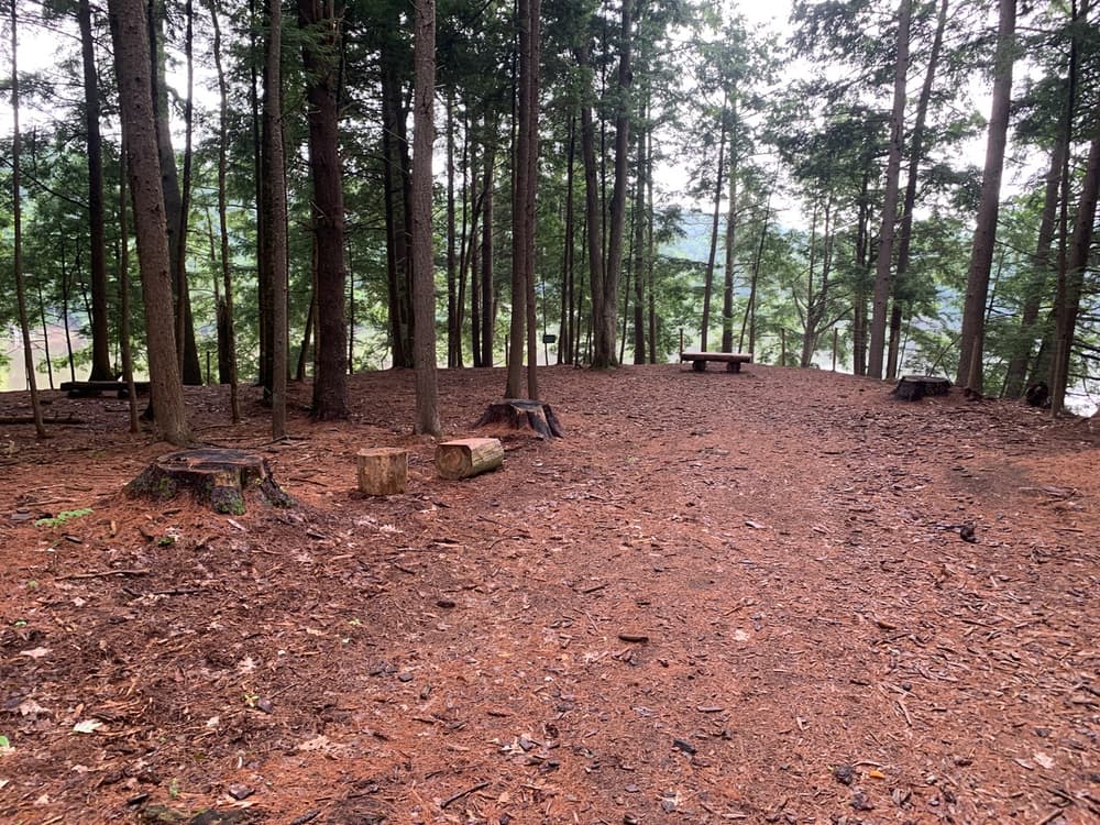
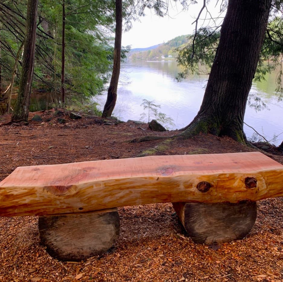
This is the most popular trail in the park. It runs parallel to the Connecticut River, with great river views for its entire length, often including seeing Dartmouth's crew teams practicing. Rustic log benches provide the opportunity for rest and observation.
Many access this trail from the southwest corner of the park at Dartmouth's Occum Pond, crossing a small section of Dartmouth land. From there the trail descends Freshman Hill to the river, and continues along the river to the Four Corners trail junction and the north end of the Park. The north and south Connector Trails give hikers options to explore the interior of the park.
Fern Trail (0.4 miles)
This trail runs north to south through the heart of the park. At its northern end, the trail ends at the Four Corners junction. At its south end, it connects with the River Trail.
At one point, this path was called the Cathedral Trail due to the large trees that bordered it. A logging operation in 2019 removed many of these trees. As the name implies, the trail is now surrounded by ferns in many places. Visitors can use the south or north Connector Trails to cross to the River Trail.
South Connector Trail (0.l miles)
This trail runs east to west, connecting the River Trail and the Fern Trail. It is one of the shortest trails in the park, and includes gentle curves and a peaceful glade with a bench.
North Connector Trail (0.1 miles)
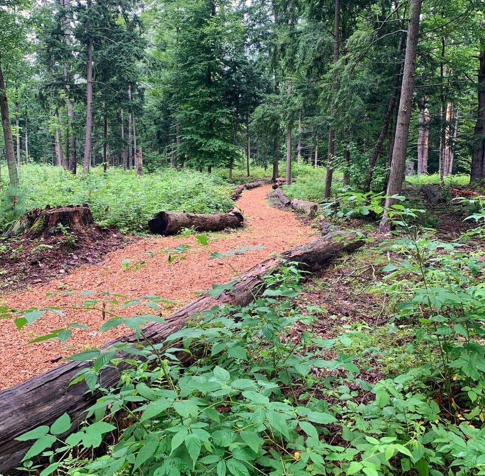
This trail also runs east to west, connecting the River Trail and Fern Trail. It crosses a section of the park that had some significant logging in 2019. The trail is bordered by some of the resulting logs. Like the South Connector, the trail curves back and forth and includes quiet glades with additional plantings planned.
Girl Brook Trail (0.8 miles)
This is one of the longer trails in the park. It follows Girl Brook, which runs south to north. There are two wooden bridges along the trail. Steep banks on either side of the trail include patches of old growth forest, a rarity in modern day New Hampshire. The trail has a variety of access points along its way from both sides. Those wanting to walk the entire length of the trail often begin at the south Lyme Road trailhead.
Firehouse Trail (0.1 miles)
The trail begins at the north Lyme Road trailhead. The trail travels gradually downhill to the west, and connects with the Girl Brook Trail.
Trail distance: from the north lyme road entrance to the four corners signpost is 291 meters,
about .2 miles.
Middle Lyme Road Trail (0.2 miles)
This is another access point to the park, from the former golf course on the east side of the girl brook ravine. The trail heads west and downhill on a dirt road, crossing a wood bridge before connecting with the Girl Brook Trail.
Esker Trail (0.3 miles)
The majority of this trail is on Dartmouth land along the western boundary of the former golf course. It begins at the green gate at the base of freshman hill and, heading north, climbs gradually before entering a wooded area, then connects to the Rope Ferry Trail. The top of the trail offers outstanding views to the south and east.
.
South Ravine Trail (0.1 miles)
This trail begins at the first junction headed north on the Rope Ferry Trail from the main trailhead. The trail heads to the east and heads downhill very steeply until coming to a bridge over Girl Brook then the intersection with the Girl Brook Trail. There is a lovely seating area at the top of the trail (at the west Rope Ferry end).
North Ravine Trail (0.1 miles)
This trail also connects the Rope Ferry Trail with the Girl Brook Trail. From the Rope Ferry Trail, it heads east then turning north, and heading steeply downhill. At its west end is an area of several new trees that were planted in the park in 2023.
(Applies to Rope Ferry Trail)
Trail conditions can change without warning. Trail last assessed: 7/31/2025
For more information, contact:
![]()
ROPE FERRY (MAIN) TRAILHEAD
From I-91, take exit 13 to VT-10A, and then follow West Wheelock Street into the center of Hanover. From Main Street in the center of Hanover, go east on East Wheelock Street for one block past the Dartmouth Green ad turn left on College Street. Go 0.3 miles and turn left on Maynard Street, then 0.1 miles to Rope Ferry Road on the right. Continue up Rope Ferry Road for 0.4 miles to the parking lot for the trailhead.
SOUTHWEST TRAILHEAD
Just before the trailhead at the end of Rope Ferry Road above, turn left on Hilton Field Road. There is a parking lot about 400 feet ahead on the right, with the trailhead another 200 feet past the parking lot.
Success! A new password has been emailed to you.