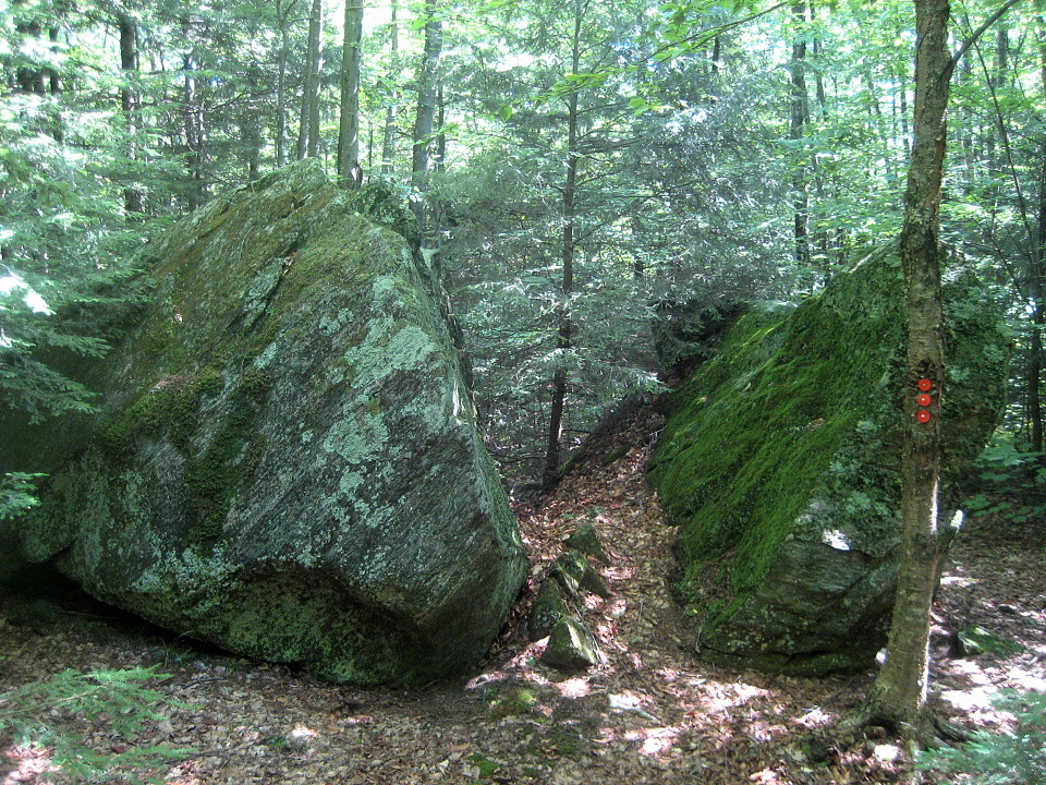
The trails in the area around Paul's Ledges are part of a larger network maintained by the Windmill Hill Pinnacle Association. The multiple trails, accessible from two trailheads, as well as an old town road that bisects the system, allow for many hiking options. The view from Paul's Ledges west to the Green Mountains is the highlight, but not the only reason to hike the trails. Magnificent hemlock trees, rock outcrops, a wildlife clearing, and a glacial erratic are found throughout this trail system.
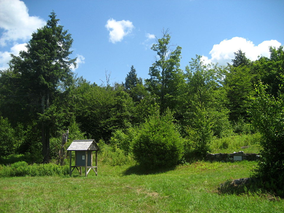
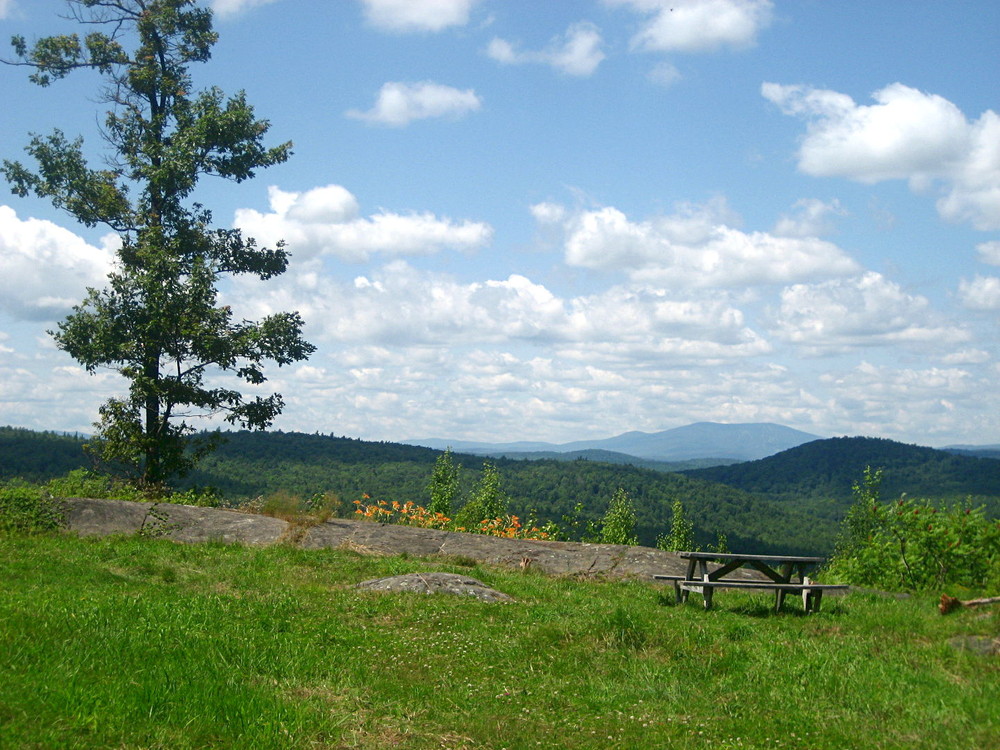
Paul's Ledges is an large open and grassy area with a picnic table and views to the west. Stratton Mountain, the highest point in southern Vermont, dominates the scene. The area has an almost park-like feel to it, being the site of a former home.
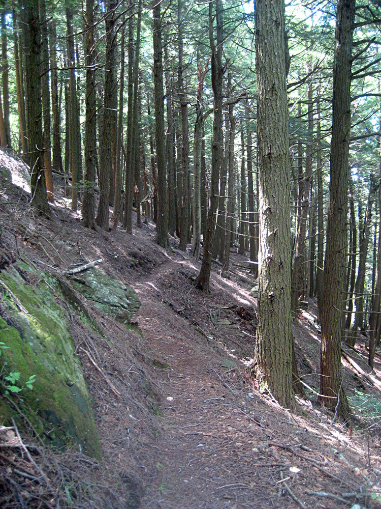
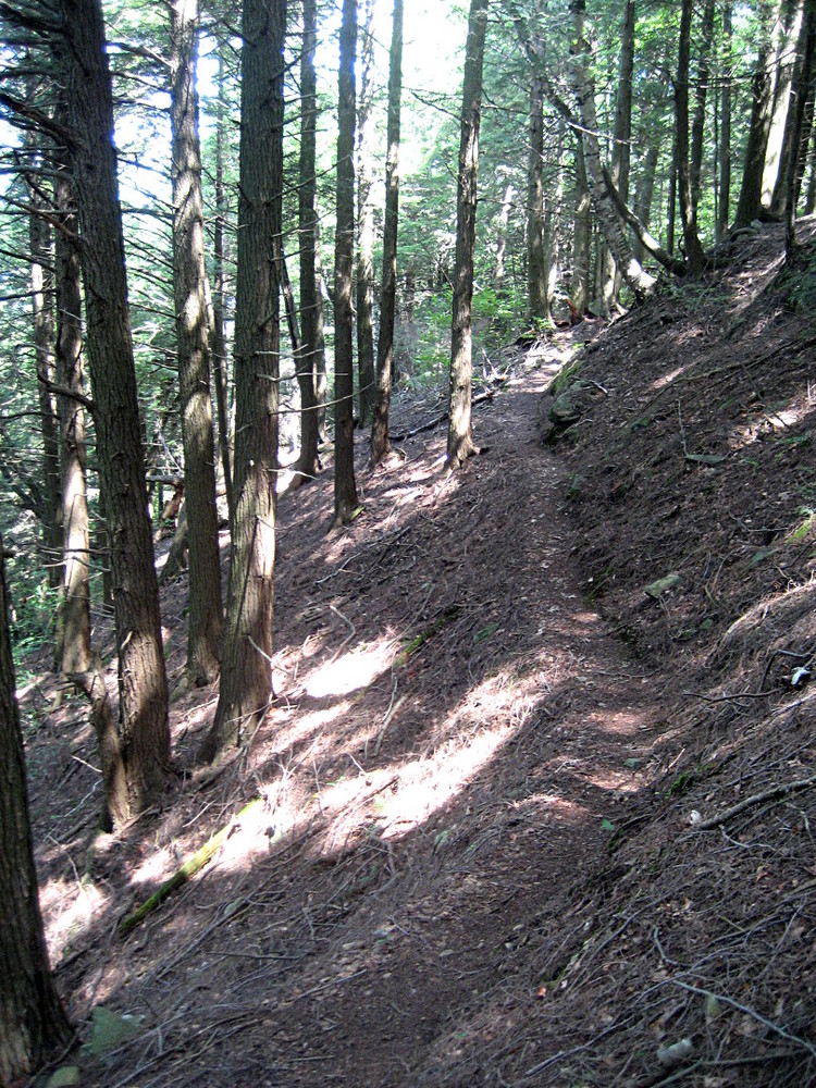
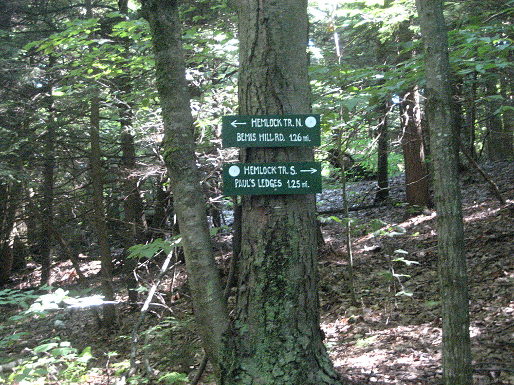
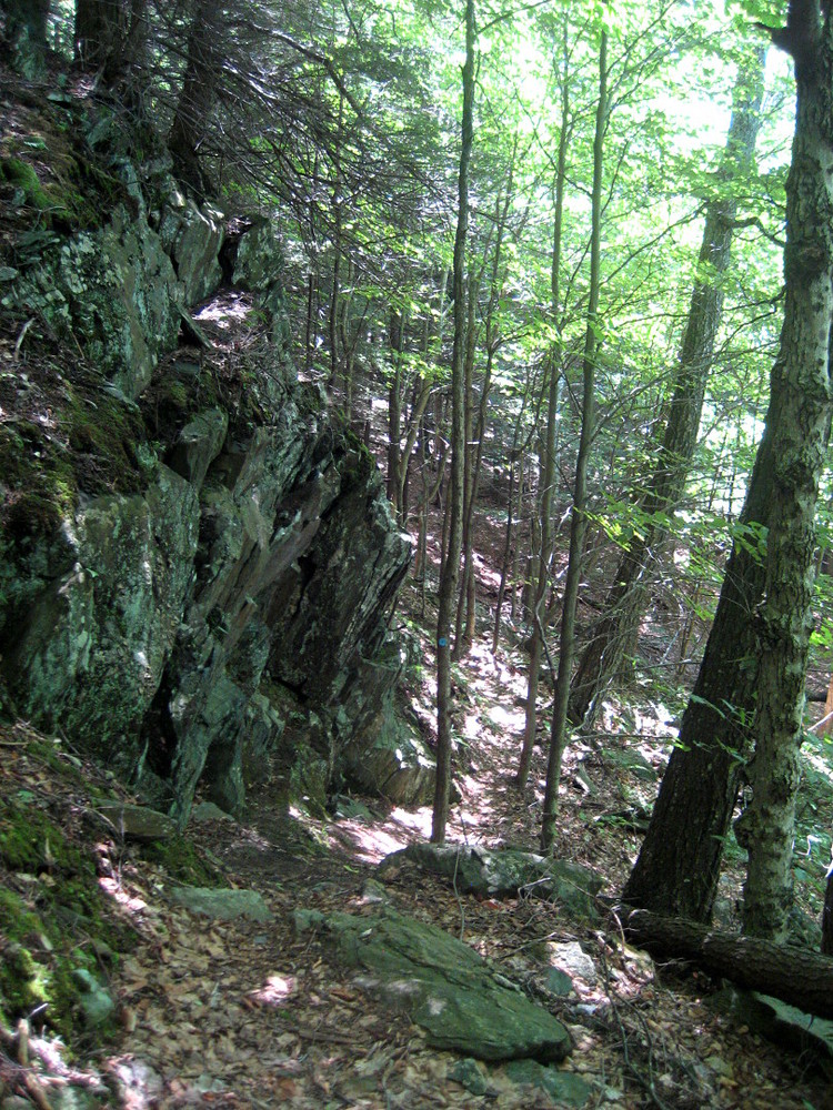
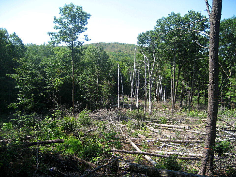
From the Athens Access Trailhead, the Athens Access Trail climbs steadily through a variety of forest types to its intersection with the Hemlock Trail. To the north, the Hemlock Trail leads to spur trails to a glacial erratic and a wildlife clearing (a 2-3 acre opening in the forest recently cleared to allow early successional plant species to thrive), and eventually through an active sugarbush to Bemis Hill Road in Westminster (parking is not available here). The scenic Hemlock Trail south is notched into the steep hillside in places, a narrow catwalk of sorts leading through beautiful hemlock forests, eventually arriving at Paul's Ledges. The Undercliff Trail, as its name implies, follows along the base of a series of rock outcrops, and provides an alternate route from the Hemlock Trail to Paul's Ledges. The trail is particularly stunning in the evening light.
Two-tenths of a mile south from the Athens Access Trailhead parking area on Valley Cemetery Road is Old County Road. Hikers parking at the trailhead can walk this road, which begins as a passable road before continuing uphill as a rough, impassable old town road where a driveway goes to the left. This old town road can be followed south to the Flame Trail, which provides access to the Undercliff Trail, to a crossing of the Hemlock Trail, or shortly beyond the Hemlock Trail to a gated side road on the left which leads to Paul's Ledges. Old County Road is best used as a return route after a hike to Paul's Ledges on the Athens Access and Hemlock Trails. You can reach Old County Road from Paul's Ledges via the Undercliff and Flame Trails, or by following the access road downhill to the gate. This is a loop hike of 3.4 miles.
From the Latham Trailhead, the Hemlock Trail north is the primary hiking route, arriving at Paul's Ledges in just over a mile. The Moosewood Trail is an alternate route bypassing a section of the Hemlock Trail that descends then climbs back up the hillside. The impassable extension of Old County Road could also be used, but may be muddy in this area.
For more information, including maps, visit the Windmill Hill Pinnacle Association's website: http://www.windmillhillpinnacle.org
![]()
Two trailhead parking areas provide access to the trail system around Paul's Ledges.
Athens Access Trailhead, 37 Valley Cemetery Road, Athens, VT
From Route 121 in Cambridgeport, follow Route 35 south 1.3 miles and bear left onto Brookline Road. Continue 1.75 miles and turn left onto Valley Cemetery Road. The trailhead parking area is 0.4 miles up this road on the left.
From Route 30 north of Newfane village at the sign for Brookline, turn onto Radway Hill Road (which becomes Grassy Brook Road at the West River bridge, soon turns left, eventually becomes unpaved, and becomes Brookline Road at the Athens town line) 9.1 miles to Valley Cemetery Road and turn right. The trailhead parking area is 1.1 miles down this road on right.
Latham Trailhead, 1966 Old Athens Road, Westminster, VT (trailhead is just over the line in Athens, but is only accessible by vehicle from Westminster)
From Route 121 in Saxtons River, follow Westminster West Road south for 5.8 miles to the center of Westminster West and bear right onto West Road at the church. Follow West Road 0.55 miles to Old Athens Road and turn right. In 1.3 miles, Old Athens Road turns sharply left and becomes rough (park here if the road is too rough). The trailhead is 0.7 miles farther on left.
From Route 5 in the center of Putney village, follow Kimball Hill/Westminster Road (which becomes Westminster West Road) for 6.9 miles to the center of Westminster West and turn sharply left at the church onto West Road. Follow West Road 0.55 miles to Old Athens Road and turn right. In 1.3 miles, Old Athens Road turns sharply left and becomes rough (park here if the road is too rough). The trailhead is 0.7 miles farther on left.
Success! A new password has been emailed to you.
