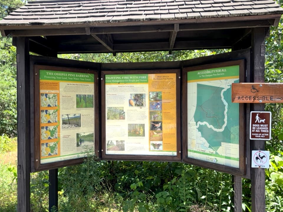
Click here for more information and a trail brochure.
ROUTE 41 - WEST BRANCH TRAILHEAD
Pine Barrens Trail - 0.7 miles (red blazes) - This trail, a Class VI Town Road, cuts across the West Branch Pine Barrens from the Route 41 kiosk to East Shore Drive near the south end of Silver Lake. Note: This is NOT a loop trail.
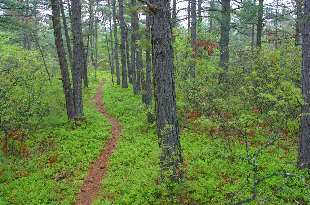
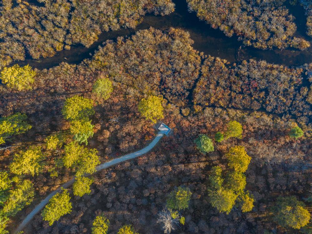
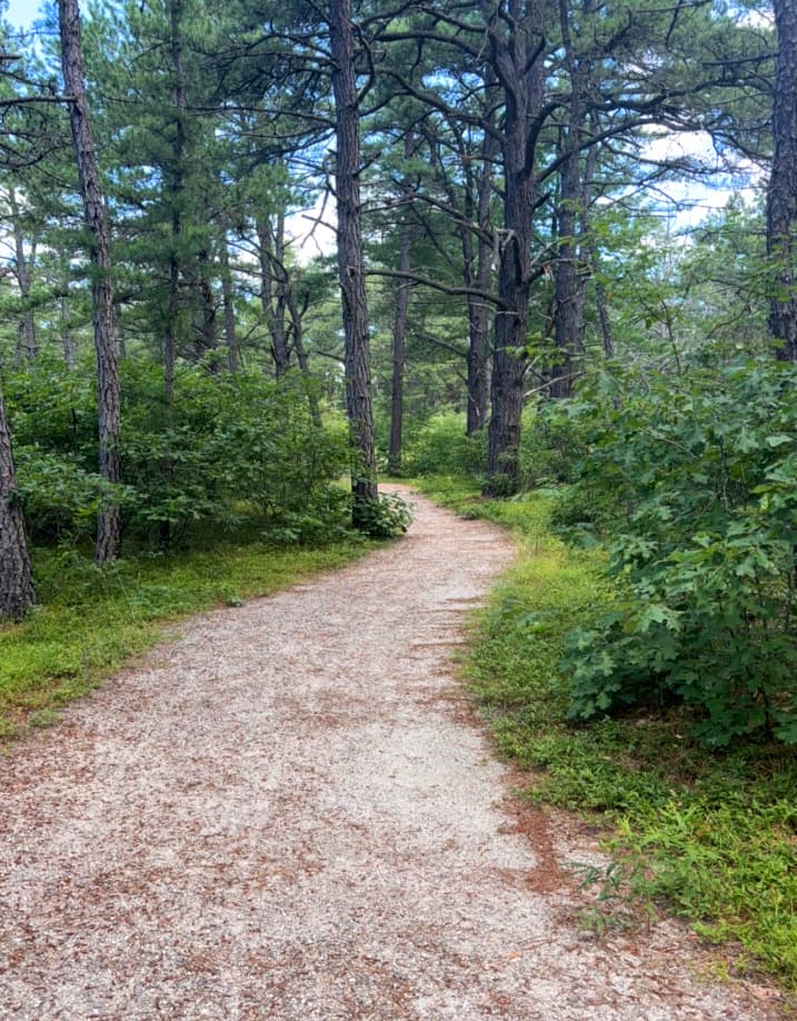
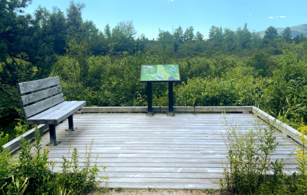
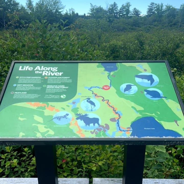
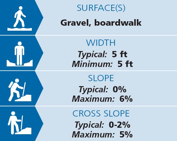
Accessible Trail - 0.8 miles (green/yellow blazes). This graded, five-foot wide trail is constructed from hard-packed sand and gravel, making for flat easy travel by the young, old and explorers of all abilities, including those pushing strollers or using wheelchairs. It offers an easy excursion through classic pitch pine-scrub oak barrens, and the opportunity to experience a variety of unique birds and other wildlife seldom encountered elsewhere in the state. The trail crosses under a power line just before reaching an observation platform overlooking the West Branch of the Ossipee River at the terminus of the trail, complete with a view of Mount Whittier and the Ossipee Mountains. See Trail Access Information below for more information about this Accessible Experience.
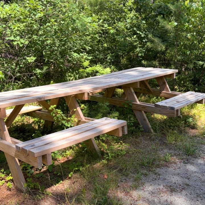
This trail can be accessed from the parking area on Route 41.
LEAD MINE ROAD - COOKS POND TRAILHEAD
Cooks Pond Forest Loop Trail - 2.4 miles (green and yellow blazes) - This loop meanders through oak forest, pitch pine-scrub oak woodland and eskers, providing views of Cooks Pond and its associated wetlands.
Cooks Pond Forest Loop Cut-Off - (red blazes) - This trail cuts about 0.5 mile off of the Cooks Pond Forest Loop.
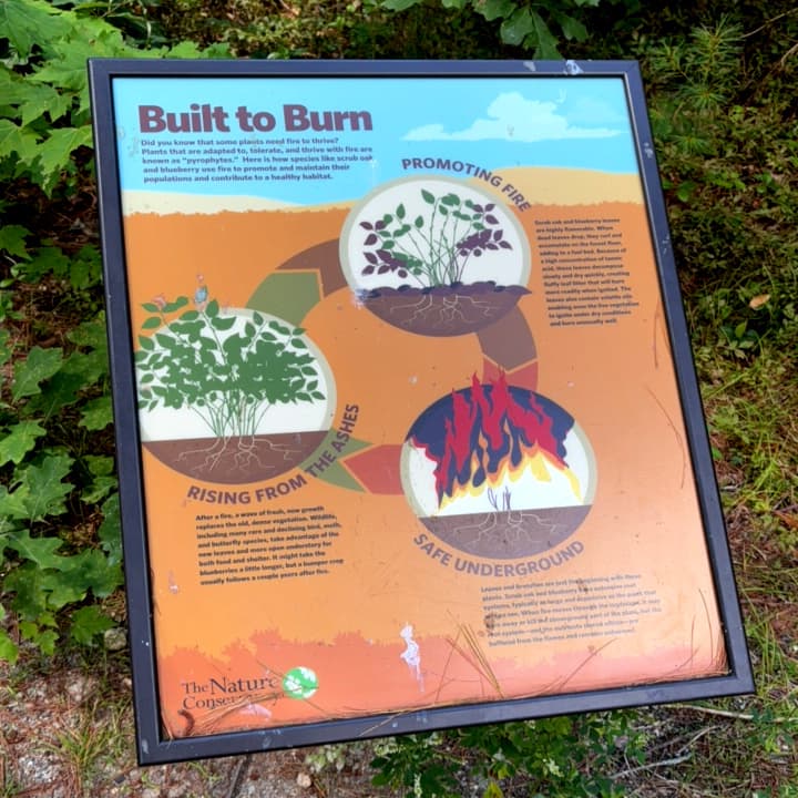
Madison Town Forest Loop Trail - 0.75 mile (red blazes) - This short walk traverses wetlands adjacent to areas recently (2014) treated with prescribed fire through a partnership between The Nature Conservancy and town of Madison. This trail also provides alternate access to the Jackman Ridge Summit Trail
OSSIPEE LAKE ROAD - JACKMAN RIDGE
Jackman Ridge Lookout Loop Trail - 2.3 miles (green and yellow blazes) - This moderately uphill trail leads to a viewpoint looking south of Ossipee Lake to the Ossipee Mountains and a sweeping view west of the Ossipee Pine Barrens Preserve.
Forest Ecology Loop Trail - 1.2 miles (red blazes) - This flat hike winds through pitch pine-scrub oak woodland recently (2013) treated with prescribed fire.
West Branch Trail - 3.2 miles (orange blazes) - A popular snowmobile trail, this path begins at Camp Calumet Conference Center. Following the West Branch of the Ossipee River, it traverses through pitch pine, white pine and hardwood forests.The trail ends at East Shore Drive across from the boat access at the south end of Silver Lake. Note: This is NOT a loop trail.
(Applies to 0.8-mile Accessible Trail)
Trail conditions can change without warning. Trail last assessed: 7/23/2025
A trail guide with more information is also available from the NH Natural Heritage Bureau.
The Nature Conservancy asks that you abide by the following rules while on the preserve:
The Nature Conservancy is a global non-profit conservation organization. Our mission is to conserve the lands and waters on which all life depends.
The Nature Conservancy in New Hampshire has been safeguarding our state's most precious natural resources since 1961, conserving 290,000 acres of forests and files and 680 miles of river and estuary shoreline. Our preserves are open for hiking, fishing, skiing, hunting, and wildlife viewing. Learn more at: www.nature.org/newhampshire.
![]()
From the intersection of NH 16 and NH 41 in West Ossipee:
Success! A new password has been emailed to you.