Mud season is here!Protect the trails we all love by sticking to open, dry areas. Learn more! 

Magalloway Mountain

This remote hike consists of short climb to a fire tower offers staggering views of the Great North Woods and into Canada.
Trail Activity
Hiking Snowshoeing
Length
1.70 miles, Round Trip
Difficulty
Advanced
Town
Pittsburg (NH)
Surface
Packed Earth/Dirt
Pets
Permitted on leash
Fees
No

Description

There are two trails up Magalloway Mountain that meet up with each other 0.2 miles before the summit.

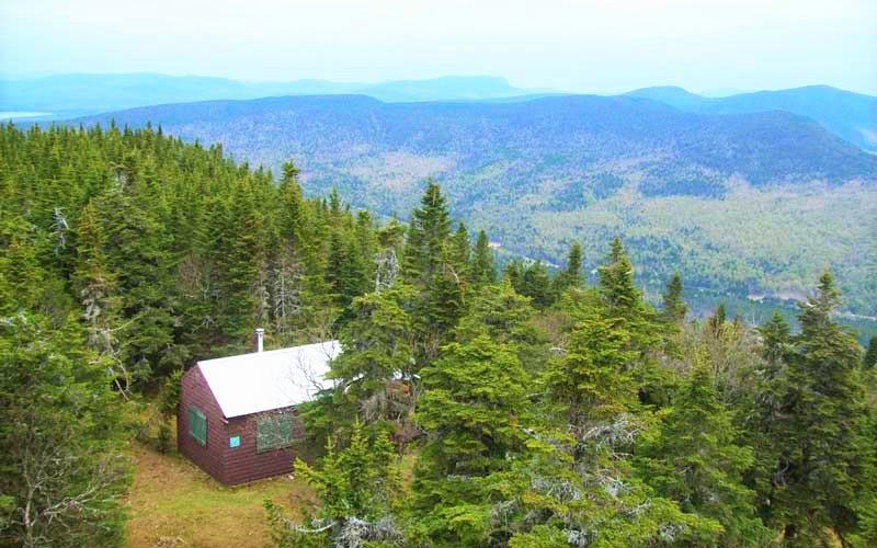
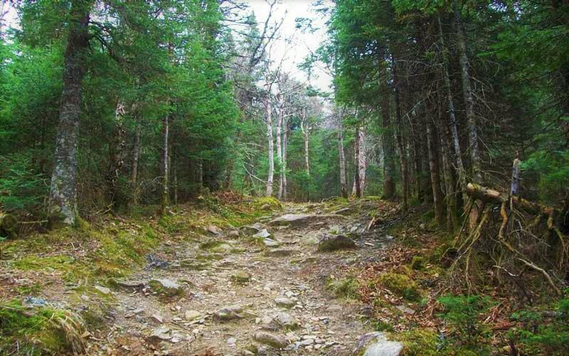
The Coot Trail, 0.8 miles in length, follows an old fire warden’s Jeep road to the summit. The trail begins ascending at a moderate grade, soon passing a cabin. It then becomes steep and rocky, with some rough, eroded sections, and climbs quickly for the next 0.5 miles. From the junction with the Bobcat Trail, the Coot Trail flattens out and gradually climbs for 0.2 miles on a grassy path to a clearing with a cabin and fire tower.

Climbing the tower provides far ranging views of the Great North Woods, from the First and Second Connecticut Lakes below, to distant peaks into Canada to the north, and the White Mountains in the distance to the south. Hikers are permitted to climb the fire tower, but there is not access to go inside the tower's cabin at the top.

The Lookout Trail leads 0.2 miles from the fire tower to an overlook of an avalanche slide that scars the north face of the mountain.

The Bobcat Trail provides the opportunity to hike in a loop. It generally has better footing than the Coot Trail, and at 0.6 miles from the trailhead features a good view of nearby lakes.

Trail Manager

For more information, visit the Connecticut Lakes Working Forest website or contact: 

New Hampshire Division of Forests & Lands

New Hampshire Division of Forests & Lands
172 Pembroke Road
Concord, NH 03301
Phone: (603) 271-2214
View website

New Hampshire State Parks

New Hampshire State Parks
172 Pembroke Road
Concord, NH 03301
Phone: (603) 271-3556
nhparks@dncr.nh.gov
View website

Trail Tips

Be Considerate of Other Visitors
Be aware of and limit the noise you and your group generate. Enjoy the sounds of nature.
Legend
Hide All

Trailhead Information

From the intersection of US-3 and NH-145 in Pittsburg, head north on US-3. Drive 11.6 miles and turn right onto Magalloway Road. There is no road sign, but there is a sign for the fire tower. Drive 5.3 miles and take a right onto Tower Road. Go 3.0 miles to the end of this road, where there is a small parking area at the trailhead. These are very rough and rutted roads, proceed cautiously if driving a vehicle with low clearance.

Click on a parking icon to get custom directions
Please Log In or Create Account to add comments.
These awesome businesses support our goal of connecting people to outdoor adventures!
Hang Tight!
Nearby services are loading
No Results
No Services Found
SHARE THIS TRAIL

Add Trail Log

Please wait…
Join In on the Fun!
Log in or create an account below to unlock all the great features of Trail Finder: keep track of trails you want to do, preserve memories of trails you’ve done, earn badges, and more!
Your log in attempt was not successful. Please try again.
    Lost your password? Reset your password
    Don't yet have an account?
    There was an issue with your submission. Please try again.
      * Indicates required field
      Already have an account? Login here
      Enter your username, and we will send you a new, randomly generated password to your email account.
      There was an issue with your submission. Please try again.

        Success! A new password has been emailed to you.

        Log in now

        Please wait…