The Esther Currier Wildlife Management Area at Low Plain is preserved for your enjoyment as a result of community cooperation, including the Ausbon Sergent Land Preservation Trust, the Elkins Fish & Game Club, the New London Conservation Commission, and the NH Fish & Game Department. A self guided trail map with notes is available here and at the NH-11 entrance. Winter travel by snowshoes or cross country skis is popular.
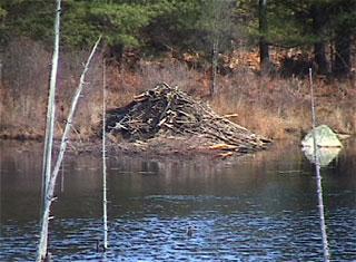
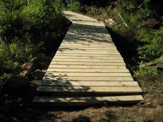
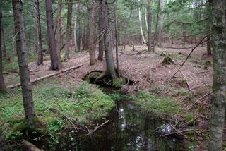
The main trail is named the Davis Path. It is a gated gravel road that runs between Route 11 and Mountain Road. Side trails go to an overlook and to observation blinds along the edge of an active Beaver Pond. A quaking bog may be viewed from a boardwalk on the trail to the Marsh Point blind (which may not passable at high water). A high water bridge, built by Elkins Fish and Game Club, takes visitors over the waters that flood a portion of Davis Path during Spring thaw. A geological exhibit (boulder collection) and a salamander pool are visible from the Davis Path. The Davis Path is 1.13 miles in length (one way). The Conservation Commission has also developed a Forestry Management Cover Map and Forestry Plan for the Low Plain area.
More information is available on the New London Conservation Commission website. For inquiries about this trail, please contact:
NH-11 Parking - From downtown New London, head southeast on NH-114. Turn left on Seamans Road. At the four-way intersection, turn left on NH-11. Parking is available on the right across from the Elkins Cemetery after 0.8 miles.
Mountain Road Parking - From downtown New London, head southeast on NH-114. Turn left on Seamans Road. At the four-way intersection, turn left on NH-11. After 0.3 miles, turn right onto Shaker Street. Continue for one mile then turn left onto Mountain Road. Parking is available on the left after 0.4 miles.
Success! A new password has been emailed to you.