Mud season is here!Protect the trails we all love by sticking to open, dry areas. Learn more! 

Lamoille River Walk

Enjoy a bounty of nature and experience a walking trail through beautiful evergreens, ferns, and wildflowers along the Lamoille River.
Trail Activity
Walking
Length
1.30 miles, One Way
Difficulty
Easy, Moderate
Town
Milton (VT)
Surface
Packed Earth/Dirt
Pets
Unknown
Fees
No

Description

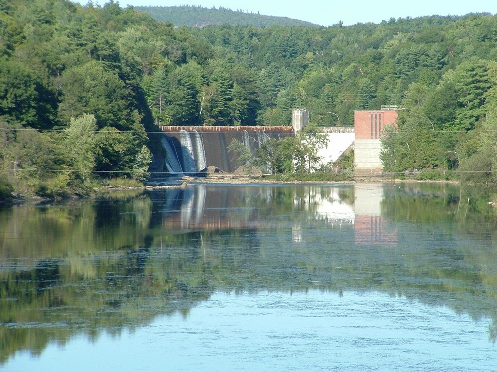
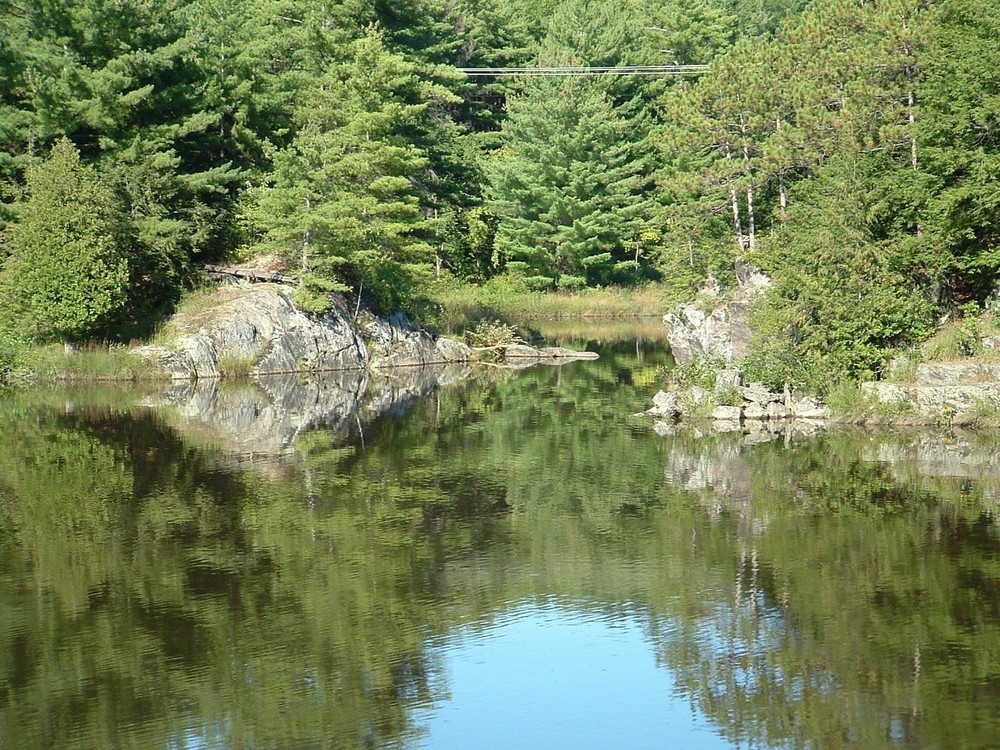
This trail is a lovely walk along the Lamoille River and offers a wonderful variety of plants, flowers, and wildlife. The lower Lamoille River is the last stretch of an 85-mile waterway that flows west into Lake Champlain. At the east end of the trail you can see the first dam that was built on the lower Lamoille. The beginning of the trail also offers a unique foot bridge. This area is also popular for fishing.

Roughly half of this trail is on property that was retained by the Town of Milton through open space set aside from Checkerberry developments. The other half is on Green Mountain Power (GMP) land provided through a license agreement.

Trail Manager

Visit Town of Milton online for more information or contact:

Milton Conservation Commission

Milton Conservation Commission
43 Bombardier Road
Milton, VT 05468
Phone: (802) 893-1186
View website

Milton Recreation Department

Milton Recreation Department
43 Bombardier Road
Milton, VT 05468
Phone: (802) 893-4922
Recreation@miltonvt.gov
View website

Trail Tips

Travel on Durable Surfaces
If you have to step off the trail, step onto a rock or soil. Avoid stepping on fragile vegetation.
Legend
Hide All

Trailhead Information

Green Mountain Power, Co. (GMP) Trailhead: From Route 7 head west on Ritchie Avenue all the way to the GMP gate (sometimes closed). Beyond the gate go down the switchback road, past the brick building and old foundation. The trailhead is along the tree line, south of the old foundation. Parking is at GMP's Route 7 Park.

Checkerberry Trailhead: From Route 7 head north on Nancy Drive. At the end of Nancy Drive, take a left onto Checkerberry Square and follow to the end. Park at the very end of the road and walk north toward the trailhead.

Click on a parking icon to get custom directions
Please Log In or Create Account to add comments.
jordanvt
June 04, 2023
Awkward geometry and layout. Trail head near river is quite a distance away from parking and requires about 1/4 mile along side of road to get there. Other side of trail has easy parking, but not much of it, just the end of a street. This trail is largely unmaintained and poorly laid out. Crosses VAST trails, signs are not clear as to the path to take, grades are difficult with slippery surface. Serious erosion and mud on walking surface. After hiking about 1/3 of the trail and being unsure which path to take, we abandoned the hike and back tracked to the car. Our experience was that this was more of a primitive forest hike than a pleasant river walk. Can't recommend.
These awesome businesses support our goal of connecting people to outdoor adventures!
Hang Tight!
Nearby services are loading
No Results
No Services Found
SHARE THIS TRAIL

Add Trail Log

Please wait…
Join In on the Fun!
Log in or create an account below to unlock all the great features of Trail Finder: keep track of trails you want to do, preserve memories of trails you’ve done, earn badges, and more!
Your log in attempt was not successful. Please try again.
    Lost your password? Reset your password
    Don't yet have an account?
    There was an issue with your submission. Please try again.
      * Indicates required field
      Already have an account? Login here
      Enter your username, and we will send you a new, randomly generated password to your email account.
      There was an issue with your submission. Please try again.

        Success! A new password has been emailed to you.

        Log in now

        Please wait…