Mud season is here!Protect the trails we all love by sticking to open, dry areas. Learn more! 

Hurricane Forest Wildlife Refuge Trails

This refuge is 142 acres of protected forest, wildlife sanctuary, and a lovely section of stream donated to the town of Hartford in 1973 by Winsor and Bertha Brown.
Trail Activity
Hiking
Length
3.00 miles, Network
Difficulty
Moderate
Town
Hartford (VT)
Surface
Packed Earth/Dirt
Pets
Permitted on leash
Fees
No

Description

Trails have been built by volunteers, including the Boy Scouts and the Vermont Youth Conservation Corps, and are maintained by a dedicated volunteer group. Although this park takes its name from a hurricane that struck the area in the late 1700s, there is ample evidence of the effects of a more recent occurrence: the hurricane of September 21, 1938 toppled many old-growth white pine trees whose giant trunks remain today. There are other areas with enormous ancient trees still standing, including white pine and red oak. 

Trail Manager

Visit Hartford Parks and Recreation Department online for more information or contact:

Hartford Parks & Recreation Department

Hartford Parks & Recreation Department
171 Bridge Street
White River Junction, VT 05001
Phone: (802) 295-5036
recreation@hartford-vt.org
View website

Trail Tips

Plan Ahead and Prepare
Be prepared for emergencies. Pack extra clothing, food, and water and also a flashlight, first aid and repair kit, matches/fire starters, whistle, signaling mirror, and pocket knife.
Legend
Hide All

Trailhead Information

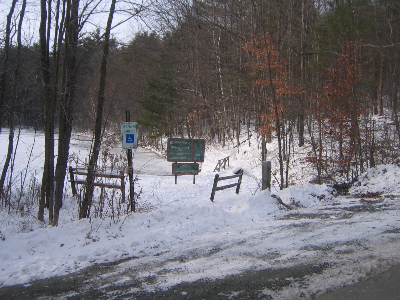
Take Route 5 South from White River Junction past the VA hospital. Take an immediate right after the I-89 overpass onto Wright Reservoir Road; parking is at the pullover just a few feet before the refuge entrance on Wright Reservoir Road.

Click on a parking icon to get custom directions
Please Log In or Create Account to add comments.
caecias
September 04, 2022
Very nice network of trails. Several QR codes posted about various nature information from a local 8th grade. Well maintained. Lots of chipmunks and squirrels.

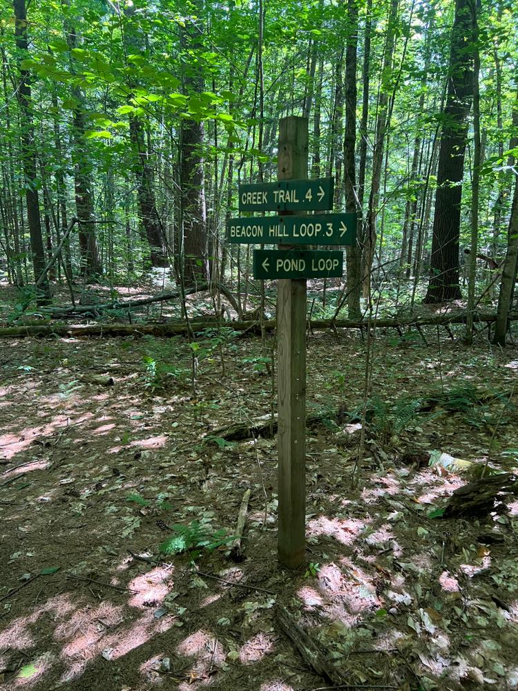
I hiked around the outside, Pond Loop to Creek Trail to Beacon Hill, to Monument, and back to Pond Loop. Probably about two miles. The VAST trail intersection was a little confusing. The big black arrows on a yellow diamond signs are the VAST trail, so don't follow them. Most other intersections were well marked, except the T intersection at the northmost part of Beacon Loop. Why that one is the only one without a marker, I'm not sure. Pond Loop is fairly easy, but short. Beacon Hill is definitely moderate.
kpjenkins
May 02, 2021
Pretty network of trails, well groomed and well preserved forest. Probably should be designated easy rather than moderate.
These awesome businesses support our goal of connecting people to outdoor adventures!
Hang Tight!
Nearby services are loading
No Results
No Services Found
SHARE THIS TRAIL

Add Trail Log

Please wait…
Join In on the Fun!
Log in or create an account below to unlock all the great features of Trail Finder: keep track of trails you want to do, preserve memories of trails you’ve done, earn badges, and more!
Your log in attempt was not successful. Please try again.
    Lost your password? Reset your password
    Don't yet have an account?
    There was an issue with your submission. Please try again.
      * Indicates required field
      Already have an account? Login here
      Enter your username, and we will send you a new, randomly generated password to your email account.
      There was an issue with your submission. Please try again.

        Success! A new password has been emailed to you.

        Log in now

        Please wait…