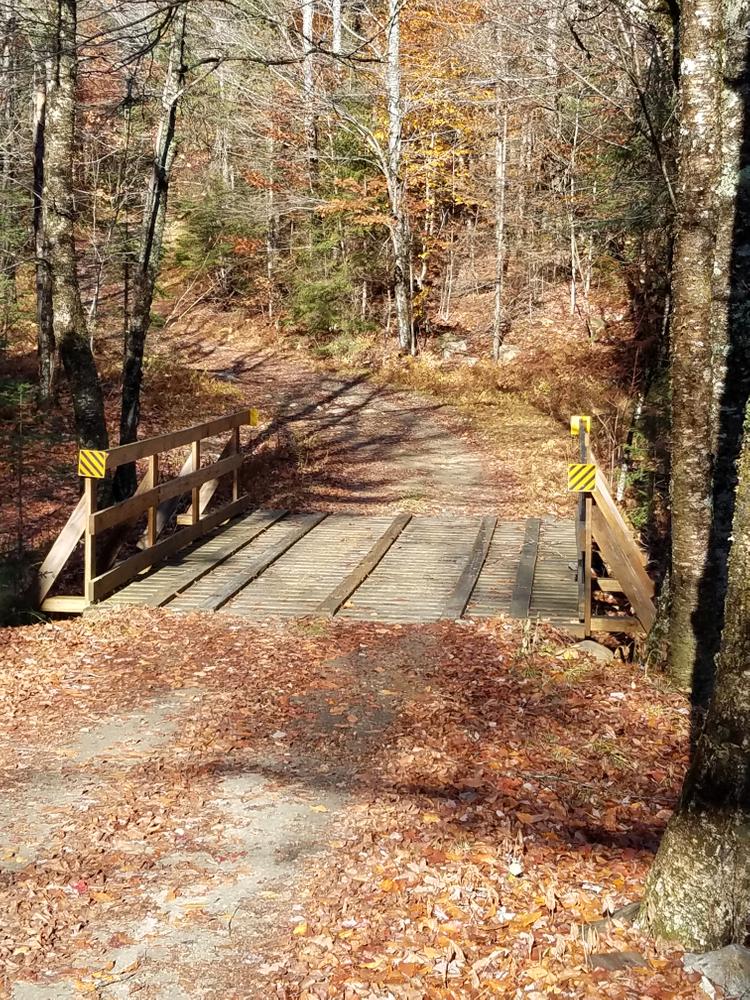
Grantham Mountain Road: From the parking area, hike 300 yards up the hill on the wide historic Grantham Mountain Road (also called the Meriden Road) past the Blue Mountain Snow Duster's cabin on your right to the "Four Corners" intersection with the Croydon Turnpike. There are numerous old cellar holes at Four Corners. Farther up Grantham Mountain Road, there is an old cemetery on the left. The road, used by snowmobilers in the winter, continues along the northern fence of Corbin Park, a private game reserve, before passing to the south of Lily Pond. It climbs over the Grantham Ridge and ends at Bean Road in the town of Meriden.
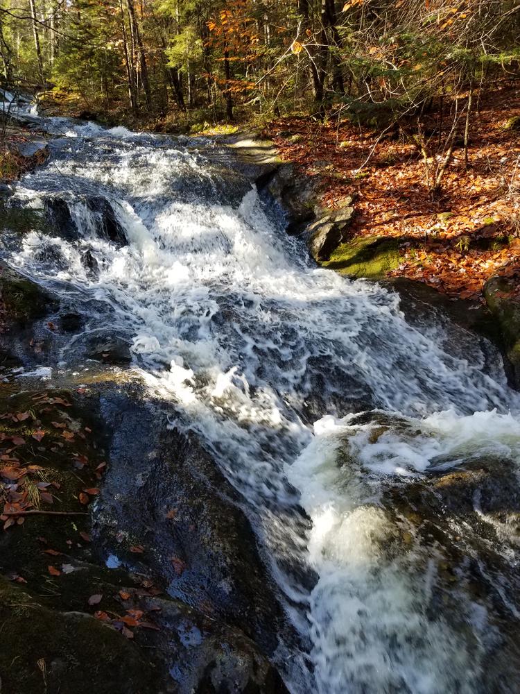
Croydon Turnpike: The Croydon Turnpike is a wide, level, abandoned dirt roadway maintained by the Blue Mountain Snow Dusters for snowmobiling. The Class VI portion of Croydon Turnpike runs 8.6 miles from Loverin Hill Road in Croydon through the Grantham Town Forest and ends at Goodwin Road in Plainfield. South of Four Corners, the Turnpike follows the boundary fence of the private game reserve of Corbin Park. To the south, the Turnpike passes the driveable Walker Road and crosses Sawyer Brook where there are ruins of an old Mill just downstream. Farther on, it intersects with the abandoned Forehand, Nelson and Harthorn Roads. North from Four Corners, the Turnpike passes another old mill site, a beaver dam at the base of Chase Pond, numerous side trails, and connects with Goodwin Road in Plainfield.
Brook Loop: Just before reaching the BMSD cabin and Four Corners from the parking area, a narrow trail, blazed in orange, branches off to the right before connecting with the Croydon Turnpike. It offers the opportunity for an easy loop. It first drops down the hill and then ascends along a lovely section of Lily Brook before rejoining the Turnpike. The trail is too narrow for skiing.
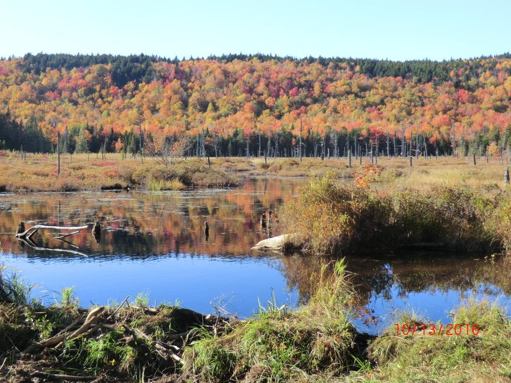
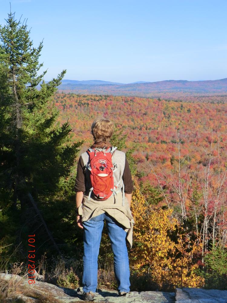
Little Mount Washington: 0.8 miles north on the Turnpike, the beaver dam that forms Chase Pond is on the left. After another half mile along the eastern edge of Chase Pond (the trail is often muddy), there is a gate and the Leavitt Pond trail branches off to the right. Shortly up Leavitt Pond trail, an unmarked trail cuts off to the right (skiing and snowmobiling end at this point) and climbs steeply up the hill to rejoin the Leavitt Pond trail, then again cuts off to the right and climbs to the ledge of Little Mount Washington. Explore the various ledge out-crops to your right to enjoy the spectacular 180 degree view to the east.
The Croydon Turnpike and the Leavitt Pond trail continue past the described trails onto private land. The public is welcome to use the trails. Please respect the private landowners and act responsibly if you choose to use these trails.
Please note, the trails are closed to wheeled-vehicles during the muddy seasons.
For more information visit the Grantham Conservation Commission's website or contact:
From Exit 13 off of I-89, head north on Old New Hampshire 10 for 2.6 miles. Turn left on Miller Pond Road and proceed 2.4 miles to the end of Miller Pond Road (the last portion of the road is private but open to the public). At the end, the road forks with the right fork leading to a private home. Go left 50 yards to the large gravel parking area on the left. From there continue on foot through the gate and up the hill to the intersection of Mountain/Miller Pond Road and the Croydon Turnpike.
Success! A new password has been emailed to you.