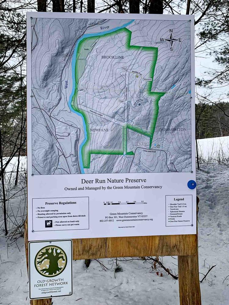
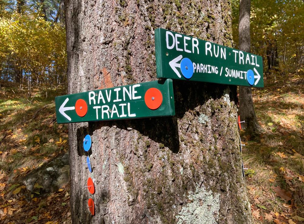
Currently, there are five trails open on the Deer Run Nature Preserve. Plans are to open one per year for the next few years. The total distance for all the out and back trails is 8.0 miles.
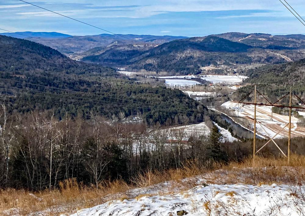
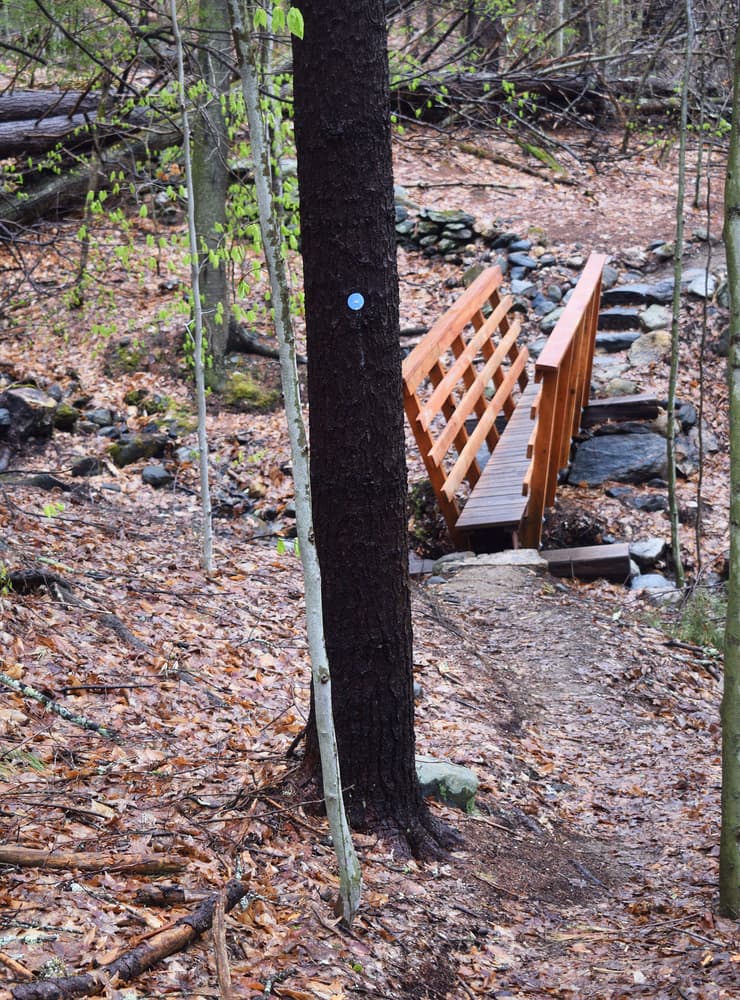
The Deer Run Trail (blue markers) is 2 miles from the parking lot to the summit and has an elevation gain of 930 feet. The total round trip is 4 miles. The trail crosses a power line in 2 places. Just before the second power line crossing is the first spectacular vista. The trail is considered moderate, with a short, flat section at the beginning then gradually increasing in elevation with some steeper sections, providing something for everyone.
The Shoulder Trail (yellow markers) begins approximately 1.8 miles from the parking area. It is a 0.4-mile spur off the Deer Run Trail. This trail climbs 150 feet through beautiful forest lands to a vista from the power line, offering expansive views of the the West River Valley.
The North Trail (blue markers) begins at the end of the Shoulder Trail, 2.2 miles from the parking area. The North Trail is 1.3 miles. The elevation descends 850 feet from the Shoulder Trail as it winds through an oak-hop hornbeam savanna, hemlock woods and a boulder field, emerging onto a flood plain, then culminating at the West River. Total round trip distance from the parking lot to the end of the North Trail is 7 miles. A tractor lane through the fields along the West River connects the North Trail with the Ravine Trail.
The Ravine Trail (orange markers) begins about 1 mile from the parking area, off of the Deer Run Trail. The ascent to the Ravine Trail from the parking area is 530 feet. The trail continues downhill another 1.1 miles, for a round trip moderate hike of 4.2 miles from the parking lot. The trail culminates at the West River. The elevation gain on the Ravine Trail is 730 feet, with the uphill portion of occurring on the way back to the trailhead from the river. A tractor lane through the fields along the West River connects the Ravine Trail with the North Trail.
The Shagbark Trail (white markers) begins about 0.9 miles from the parking area, off of the Deer Run Trail. The trail descends 0.85 miles to a beautiful cove forest filled with shagback hickories. The trail dead-ends here, but plans are to extend the trail in the future. Total round trip distance from the parking lot to the end of the Shagbark Trail is 3.5 miles.
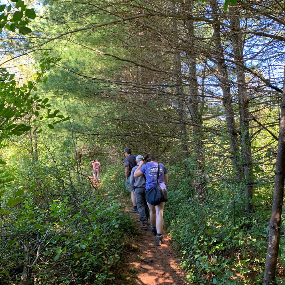
This land is one of the last remaining unfragmented large parcels in the region. It is remarkable for its tall hardwoods, hemlock-filled ravines, stunning views, stone walls and a curious rock structure known as “the monument.” It includes deer wintering yards and a variety of forest types including hardwood savannas and hemlock “cathedrals.” There are several wetlands and vernal pools that host a variety of amphibians including the rare Jefferson Salamander.
The significant features of this land include panoramic views from the highest elevations, topographic benches left behind by a series of glaciations and by more recent flooding events, cliffs created by uplift and continental collisions eons ago, a dramatic and active landslide area, numerous rich forest sites including a cove with incredibly tall trees including shagbark hickories, There are forests of all ages, large maple, oak, ash, hickory, hemlock, and white pine trees, and grasslands that provide nesting sites for numerous bird species and corridors for wildlife and species movement, adaptability, and resiliency. It is truly spectacular.
Two transmission lines cross the preserve, which ecologists and botanists recognize as valuable early-successional/shrub-scrub habitat that these rights-of-way provide.
The site is a haven for over 70 species of birds (view bird list here) including birds that are listed “in greatest need of conservation” in the Vermont Conservation Design. Birds that have been declining in Vermont — brown thrasher, wood thrush, field sparrow, prairie warbler, mourning warbler, woodcock, the red-shouldered hawk, and the bald eagle — have been among those found in numbers, rewarding bird enthusiasts with a variety of interesting sightings.
![]()
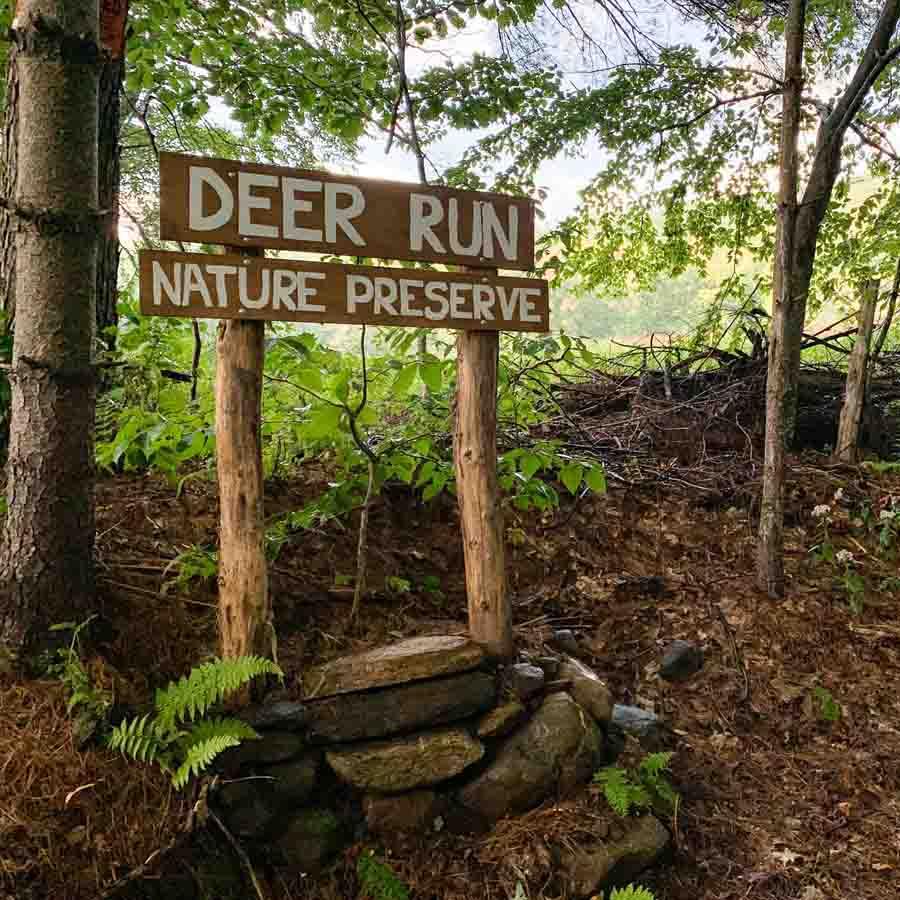
The Deer Run Nature Preserve is located at 940 Camp Arden Road, Dummerston, VT 05301.
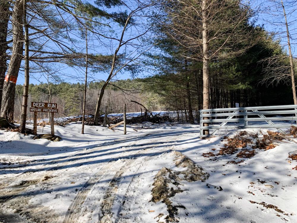
From VT-30 near West Dummerston, cross the Dummerston Covered Bridge and immediately turn left onto Camp Arden Road. From Dummerston Center, take the East-West Road and continue straight onto Camp Arden Road at the stop sign instead of crossing the bridge. About 1/2 mile from the Covered Bridge, bear left at the fork in the road and follow the river. Continue for another mile. The trailhead is on the right and clearly marked at a parking area.
Success! A new password has been emailed to you.