The network includes 1.4 miles of double track trails, which are open to horses and motorized vehicles except when muddy, and 7 miles of single track trails, on which horses and motorized vehicles are not allowed.
The terrain is undulating and mostly forested with exposed rock ledges, vernal pools, seasonal streams, and wetlands and about a half mile of high voltage power line, which roughly bisects the property. Wildlife browse, den trees, and snags abound.
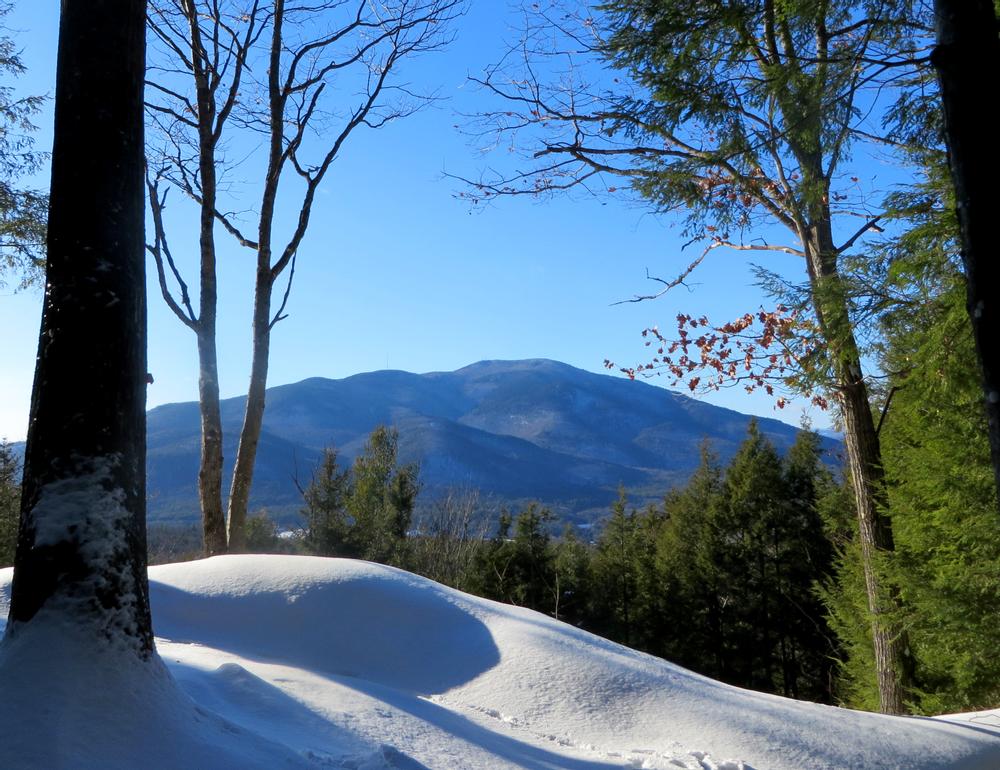
A rocky overlook atop Wellman's Hill (elevation 1,110 feet), at the northeastern corner of the property and 1.4 miles from theTandy Brook Road parking lot via the red trail, offers an excellent view of Mt. Ascutney.
The Town Forest comprises just one piece of approximately 1,800 acres of undeveloped woodland. The trails in the Town Forest connect to trail networks on abutting properties.
Please note that hunting is permitted by licensed hunters during established hunting seasons.
These trails link to the neighboring Lipfert Forest trails, which have a trailhead and parking area on NH-12A in Cornish.
For more information please visit the Town of Cornish website or the Cornish Town Forest Facebook page, or contact:
Cornish Town Forest CommitteeTANDY BROOK ROAD TRAILHEAD
From North: From the Cornish-Windsor Covered Bridge, proceed south on NH Rt 12A for 0.1 miles. At the 12% Solution Store, bear to the left and continue on Town House Road for 1.6 miles. Turn right on Chase Hill Rd (which changes to Tandy Brook Rd after 0.2 miles) and proceed 1.9 miles to small parking area and trailhead on side of the road (right side).
From South: From the intersection of NH Rt 12/103 and NH Rt 12A in West Claremont, proceed east on NH Rt 12/103 for 2.2 miles, then turn left on Bowker St. After 0.4 miles, Bowker St becomes Red Water Brook Rd. Continue 1.8 miles and stay straight to go onto Old Coach Rd. After 0.1 miles, turn left onto Ironwood Hill Rd. Continue 0.5 miles and turn slightly to the right onto Hewitt Rd. Continue 0.6 miles as Hewitt Rd becomes Tandy Brook Rd. The trailhead and parking area is on the left.
ROOT HILL ROAD TRAILHEAD
From North: From the Cornish-Windsor Covered Bridge, proceed south on NH-12A, bearing right at the intersection with Town House Road, for 3.9 miles. Turn left on Windy Hill Road and cross railroad tracks, proceeding 1.1 miles. Turn left on Paddy Hollow Road and proceed 0.5 miles to swinging gate. Park near gate during major snow events and mud season (do not block or use any residential driveways). At other times, proceed through gate and continue 0.4 miles (road becomes Root Hill Rd) to Town Forest parking area on right.
From South: Proceed to the intersection of NH-12A and NH-12/103 in West Claremont. Proceed north on NH-12A (Windsor Rd) for 1.2 miles. Turn right on Windy Hill Road and cross railroad tracks, proceeding 1.1 miles. Turn left on Paddy Hollow Road and proceed 0.5 miles to swinging gate. Park near gate during major snow events and mud season (do not block or use any residential driveways). At other times, proceed through gate and continue 0.4 miles (road becomes Root Hill Rd) to Town Forest parking area on right.
This trailhead also provides direct access to the Lipfert Forest trails.
Success! A new password has been emailed to you.