This description explains the sections if you walk them continuously beginning at the southeast trail head at Basin Street and traveling clockwise.
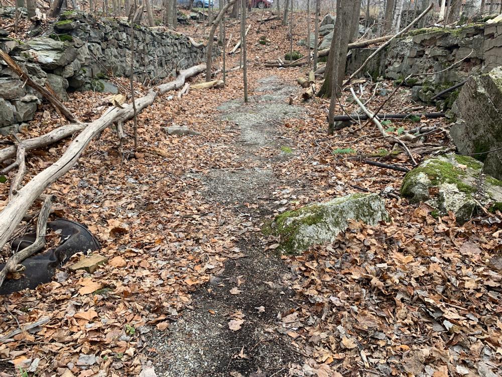
Park in the village and walk east on Main Street (also called Rt 116/Rt 17/East Street). Turn right on Basin Street and walk to the bottom of the hill, then turn right and walk past the gate to follow the tree line into the woods. You’ll see a yellow BTN sign marking the trail, which turns immediately uphill once in the trees. This short segment emerges at the bottom of South Street. Turn left and walk on the shoulder of the road toward the bridge, then turn right and carefully cross South Street to enter the Coffin Factory Loop where you can find the foundation stones of the old coffin factory and an interesting informational sign.
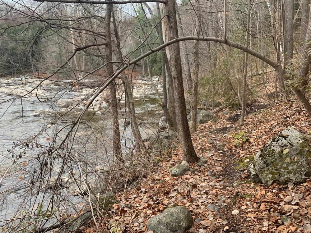
You can then continue to hike along the New Haven River for about half a mile on the River Bend Trail section of the network. As you hike, you'll pass through several distinct forest types along with evidence of historical efforts to prevent bank erosion. Basin Street, Coffin Factory, and River Bend all have excellent access the river for fishing.
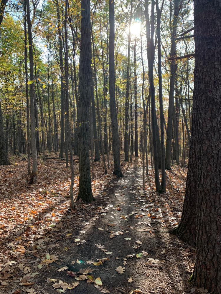
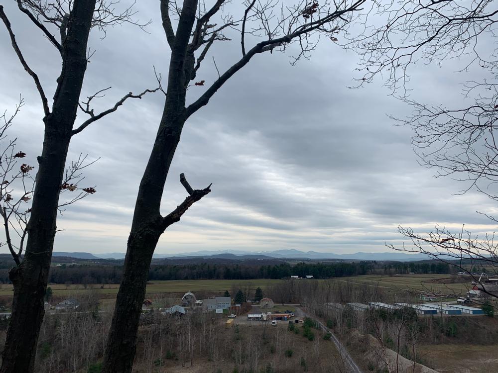
After about 0.6 miles, The River Bend Trail climbs steeply up to the level of downtown Bristol where it intersects with the Business Park Loop section of the network. Short and flat, the Business Park Loop has stunning views to the south and east.
Emerging from the Business Park Loop, follow Fire House Drive past the fire station to Main Street (also called West Street/Rt 116/Rt 17). Carefully cross to the sidewalk and turn left toward Airport Drive. At Airport Drive turn right and walk along the shoulder until you come to the American Legion driveway, then turn left and cross Airport Drive. Once on the grass, turn left and walk to the tree line at the south corner of the High School property where you’ll see the BTN sign as you enter the trees to begin the High School Trail, with magnificent westerly views of the Champlain Valley and the Adirondacks. The High School Trail offers the option to loop back towards school grounds or continue on along the Old Dump Trail.
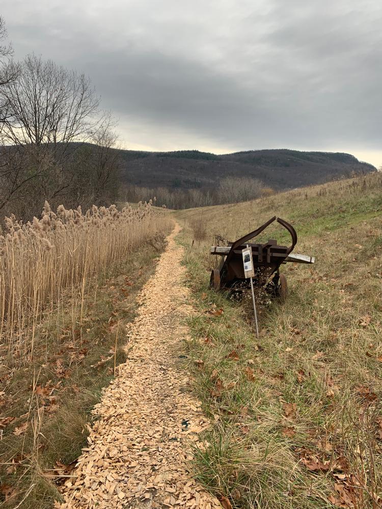
While a bit unusual, the Old Dump Trail provides opportunities to view flora and fauna that prefer the more open landscape as well as salvaged historical equipment with handy informational signs. This is currently the final section of the Bristol Trail Network, and terminates at Pine Street at the northwest corner of the village. It is an easy walk from there through town along Main Street (featuring pleasant shops and restaurants in case you've worked up an appetite) back to your starting point.
Certain sections of this trail pass through land that has been used for a multitude of purposes over the years. As such, this trail provides a window into the history of the interaction between nature and the people of Bristol. On the River Bend trail, which has several elevation changes on loose and gravelly soils, it is highly recommended to wear well-soled shoes.
For more information, contact:
This trail is designed to have multiple points of access from the Village of Bristol, VT. It is easy to hike the whole 3.6 miles or just hike one or two small sections.
You can park on Main Street or along the Town Green and easily walk to any of the trail segments. There is also parking at trail heads on South Street and behind the Fire Station as well as at the High School and the Recreation Park.
Success! A new password has been emailed to you.