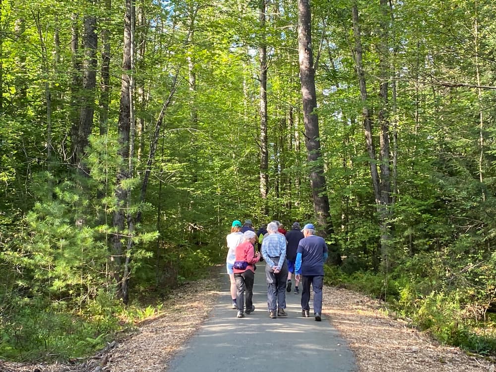
Originally inspired by the carriage roads of Acadia National Park, the trails at Brewster Uplands are generally broad with a spacious trail corridor, making them attractive for hiking, mountain biking, horseback riding, and cross-country skiing in the winter.
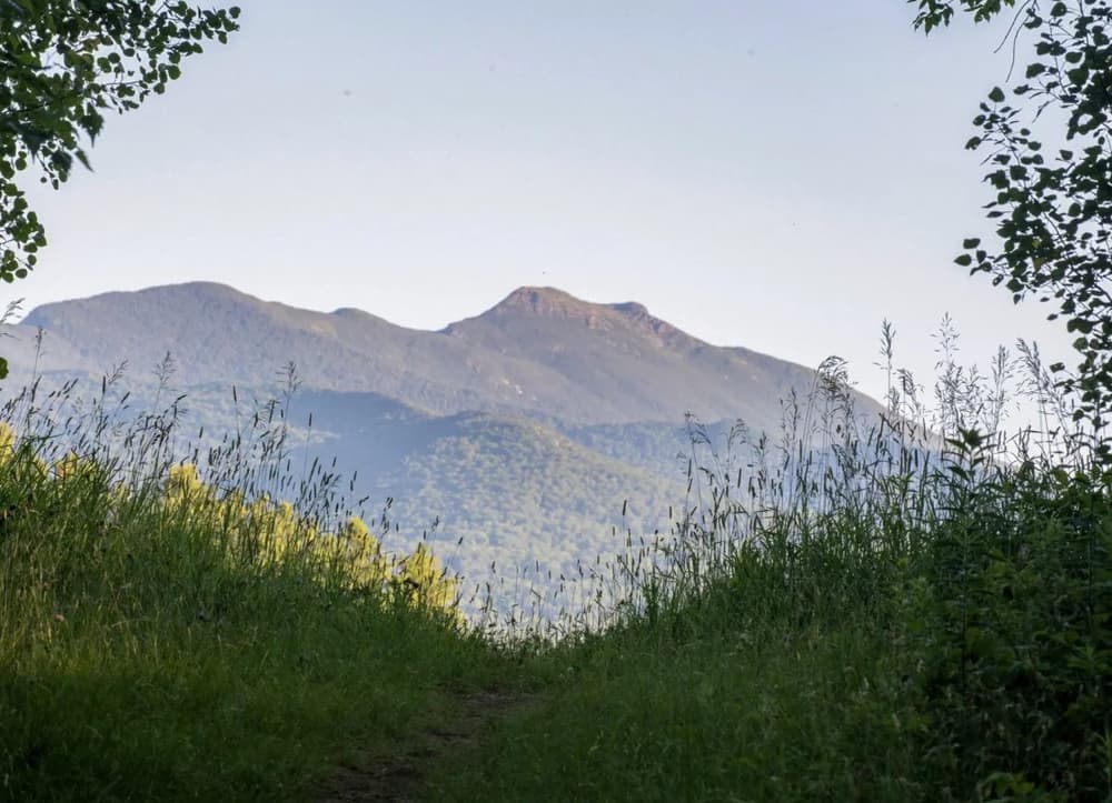
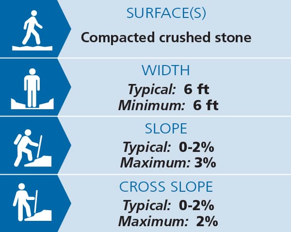
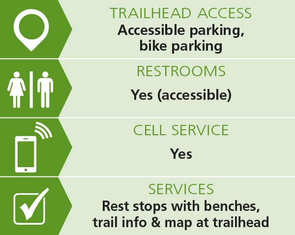
The Pond Loop Trail (1 mile) is an accessible trail that winds through a beautiful swamp, past vernal pools and wetland plants, and to a scenic pond overlook. This compacted gravel trail meets the U.S. Access Board guidelines for trail accessibility and can be accessed from an ADA-compliant parking lot. Visitors will find benches every ¼ mile along the trail and at the pond overlook. See Trail Access Information below for more information about this Accessible Experience.
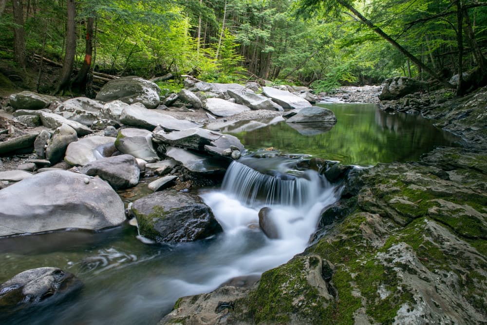
The Alden Bryan Brewster River Trail (3.8 miles) meanders along the tranquil Brewster River through hemlock forest. From the Canyon Road trailhead, look for the Gorge Overlook for a beautiful view of the cascading Brewster River Falls. Or find the spur trail to a swimming hole at the base of the falls. Beyond the falls, the trail continues south as an out-and-back along the river with a turnaround at private property. The southern sections of the Alden Bryan Brewster River Trail can be accessed from Clif Reynolds Road. From there, visitors can follow the river south to connect to the Smugglers Notch Resort trails.
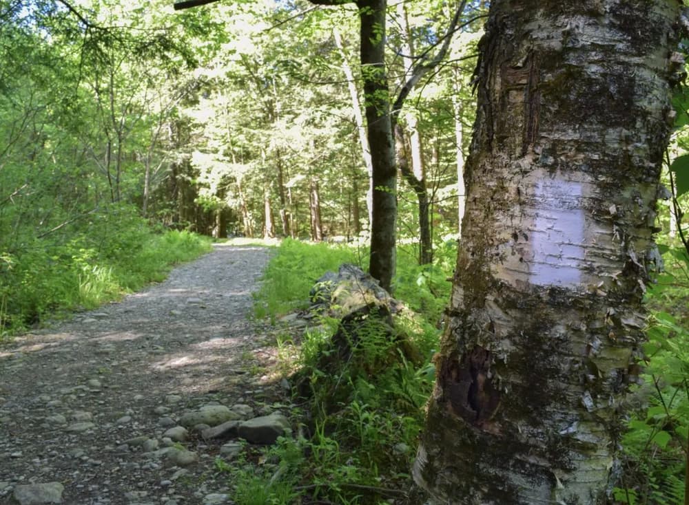
The West Farm Trail (1.2 miles) is striking in every season, taking visitors through northern hardwood forest and along the edge of a hemlock-balsam fir-black ash seepage swamp. The trail emerges from the woods to stunning views of Mt. Mansfield.
At the northern end of the property, the Loggers’ Loop Trail network explores the more undisturbed, “backwoods” areas of Brewster Uplands. Accessed from the Canyon Road Trail (0.3miles) or the Junction Hill Trail (.1 miles), this network includes the Loggers’ Loop Trail (2.2 miles), the Loggers’ Loop Shortcut (0.3 miles), and the Logger’s Loop Spur (0.3 miles).
(Applies to Pond Loop Trail)
Trail conditions can change without warning. Trail information reflects conditions as of Dec 2025.
Brewster Uplands is open to the public year-round from dawn until dusk. Dogs must be leashed at all times.
The property hosts two working farms. These farms are not open to public recreation. Please stay on marked trails and off farm fields during your visit.
For additional information, visit the Vermont Land Trust website, or contact:
![]()
There are five parking lots used to access different parts of the Brewster Uplands property. Directions below lead to the ADA-Accessible parking lot on West Farm Road and the accessible Pond Loop Trail. Under “Other Parking and Trailheads,” find directions to the other parking lots and trailheads.
Please note: Smugglers Notch is closed all winter — as early as October and as late as May some years. There is no route from Stowe north on VT-108 when the Notch is closed.
From the North
Traveling south on VT-108 towards Smugglers Notch, you’ll reach the village of Jeffersonville. Continue half a mile and just past the house on the left with the old water mill, bear left onto Canyon Road. Continue through the Grist Mill Covered Bridge (you’ll see a sign welcoming you to Brewster Uplands on the right). Stay on Canyon Road until you meet West Farm Road. Turn right on West Farm Road and continue for 400 feet until you reach the parking lot on your left (you’ll drive past another non-accessible parking lot on West Farm Road).
From the South
From Stowe and Smugglers Notch, head north downhill on VT-108 towards Jeffersonville. As you approach the village, there is a very sharp right onto Canyon Road just before the house with the water mill. Only cars with a tight turning radius should attempt this turn! Otherwise, continue on for half a mile to the village, then turn around and head back up VT-108 so you can make an easy left turn onto Canyon Road. Continue through the Grist Mill Covered Bridge (you’ll see a sign welcoming you to Brewster Uplands on the right). Stay on Canyon Road until you meet West Farm Road. Turn right on West Farm Road and continue for 400 feet until you reach the parking lot on your left (you’ll drive past another non-accessible parking lot on West Farm Road).
The Pond Loop Trail departs directly from the ADA-accessible parking lot. There is also an ADA-compliant toilet at the parking lot. You can cross West Farm Road to access the West Farm Trail, which connects to the Alden Bryan Brewster River Trail.
CANYON ROAD
The main trailhead for the Alden Bryan Brewster River Trail is located on Canyon Road. Parking is not allowed on Canyon Road, so visitors should park at the Brewster River Park parking lot on the other side of the river and walk across the Grist Mill Covered Bridge to access the trailhead.
WEST FARM ROAD
There is a second parking lot on West Farm Road that includes a non-accessible trailhead for the Pond Loop Trail. Directly across West Farm Road from this parking lot, there are stairs that connect to the West Farm Trail. Across Canyon Road, find the trailhead for the Canyon Road Trail, connecting to the Loggers’ Loop trails. This parking lot is the first one you will see when you turn off Canyon Road onto West Farm Road. It is about 200 feet from the ADA-accessible parking lot.
JUNCTION HILL ROAD
From the Junction Hill Road parking lot, access the Loggers’ Loop trails at the northern end of Brewster Uplands.
Driving on VT-108 from the south, turn right on Edwards Road, 0.6 miles past the Smugglers Notch Resort. After 0.2 miles, veer left onto Clif Reynolds Road. After 0.9 miles, Clif Reynolds Road becomes Junction Hill Road. Continue for another 0.9 miles, then turn right to stay on Junction Hill Road. Continue for 0.5 miles to the parking lot on the left.
Driving on VT-108 from the north, take the first exit on the roundabout to get on VT-15. In 0.9 miles, turn right on Junction Hill Road. Continue for 0.7 miles to the parking lot on the right.
CLIF REYNOLDS ROAD
From the Clif Reynolds Road parking lot, access the two southern portions of the Alden Bryan Brewster River Trail. Driving on Rt. 108, turn onto Edwards Road (from the south, a right turn; from the north, a left turn). Just before the intersection with Clif Reynolds Road, you will see a parking lot on your left.
This parking lot is also used for the Midlands Mountain Biking Trail, managed by the Brewster River Mountain Biking Club. To continue north on the Alden Bryan Brewster River Trail, use the trail that leaves directly from the parking lot. To continue south on the Alden Bryan Brewster River trail along the river, walk east from the parking lot on Edwards Road past Martell’s and you’ll see the trailhead on your left.
Success! A new password has been emailed to you.