Mud season is here!Protect the trails we all love by sticking to open, dry areas. Learn more! 

Bachelder Town Forest

Nice wooded trails with three loops and two access points that wind by a marsh and beaver pond, several vernal pools, and pass through an historic range way.  
Trail Activity
Hiking Mountain biking Ungroomed cross-country skiing Snowshoeing
Length
3.70 miles, Network
Difficulty
Easy, Moderate
Town
Loudon (NH)
Surface
Packed Earth/Dirt, Snow, Ungroomed
Pets
Permitted on leash
Fees
No

Description

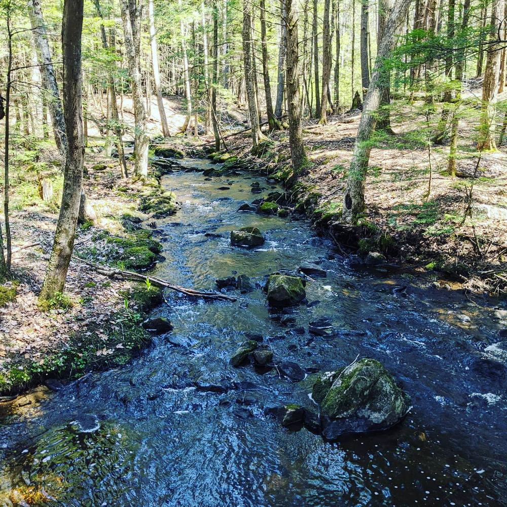
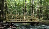
The trails consist of three loops connected by a bridge over Bumfagon Brook.

The Harry-O Circuit is a shorter and easier 1.2 mile walk. At about its halfway point, there is a short 0.1-mile connector trail that leads to the footbridge, connecting to a second loop starting on the other side of the foot bridge.

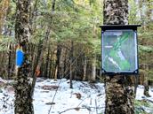
This 1.6-mile Blue Loop is a little hillier and more of a work out, but it winds through beautiful woods, by several vernal pools, and passes through an historic range way.

The third loop is accessed from the first loop or the short connector trail. This is a 1.7 mile undulating loop with interesting geologic features.

The Kenney Road Connector connects the north end of the Blue Loop to Kenney Road. 

Other Information

Please note that motorized vehicles are prohibited on the trails at the town forest.

History:
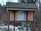
On December 31, 1991, the 150-acre  Bachelder Town Forest was generously donated to the town by Albert Bachelder. Working with the Central New Hampshire Regional Planning Commission, this property was chosen for trail development because of the beauty of the forest and points of interest. Harry MacLauchlan has also generously allowed the use of part of his property for parking and for the trail.

  • A map is posted at the trail kiosk which was built by a local Eagle Scout.  The map can also be found on the Town of Loudon website
  • The project was a community effort with many individuals volunteering their time, companies donating supplies, and funds from the Loudon Conservation Commission. 

Trail Manager

For more information, visit the town of Loudon website or contact:

Town of Loudon Trails - Subcommittee of the Conservation Commission

Town of Loudon Trails - Subcommittee of the Conservation Commission
29 S. Village Rd.
Loudon, NH 03307
sandyblanchard3@gmail.com
View website

Trail Tips

Be Considerate of Other Visitors
Respect other trail users and be courteous when passing.
Legend
Hide All

Trailhead Information

The Bachelder Town Forest Trails can be accessed from Young's Hill Road in Loudon, NH. Parking is available at the trailhead during non-snowy months. Otherwise, parking is available 2/10 of a mile down the road by the Bachelder Town Forest sign.  

  • Coming south from Laconia on Route 106, take a left onto Clough Hill Road. Travel 2.5 miles to the sharp corner by the Loudon Town Hall/Church; take a left onto Youngs Hill Road. The Trailhead is .65 miles down the road on the left.
  • Coming north from Concord on Route 106, take a right onto Route 129. Travel 3 miles and take a left onto Clough Hill Road. Travel 1.2 miles to the sharp corner by the Loudon Town Hall/Church, continue straight onto Youngs Hill Road. The Trailhead is .65 miles down the road on the left.
  • From Pittsfield, take Loudon Road to the end where it intersects with Route 129.  Go straight across Route 129 to Youngs Hill Road. The trailhead is 1 mile down the road on the right.
  • Coming from Gilmanton on Route 129, take a right onto Youngs Hill Road. The trailhead is 1 mile down the road on the right. 

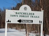
To reach the Kenney Road parking area, head southeast on Loudon Ridge Road from NH-106. After 2 miles, turn right on Lower Ridge Road. After 0.5 miles, turn left on Kenney Road. The parking area will be on the left after one mile. 

Click on a parking icon to get custom directions
Please Log In or Create Account to add comments.
These awesome businesses support our goal of connecting people to outdoor adventures!
Hang Tight!
Nearby services are loading
No Results
No Services Found
SHARE THIS TRAIL

Add Trail Log

Please wait…
Join In on the Fun!
Log in or create an account below to unlock all the great features of Trail Finder: keep track of trails you want to do, preserve memories of trails you’ve done, earn badges, and more!
Your log in attempt was not successful. Please try again.
    Lost your password? Reset your password
    Don't yet have an account?
    There was an issue with your submission. Please try again.
      * Indicates required field
      Already have an account? Login here
      Enter your username, and we will send you a new, randomly generated password to your email account.
      There was an issue with your submission. Please try again.

        Success! A new password has been emailed to you.

        Log in now

        Please wait…