Explore acres of fields, woodlands, and the remains of this Revolutionary War fortification.
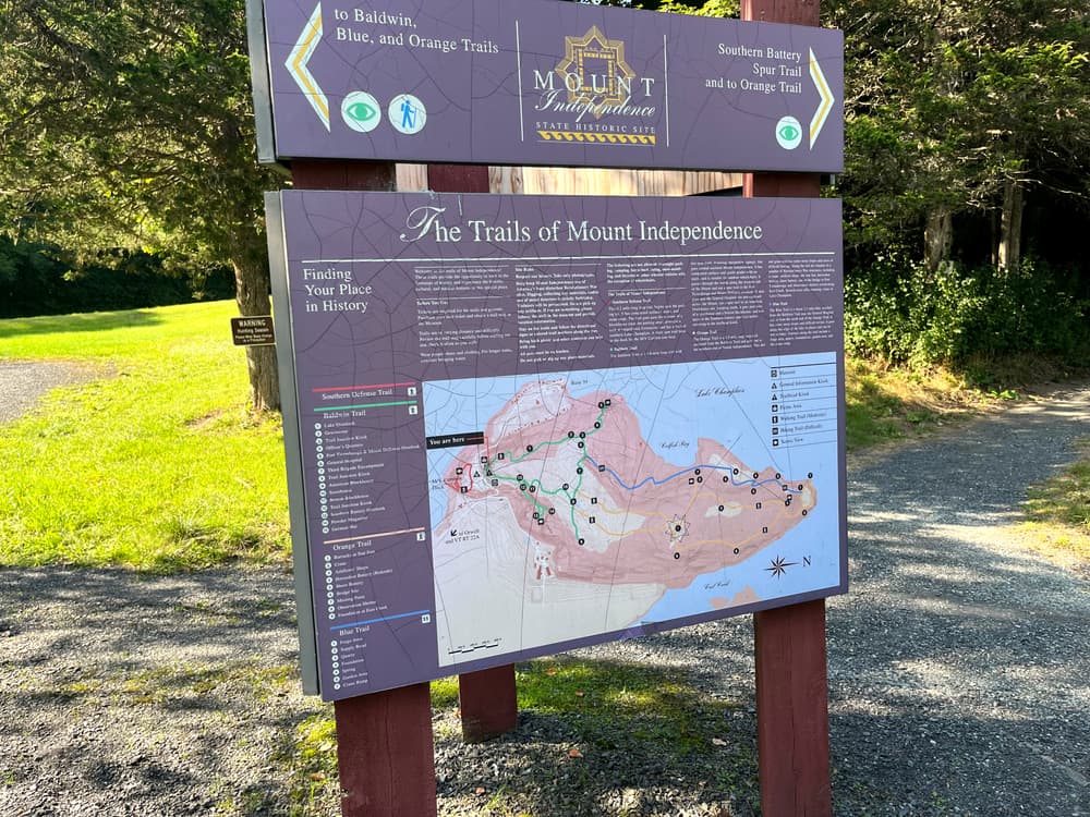
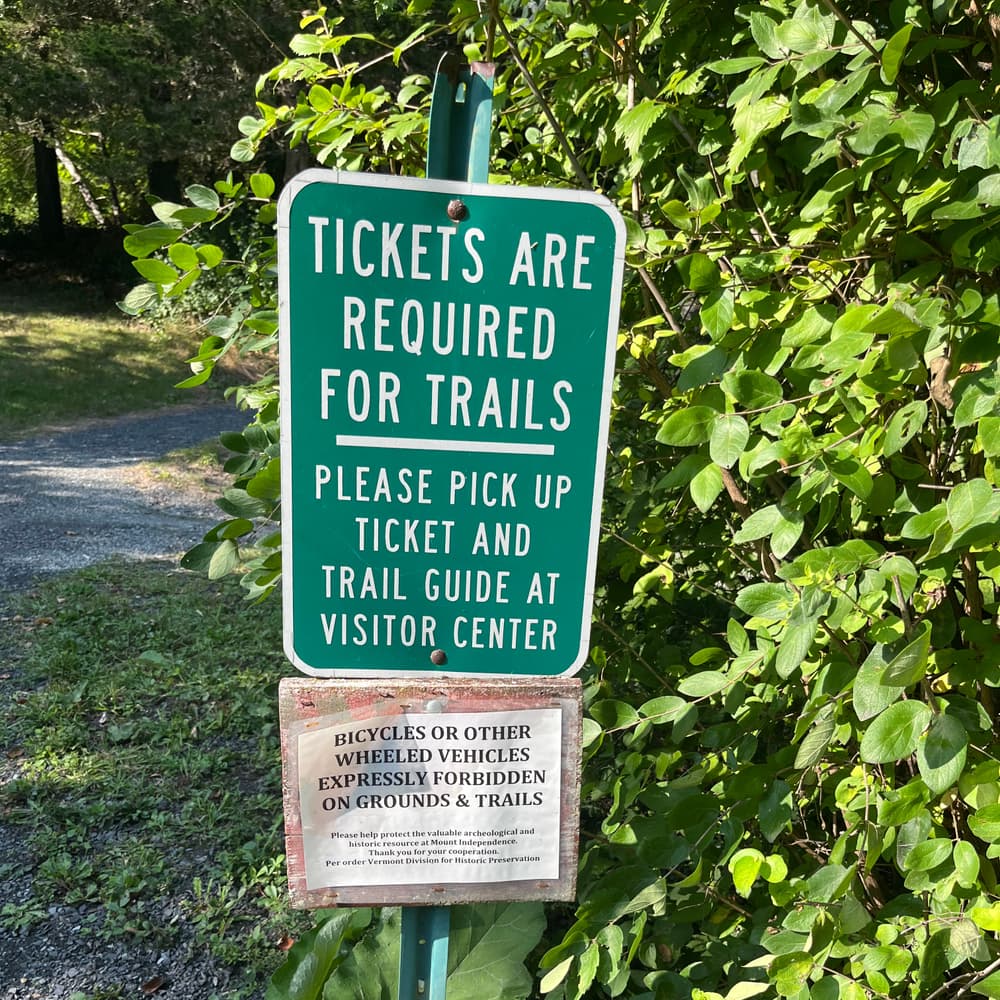
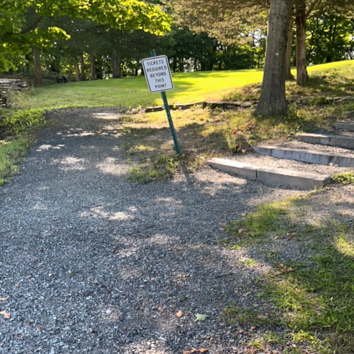
Tickets are required for the trails and grounds. Purchase your trail ticket and obtain a trail map at the on-site Museum. Historic locations are marked on the trail map handout. All trails start at the trailhead kiosk near the museum. Trails are of varying distance and difficulty. Review the trail map carefully before starting and check it often as you walk. Watch for directional signs or colored trail markers for the Blue and Orange trails. Wear proper shoes and clothing. Carry water with you.
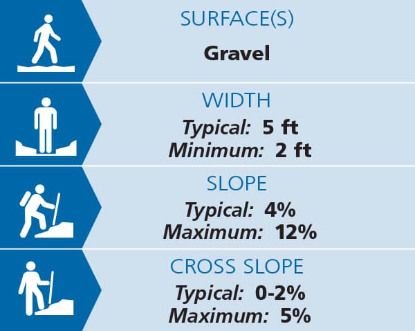
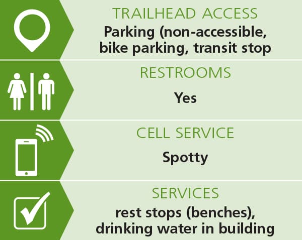
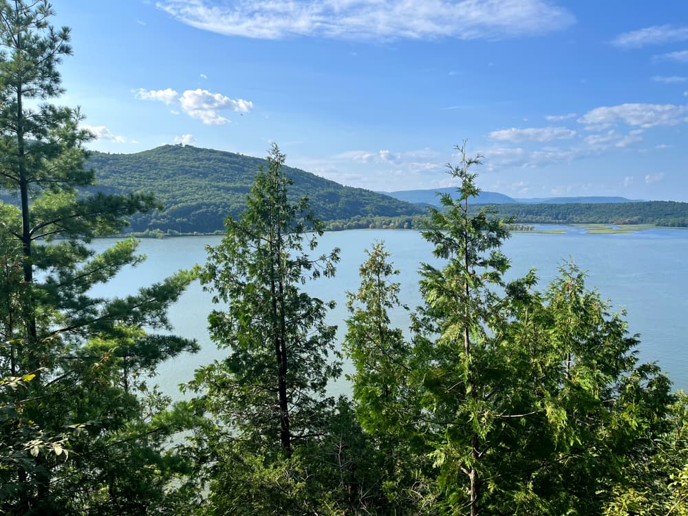
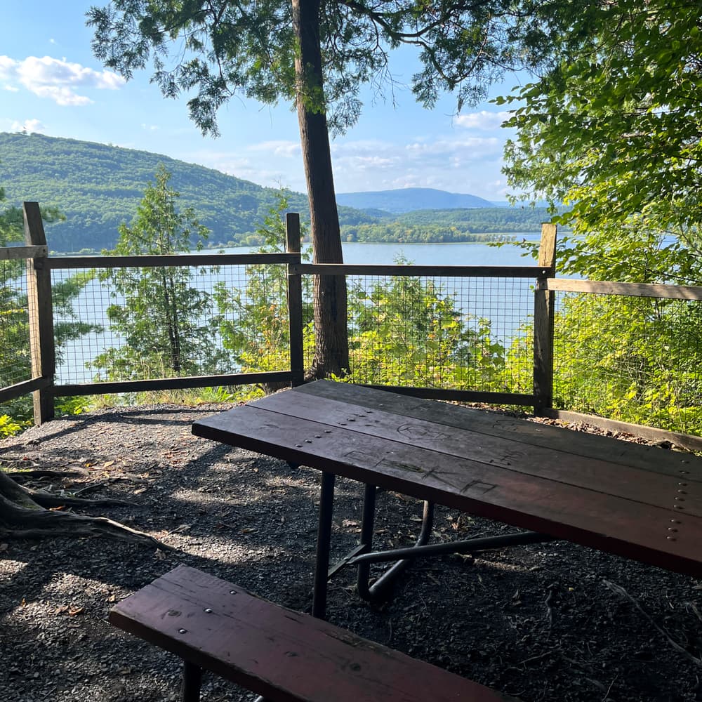
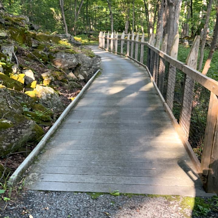
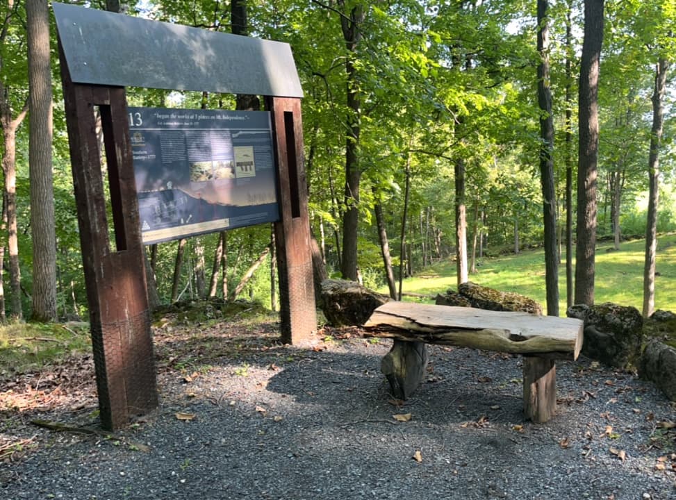
Baldwin Trail (1.6 miles): The Baldwin Trail, with its two spur trails, covers the southern half of the Mount. It is a 5-foot wide trail with compacted surfaces and gentle grades and no stairs. The surface is smooth and hard packed crushed gravel. Slopes are typically 4%. There is one very short steep section of 12% slope near sign #11. The trail also narrows to approximately 2 feet in this area. The trail features interpretive and directional signage, views of Lake Champlain, Fort Ticonderoga, and Mount Defiance, and winds through the locations of two brigade encampments and past the foundations of the General Hospital, two soldier huts, two blockhouses, a storehouse, the southern battery defenses, and a probable powder magazine. Sign and site locations are marked on the trail map handout. See Trail Access Information below for more information about this Accessible Experience.
Southern Defenses Trail (0.2 miles): This loop trail begins near the parking lot and has compacted surfaces, stairs, and stone steps. It goes past the remains of a blockhouse and provides a look at rugged rock formations and southern Lake Champlain. A short spur trail leads to the dock for the M/V Carillon tour boat.
Orange Trail (2.5 miles, off Baldwin Trail): This moderate hiking trail branches off from the Baldwin trail and travels up to the star barracks and then to the masting point before looping back to the Baldwin Trail. It passes a series of historic locations including the crane foundation, artificers shops area, the horseshoe battery, the shore batter, a bridge site and an observation shelter.
Blue Trail (2.2 miles, off Baldwin Trail or near north end of Orange Trail): This difficult hiking trail roughly follows a Revolutionary War supply road (you can see some of the original stonework for the road) between the Hospital and the bridge. It passes by other historic areas including the forge area, quarry, garden and crane ramp.
Site Rules:
Visit VT Division for Historic Preservation online for more information or contact:
VT Division for Historic PreservationTo reach the site, take VT-73 west from Orwell and take the first left turn on to Mt. Independence Road when VT-73 veers right. Stay right when the road forks. The road will turn to gravel and go parallel to Lake Champlain. Once again the road will fork; take a sharp left hand turn towards a small marina. The parking lot for the historic site is on the left at the top of the hill.
Success! A new password has been emailed to you.
