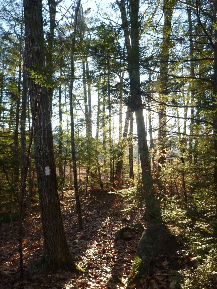
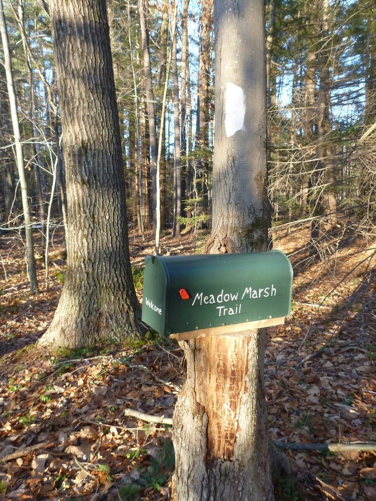
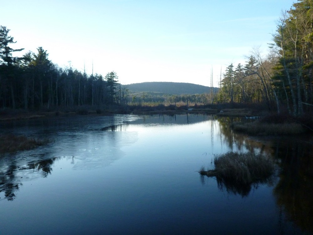
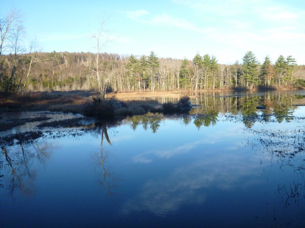
The 0.7-mile long Meadow Marsh Trail is an easy, scenic walk through mature beech-hemlock forest with views of wetlands and beaver meadows. Begin Section 1 of the trail (0.35 mile) by heading east off Craig Road. After 250 feet enjoy the marsh overlook and turn north to walk along the edge of the marsh. The first 0.25 mile of this section is level. The last 0.1 mile climbs approximately 40 feet and comes out on Craig Road (dirt). Cross Craig Road to walk 0.21 miles through upland forest on Section 2. Pass an old stone foundation at 0.1 mile. Emerge from the woods at Hattie Brown Road (dirt), where you can either return to the trailhead by turning left and walking a level 500 feet down Hattie Brown Road or cross the road to walk Section 3 along the edge of the beaver meadow 0.14 miles to return to the trailhead. After 150 feet, stop at the beaver marsh overlook. Emerge from the woods at Craig Road across from the trailhead. Or carry your canoe from Hattie Brown Road, launch at the canoe access point in this section and explore the beaver dams and floating peat bog by water.
Red-winged blackbirds, mallard ducks, kingfishers, phoebes and herons frequent the marsh. Signs of bear, deer, moose, raccoon, beaver and otter can be found in the woods, along with spring trillium, Indian cucumber root, wintergreen, partridge-berry, and starflower. White pine, birch, beech, hemlock and red oak fill the woods. Highbush blueberry, witch hazel and striped maple contribute to the understory.
The wetlands here are fed by drainage from Holt Hill to the east and from the Tuttle Hill-Willard Mountain ridge and the northeastern slopes of Goodhue Hill to the west and south. It has been speculated that before Great Brook carved out its channel, Gregg Lake may have drained north through the wetlands to the east of the trail. However, it is also possible that the lake drained through a low area at the southern end of Gregg Lake.
The trailhead is located on Craig Road 500 feet north of the intersection of Gregg Lake Road, Brimstone Corner Road, and Craig Road. From Route 31 in Antrim (2.7 miles south of Route 9 or 1.6 miles north of Route 202), drive 1.5 miles west on Gregg Lake Road. Park in the public beach parking lot. Walk 0.2 miles west on Gregg Lake Road and 0.1 miles on Craig Road to the trailhead.
Success! A new password has been emailed to you.
