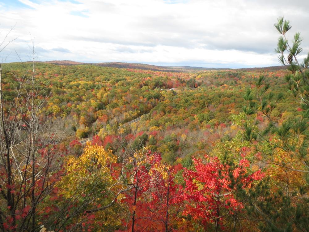
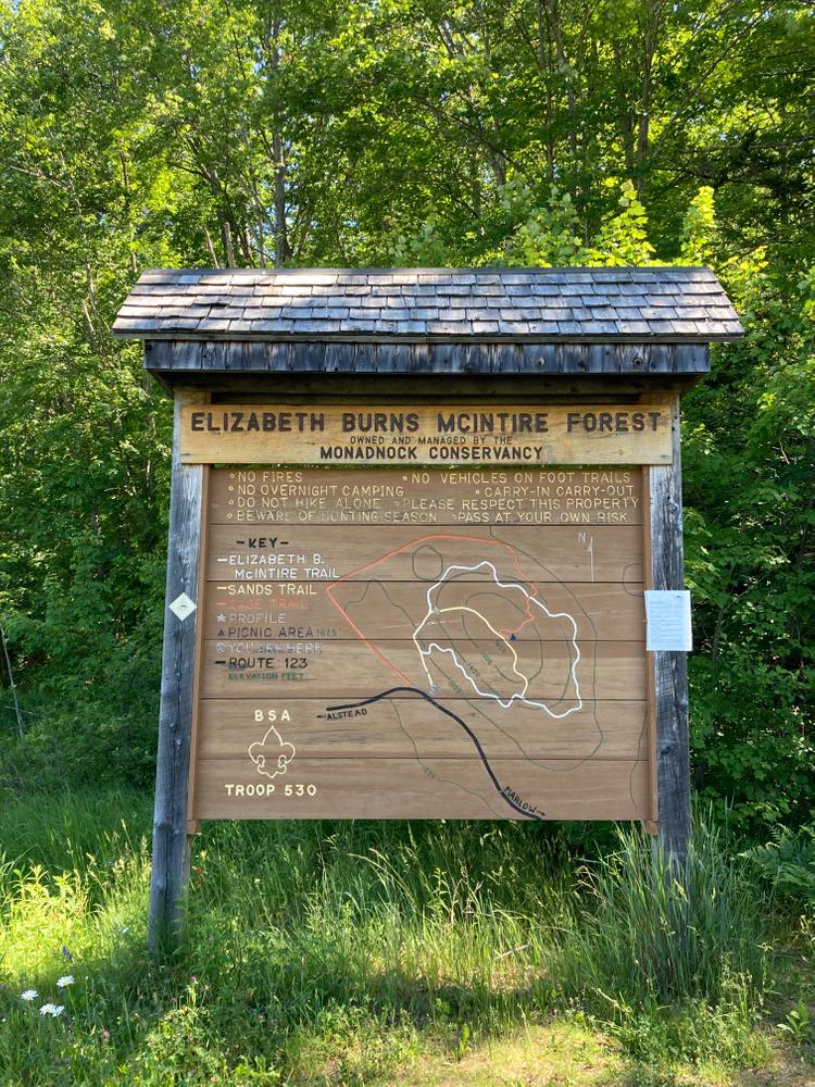
This network of trails in the Elizabeth Burns McIntire Forest travels through a forest consisting predominately of red maple, birch, aspen, red oak, white pine, and hemlock, over a short boardwalk, along the base of Bald Mountain, and ascends to a summit lookout.
To the west of the kiosk at the parking area is the Gage Trail (orange blazes). This 1.25-mile trail follows a snowmobile trail before breaking off in a short, steep climb to the summit.
To the east of the kiosk is the beginning of the Sands Trail (yellow blazes). This trail goes for approximately 800 feet before reaching an intersection with the McIntire Trail (white blazes) (if you turn right here, the McIntire Trail makes a loop around the base of Bald Mountain). Continuing straight on the Sands Trail takes you up a steep slope next to a popular climbing crag and then leads over the summit to connect with the McIntire Trail loop on the other side.
Featuring multiple human-made rock features, the summit offers many areas to explore and stunning views of the nearby hills.
Generously gifted to the Monadnock Conservancy by Ben and Judy Sands, this network of trails built by a local Boy Scout can now forever be enjoyed by the public.
For more information, visit the Monadnock Conservancy website or contact:
Monadnock ConservancyFrom NH-10: At the intersection of NH-10 and NH-123 in Marlow, follow NH-123 north for approximately 1 mile. The parking and trailhead are on the right side of the road.
From NH-123 S: From the intersection of NH-123 and NH-12A in Alstead, continue on NH-123 south for approximately 7.5 miles. The parking and trailhead are on the left side of the road.
Success! A new password has been emailed to you.
