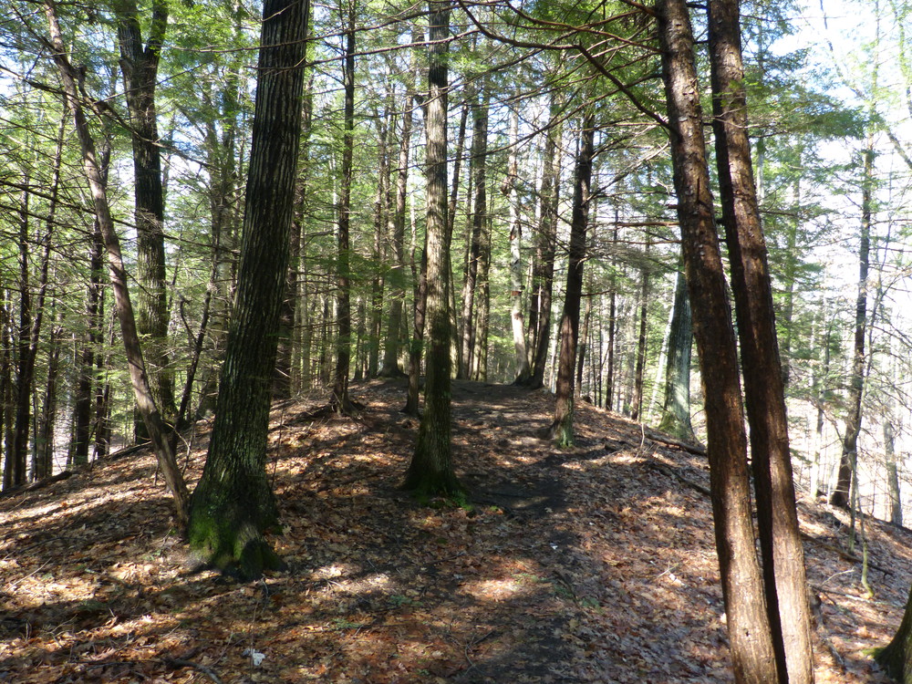
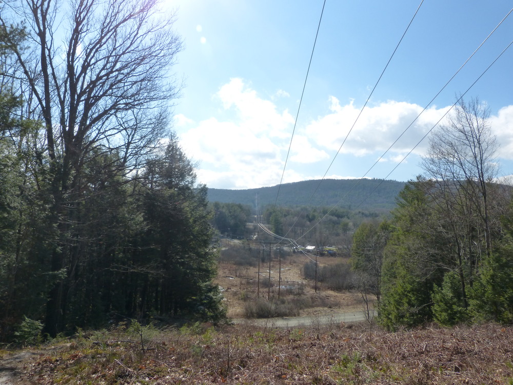
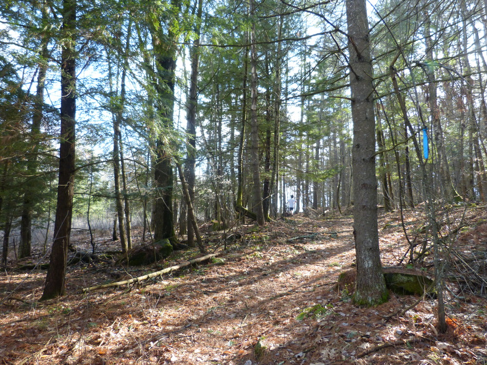
The Hazen Trail provides a 2-mile point-to-point or 4-mile out-and-back walk along a forested ridge that follows the Connecticut River between Norwich and Wilder. The trail has some ups and downs but mostly follows a wooded ridge with some good views above the Connecticut River. Near the south (Wilder) end, the trail passes along the edge of a couple of fields and passes under a power line a few times. A few hundred yards from the Wilder Trailhead, the Backwater Trail provides a short, 0.3-mile walk down to river level with a view upstream above the Wilder Dam.
The Hazen Trail proceeds north from the junction climbing up to a ridge along the river, crossing under power lines a few times and passing the Montshire Museum's "Pluto" marker. (At 3.6 billion miles from the sun, Pluto is the last stop on the Planet Walk that begins at the Montshire Museum. Note: Except for the Hazen Trail which is partly located on Montshire's property, Montshire Museum admission is required for use of their indoor and outdoor exhibits, including trails. No Dogs are allowed on Montshire Trails).
Continuing along the Hazen Trail, at the "Neptune" marker, the trail leaves the power lines. Although it remains mostly in the woods, the trail skirts a field or two in the Brookside Farm conservation area before reaching "Uranus."
At about 1.2 miles, the Hazen Trail intersects with a portion of the Planet Walk path leading to the Montshire Museum (fee for use area, admission sticker required to access Montshire Museum's outdoor exhibits and trails). Stay straight ahead for the Hazen Trail and continue for approximately 0.8 miles to the Montshire Road trailhead/parking area.
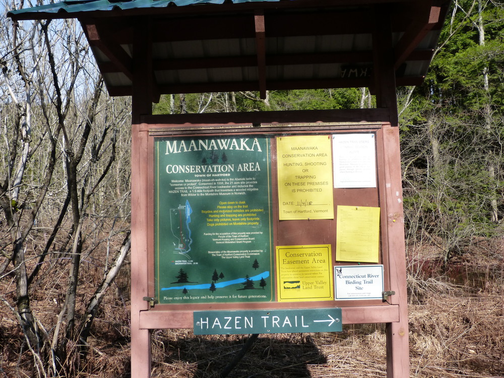
Kiosks located at both the Wilder and Norwich ends and trail signs on the Montshire property provide information about the trail. The trail is well marked with signs and distances noted at most intersections; blue flagging currently marks the north end of the trail which was rerouted in partnership between Norwich Trails Committee and the Upper Valley Trails Alliance in 2013 (special thanks to community volunteers for their help, including the Green Mountain Club's O-Section and 2013 Upper Valley High School Trail Corps). Red blazes currently indicate the southern portion of the Hazen Trail.
Hazen Trail is open to leashed dogs.
If you are a Museum member, or you pay their daily admission fee, you may park in the Museum’s parking lot and explore their full Ridge Trail loop and other Museum trails; if you do so, check in at the admissions desk. Montshire Museum trails are open from 10 a.m. to 5 p.m. Note that the Montshire Museum does not allow pets, except for service dogs, on its property.
Approximately half of the Hazen Trail is conserved by the Upper Valley Land Trust.
Visit the following organizations for more information, contact:
![]()


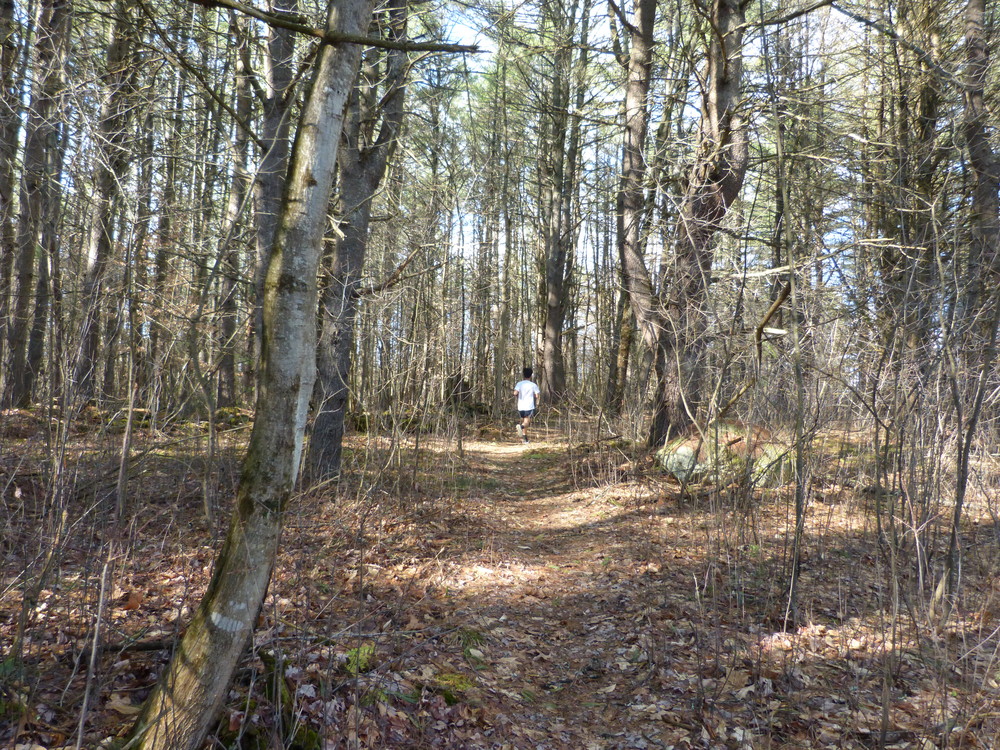
The trail is well maintained and can be started at either end.
From Wilder:
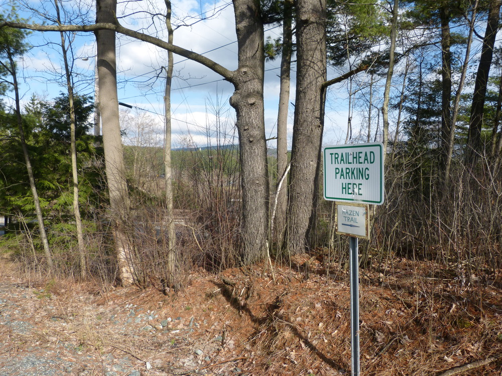
Trail access is immediately off US Rte 5 between I-91 exits 12 (Wilder) and 13 (Norwich). The dirt access road is 0.2 miles south of the I-91 overpass, just north of the village of Wilder and 0.5 miles south of the Dothan Brook School. A green post with 2393 marks the access. Park along this access road, but do not block the driveway gate.
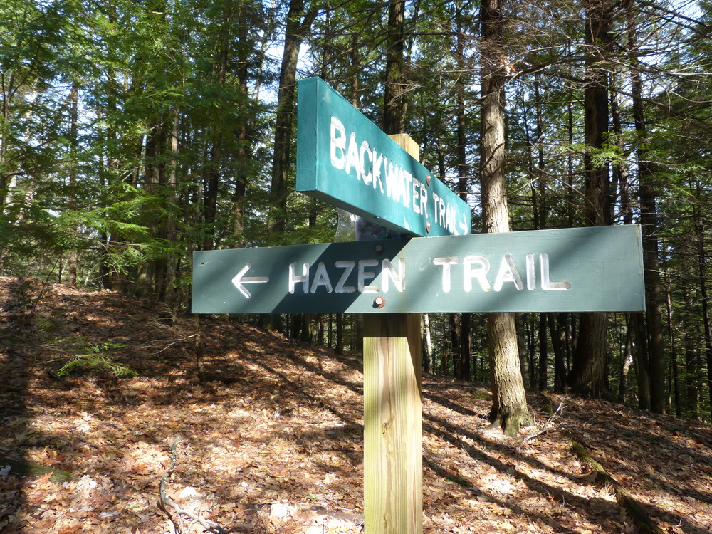
A kiosk to the right of the parking area provides information about the Maanawaka Conservation Area where the Hazen Trail begins. From the kiosk, the trail rises up into the woods and, in about 100 yards, meets the junction of the Backwater and Hazen Trails.
The Backwater Trail provides a short walk down along an inlet from the Connecticut River. Near the beginning of the trail, you can see remains of an old dam just off trail.
From Montshire Road:
The Montshire Road is the first left going uphill from the Ledyard Bridge between Hanover and Norwich. It is immediately east of the northbound exit ramp from I-91, exit 13.
Park at the signed trailhead parking (for 3 to 4 cars) on Montshire Road just beyond the Montshire Museum sign and driveway entrance. Walk a short distance beyond the parking area and you'll see the trail entrance and information kiosk.
Success! A new password has been emailed to you.

The entrance off Hartford Ave. seems to be a power substation access road and is a little overgrown at the trailhead sign. The entrance on Montshire Rd is outside the gate, just a little past that intersection. One spot was confusing where it looks like an old logging road, but if you keep your eyes peeled the posted signs are there.
I can imagine hiking this regularly.