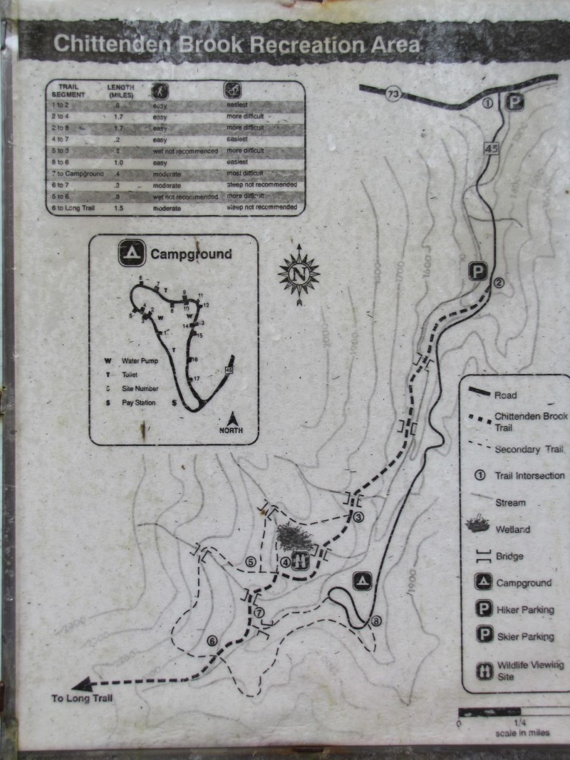
Centrally located between the Rochester and Middlebury Ranger Districts, the Chittenden Brook area offers many recreation opportunities for a variety of abilities. Trails meandering next to beautiful brooks and traveling through tall trees make this an attractive area for visitors. The area includes a 7.5 mile trail network designed for cross country ski and snowshoe use and open to summer hiking. The trail network serves as a connector to the Long Trail National Recreation Trail as well as the Brandon Gap Backcountry Recreation Area known for winter skiing and boarding. The area also includes a 17 site campground open Memorial Day weekend through Columbus Day.
The Chittenden Brook Trail starts from a parking area on FR 45 0.6 miles from VT 73. The trail begins on an old woods road and climbs moderately. During the winter season these are un-groomed trails that provide a diversity of terrain, from easy skiing along the unplowed access road, to difficult trails following Chittenden Brook. At intersection 4 the Beaver Pond Trail (1.7 miles) goes right to a pond where there may be opportunities to view wildlife. The Chittenden Brook Trail continues left toward the Long Trail. At intersection 7 a 0.4 mile spur trail on the left leads to Chittenden Brook Campground. The trail turns right and climbs through mixed hardwood and spruce/fir forest, becoming steeper as it ascends to its intersection with the Long Trail at 4.1 miles. Please practice Leave No Trace ethics and carry out what you carry in.
The Beaver Pond Trail can be accessed by getting on the Ruth Johnston Trail, adjacent to site #7 in the Chittenden Brook Campground, and following it 0.4 miles to its intersection with the Chittenden Brook Trail. Take a right onto the Chittenden Brook Trail and continue 0.2 miles to intersection 4. The pond is 0.1 miles beyond this junction.
Trail Information
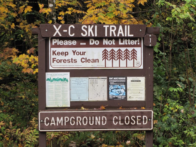
The Chittenden Brook Trail Network is marked with maps and numbered placards at intersections. Painted blue blazes and plastic blue diamonds provide for reassurance between intersections.
Campground Information, Regulations & Facilities
There are 17 campsites irregularly spaced along a wooded campground loop. Each site has a picnic table, fire ring with a grill, parking spur with space for two cars, and a gravel tent pad. There are two barrier-free vault toilets. There are no showers or hook-ups. There is a recycling and trash station at the end of the campground loop. The campground and access road cannot accommodate trailers over 18 feet. This campground is best suited for tent camping.
Camping Fee: $10/Night
Maximum stay is 14 days in any 30-day period.
Dogs must be on a leash at all times.
Quiet Hours are 10:00 PM to 6:00 AM.
Check out time is 2:00 PM.
There is no drinking water available.
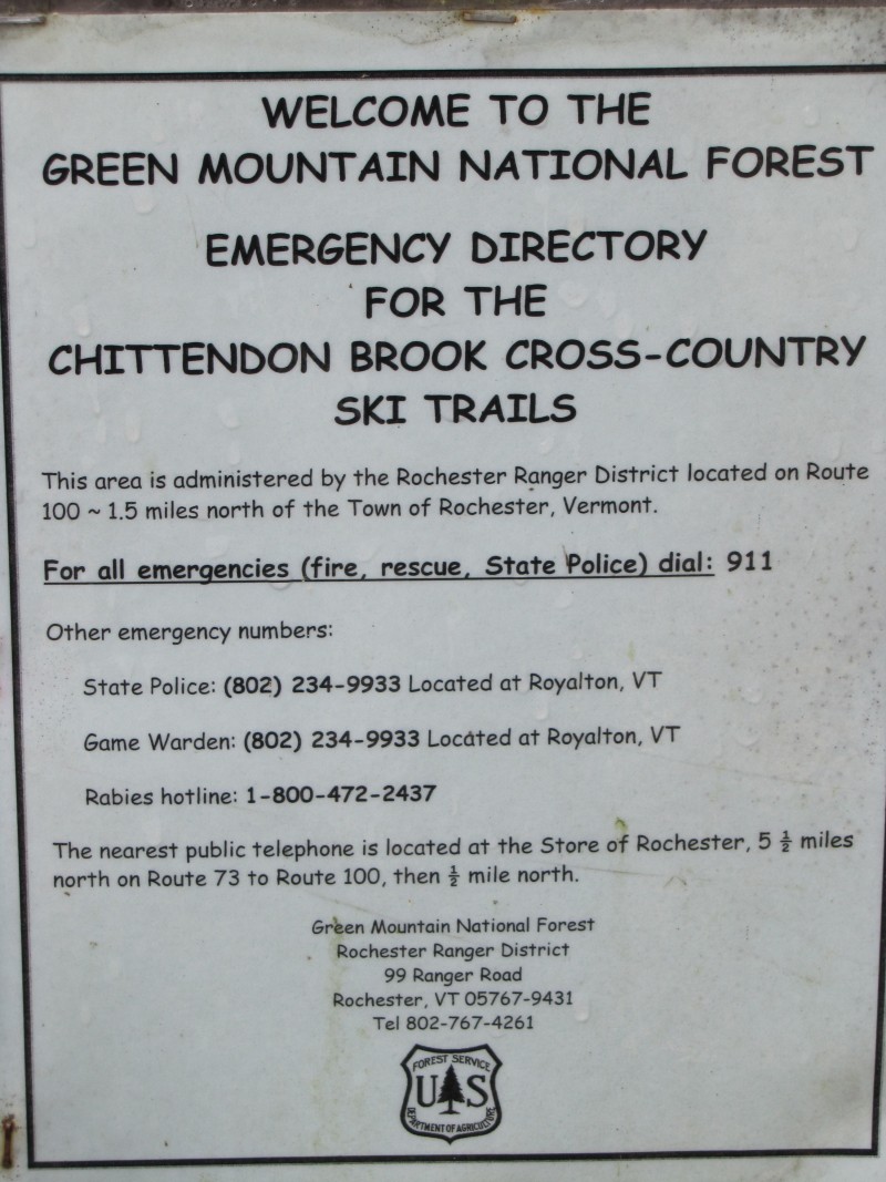
As always, let someone know before you go.
For additional information, visit the Green Mountain Club website, or contact:
![]()

From Rochester, travel south on Route 100 for 1.0 mile to its intersection with Route 73. Follow Route 73 west for 5.1 miles and turn left onto Forest Road 45, which is the access road to Chittenden Brook Campground. Parking for the Chittenden Brook Trail is located on the right at 0.6 miles. Alternate parking for the Beaver Pond and Chittenden Brook Trails is located at 2.5 miles on the left at the entrance to the campground.
From Brandon, travel east on Route 73 for 14.6 miles and turn right onto the Forest Road 45, which is the access road to Chittenden Brook Campground. Parking for the Chittenden Brook Trail is located on the right at 0.6 miles. Alternate parking for the Beaver Pond and Chittenden Brook Trails is located at 2.5 miles on the left at the entrance to the campground.
Success! A new password has been emailed to you.