PLEASE NOTE: Be sure to read description below. The Upper Valley Loop Trail uses existing roads and bike lanes, some of which may not be suitable for children or beginner cyclists. The Upper Valley Trails Alliance is continuing to work with our community leaders to advocate for improved infrastructure for cyclists and pedestrians.
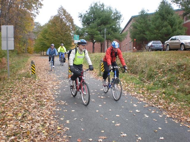
The Upper Valley Loop Trail forms the foundation for an Upper Valley Trail network. This trail provides a 16-mile bikeable route that offers a primary transportation opportunity in the Upper Valley, connecting via public transit, trail links, and sidewalks to the many cultural, social, and economic resources located in this region.
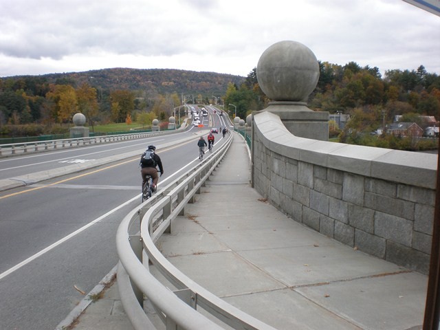
Most of the roads that have been included as part of this route offer paved shoulders or bike lanes. Crossing of the temporary Route 4 bridge between White River Junction and West Lebanon will be a bit more congested than other portions of this route until a new bridge is in place. Likewise, a proposal to provide an off-road multi-use trail parallel to Mount Support Road in Lebanon will make that trail section more enjoyable and safer.
As with some of our nation’s famous multi-state trails, many sections of the loop trail needed to be initially located along or near road corridors but in time, improvements will be made to provide for your preferred trail setting from walking and nature exploring to multi-modal trails for commuters, athletes, and more. Currently two great off-road options that parallel portions of the bikeable loop are:
In Lebanon, the Mascoma Street section may have a great alternative in the way of the Mascoma River Greenway which is likely to extend the Northern Rail Trail to Glen Road at the Miracle Mile (Route 4) in the coming years.
The specific route alignment between Mount Support Road at Lahaye Drive in Lebanon, and Route 120 at DHMC North Access Road is currently being finalized and is therefore unsigned. The use of a wide paved shoulder along Route 120 can be used to complete the loop for those people comfortable with the higher automobile speeds and traffic volume on Route 120 - that section is signed as a State Bike Route. The Trails Alliance is currently working with DHMC to consider safer options.
Hanover has a suggested east route as well as a suggested west route.
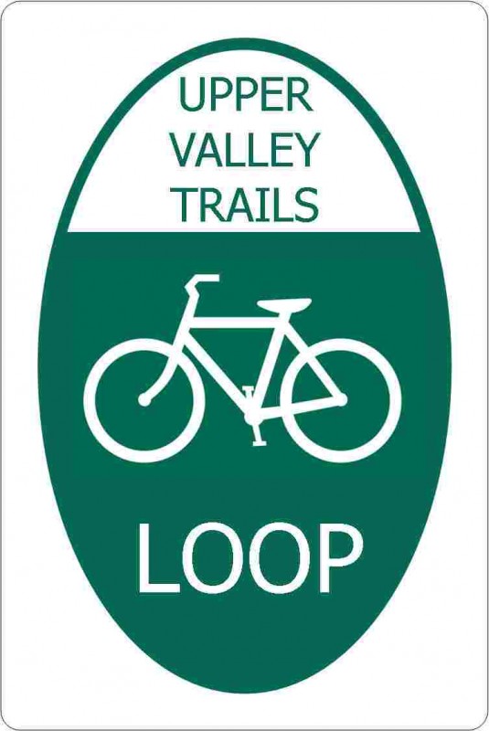
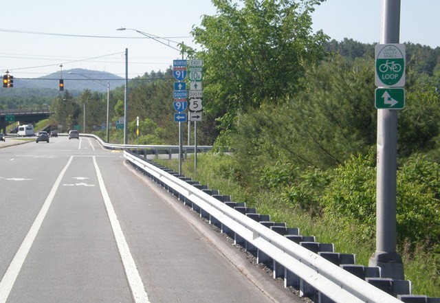
This multi-community Loop Trail effort has resulted in a green and white standardized Upper Valley Trails "LOOP" sign that guides riders along the route.
Over ten years ago, in 1999, the founders of the Upper Valley Trails Alliance realized the importance of trails to our cities, towns and villages. Trails for education and recreation, pathways for health improvement, safe routes to school, alternative commuting corridors, and places for community building, “Solace in Nature,” and athletics.
The concept of a trail network that would include an Upper Valley Loop Trail was conceived at that first meeting and over the years many trail alignment studies have been completed. The vision called for a central trail hub or corridor that would connect Hanover and Lebanon, NH with Norwich and Hartford, VT, with spokes or threads traveling to other communities, Park and Rides, and conservation lands.
Special thanks to the many hours that Steering Committee members, town and city officials, and volunteers have offered to make this trail possible.
Visit Upper Valley Trails Alliance online for more information or contact:
Use Trail Finder map to identify various options to reach the loop.
Consider the use of public transit bike carriers or Park and Ride facilities (Huntley Meadow in Norwich or Route 5 Park and Ride by Bugbee Street in Hartford) to get you near or on the loop with your bike.
Success! A new password has been emailed to you.