The solar eclipse is coming on April 8th! Learn more about where you can go to view the eclipse and other useful tips.

Hopkinton-Everett Multi-use Trail System

24-miles of maintained multi-use trails offering a wide range of terrain only 15 minutes from Concord, NH.
Trail Activity
Hiking Mountain biking Horseback riding Atv riding Snowshoeing Ungroomed cross-country skiing Snowmobiling
Length
24.00 miles, Network
Difficulty
Easy, Moderate, Advanced
Towns
Dunbarton (NH), Weare (NH)
Surface
Packed Earth/Dirt, Road, Unpaved, Snow, Ungroomed
Pets
Permitted on leash
Fees
No

Description

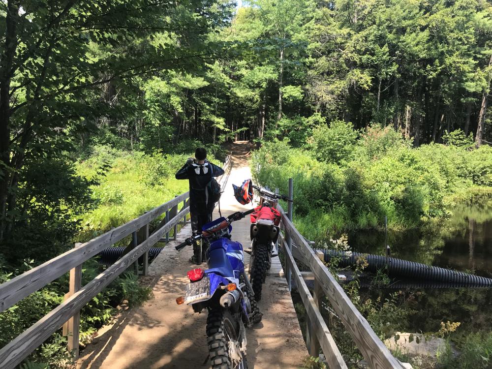
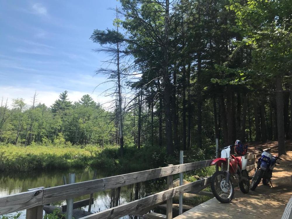
This expansive network of multi-use trails begins at the parking area off Winslow and Ray Roads in Dunbarton, NH. Six distinct loops wind outwards towards Stark Pond and Everett Lake, passing over hills and crossing streams and rivers at several points. In addition to the 24 miles of cut trail, numerous dirt and woods roads offer trail users plenty of territory to explore. 

  • Stark Pond Loop: from the parking lot, this 3-mile loop travels northeast around the far side of Stark Pond before turning and looping back southwest and returning to the parking lot.
  • Sugar Hill Loop: from the parking lot, this 4.25-mile loop travels northwest to cross Choate Brook and then intersects with the snowmobile/multi-use trail extending from Hopkinton Lake. See Elm Brook Park and Hopkinton Lake Recreation Trails posting for more information.
  • Bob Thomas Trail: this 3.6-mile loop runs through the heart of the trail system connecting to Bassett Mill, Sugar Hill and Hang Glider Hill.
  • Hang Glider Hill Trail: this 2.8-mile connector trail runs from the southern end of Stark Pond Loop near the parking lot to Bassett Mill Loop in the west.
  • Bassett Mill Loop: this 4-mile loop connects Sewell-Hoyt Road and Sugar Hill Loop in the north to the River Loop Trail in the southeast.
  • River Loop: this 5.2-mile loop extends west along the Piscataquog River before crossing the river and looping south and then back east and crossing again to rejoin Bassett Mill Loop.

Other Information

Trail conditions change often due to weather or maintenance schedules. Before you head out, click here for up-to-date conditions and closure information. 

This is a multi-use trail system. Please be considerate of other users and know that you may encounter hikers, bikes, ATVs, and horses at any point.

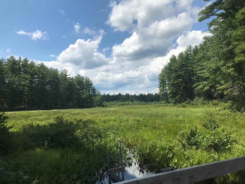
The Hopkinton-Everett Reservoir is a 10,000 acre project administered by the US Army Corps of Engineers. It involves multiple, large flood control structures and covers a drainage that includes Choate Brook and the Contoocook and Piscataqoug Rivers. Much of the land is open to hunting and fishing. There are two developed recreation areas on the project: Elm Brook Park and Clough State Park.

Trail Manager

Please visit the Army Corps of Engineers website for more information and a printable map of of this trail system. 

NH Bureau of Trails

NH Bureau of Trails
172 Pembroke Road
Concord, NH 03301
Phone: (603) 271-3254
nhtrails@dncr.nh.gov
View website

US Army Corps of Engineers - Peterborough Office

US Army Corps of Engineers - Peterborough Office
Edward MacDowell Lake
75 Wilder Street
Peterborough, NH 03458
Phone: (603) 924-3431
View website

Trail Tips

Dispose of Waste Properly
Pack it in, pack it out. This goes for trash, leftover food, toilet paper, and hygiene products. If you brought it into nature, please bring it out.
Legend
Hide All

Trailhead Information

From the junction of I-89 and I-93 in Concord, NH: take I-89 north and take Exit 2 to NH-13. Turn left onto NH-13 south and and stay straight at the intersection with NH-77 at the blinking light. Continue on NH-77 for just over 1 mile and then turn left onto Ray Road across from the the transfer station. Follow Ray Road as it turns to dirt and continue for just over 1 mile until the parking lot appears on the right.

Click on a parking icon to get custom directions
Please Log In or Create Account to add comments.
76lish
September 06, 2017
I walked the Stark Pond Loop trail on a busy holiday weekend. It's a nice area, but definitely heavy with ATV and dirt bike traffic. It wasn't as peaceful as I would have liked. On the plus side, you can hear them coming and have plenty of time to get off the trail! If I go again to check out other trails, it will be on a weekday.
These awesome businesses support our goal of connecting people to outdoor adventures!
Hang Tight!
Nearby services are loading
No Results
No Services Found
SHARE THIS TRAIL

Add Trail Log

Please wait…
Join In on the Fun!
Log in or create an account below to unlock all the great features of Trail Finder: keep track of trails you want to do, preserve memories of trails you’ve done, earn badges, and more!
Your log in attempt was not successful. Please try again.
    Lost your password? Reset your password
    Don't yet have an account?
    There was an issue with your submission. Please try again.
      * Indicates required field
      Already have an account? Login here
      Enter your username, and we will send you a new, randomly generated password to your email account.
      There was an issue with your submission. Please try again.

        Success! A new password has been emailed to you.

        Log in now

        Please wait…