Mud season is here!Protect the trails we all love by sticking to open, dry areas. Learn more! 

Abbey Pond

This trail system is currently CLOSED. See Trail Alerts tab for details.
A 2-2.5 hours round trip (3.6 miles) trail suitable for all ages with the turnaround point at Abbey Pond.
Trail Activity
Hiking Snowshoeing
Length
1.80 miles, One Way
Difficulty
Moderate
Towns
Middlebury (VT), Ripton (VT)
Surface
Packed Earth/Dirt
Pets
Unknown
Fees
No

Description

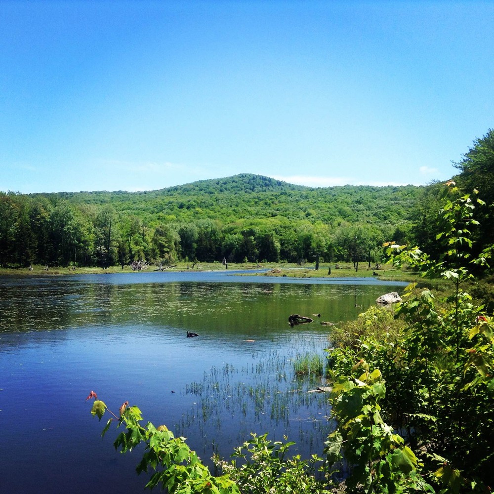
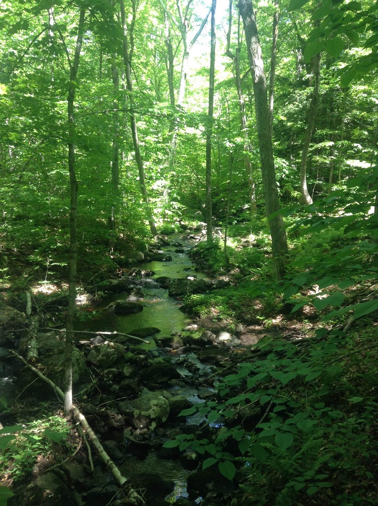
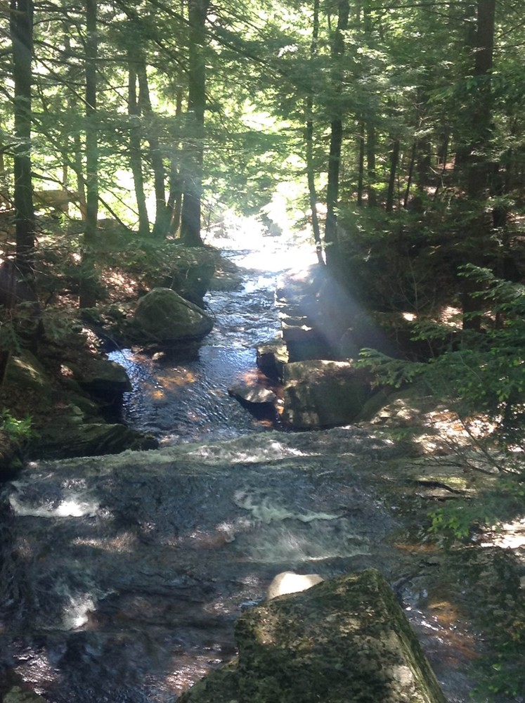
From the parking lot, the trail leads into the woods and climbs moderately to a bridge at 0.2 miles. The trail continues beside a stream to a second stream crossing that has no bridge, but can be crossed on rocks. Ascending steadily after the second stream crossing, the trail climbs to a third stream crossing after which the terrain is gentler. The trail arrives at the outlet of Abbey Pond at 2.1 miles. Abbey Pond supports a community of marsh plants and animals. This trail is sometimes closed to protect nesting great blue herons. Watch for the closure posters. Please practice Leave No Trace ethics, such as carry out what you carry in.

No horses, mountain bikes, or motorized vehicles. 

Trail Manager

Visit Green Mountain National Forest online for more information or contact:

US Forest Service
Phone: (802) 767-4261
View website

Trail Tips

Plan Ahead and Prepare
Know your limits – it’s okay to turn back. Your home is the ultimate destination, not the summit.
Legend
Hide All

Trailhead Information

From the Middlebury Green, head northeast on Washington Street and then out of town on Seminary Street Extension. Bear left onto Quarry Road, then turn left at the intersection with VT-116/Case Street. Travel north on Route 116 for 0.7 miles, and look for a sign for the Abbey Pond Trail on the right. Turn right onto a gravel road and follow the right spur to the trailhead parking at 0.3 miles. The land adjacent to the road and parking lot is private property. Please be respectful of the owner.

From Bristol, travel west 1.0 mile on Route 17/116. Turn left onto Route 116 at a blinking light, travel 6.9 miles and look for a sign for the Abbey Pond Trail on the left. Turn left onto a gravel road and follow the right spur to the trailhead parking at 0.3 miles. The land adjacent to the road and parking lot is private property. Please be respectful of the owner.

Click on a parking icon to get custom directions
Please Log In or Create Account to add comments.
eliseawa
March 29, 2024
Trail closed due to summer 2023 flooding. Bridge across the first stream crossing was washed out.
These awesome businesses support our goal of connecting people to outdoor adventures!
Hang Tight!
Nearby services are loading
No Results
No Services Found

Trail Alerts

Trails
Flooding

Some or all of the trails in this system are temporarily closed due to flooding.

SHARE THIS TRAIL

Add Trail Log

Please wait…
Join In on the Fun!
Log in or create an account below to unlock all the great features of Trail Finder: keep track of trails you want to do, preserve memories of trails you’ve done, earn badges, and more!
Your log in attempt was not successful. Please try again.
    Lost your password? Reset your password
    Don't yet have an account?
    There was an issue with your submission. Please try again.
      * Indicates required field
      Already have an account? Login here
      Enter your username, and we will send you a new, randomly generated password to your email account.
      There was an issue with your submission. Please try again.

        Success! A new password has been emailed to you.

        Log in now

        Please wait…